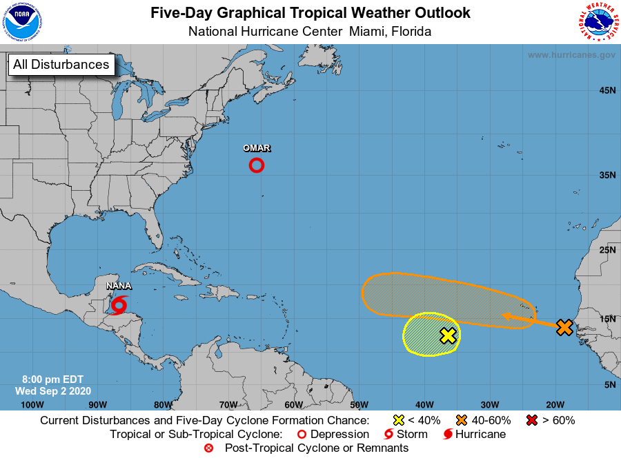
System has strong chance of development into tropical depression this weekend
September 2, 2020
Danos Enlists Justin Gonce as Executive Account Manager, Welcomes Melanie Hill as Business Development Rep
September 3, 2020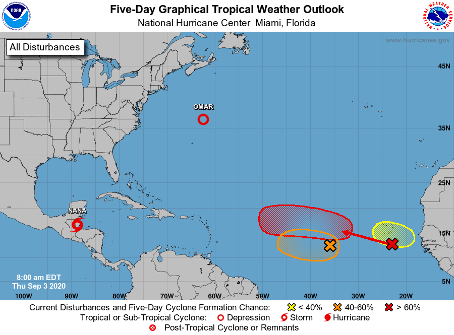
It’s a very colorful map this morning! There are three areas of possible tropical development that the National Hurricane Center is watching.
A broad area of low pressure is located over the eastern tropical Atlantic several hundred miles west-southwest of the Cabo Verde Islands, producing a small area of disorganized showers and thunderstorms. Gradual development is possible early next week as the larger tropical wave located off of the coast of Africa passes to the north of the system on Sunday. It has a medium (40 percent) chance of formation during the next five days. (This system is pictured in orange)
There’s also a tropical wave located off the coast of west Africa merging with another disturbance located a couple of hundred miles south of the Cabo Verde Islands. This is resulting in an extensive area of disorganized showers and thunderstorms. Development of this system is likely to be slow during the next couple of days while it moves west- northwestward at about 15 mph, and a tropical depression is more likely to form early next week over the central tropical Atlantic where environmental conditions are forecast to be more favorable for development. It has a high (70 percent) chance of formation during the next five days. (This system is pictured in red)
In addition, another tropical wave is forecast to move off the west coast of Africa over the weekend. An area of low pressure is expected to form from the wave, and some development of this low will be possible early next week while it moves generally westward over the far eastern tropical Atlantic.It has a low (20 percent) chance of formation during the next five days. (This system is pictured in yellow)

