Tropical Storm Beta begins its turn West
September 19, 2020
Bollinger Awarded Contract for State-of-the-Art Floating Dry Dock for the Nation’s New Columbia Class Ballistic Missile Submarine
September 19, 2020
The newest update shows Tropical Storm Beta continuing on a path towards Texas. The main threats to southeast Louisiana will be the potential for heavy rainfall and minor coastal flooding. Beta is a slow moving storm and will lead to a prolonged wet period. Flash flooding may become a concern depending on the location and duration of the heaviest rain, which are still uncertain at this time.
Due to Beta’s slow motion, there will also be a prolonged period of east to northeast winds. A Wind Advisory is currently in effect from 9/19/2020 2:00 PM to 9/20/2020 7:00 AM CDT for Terrebonne Parish. These winds are expected to lead to minor coastal flooding of 1-3ft and a coastal flood advisory has been issued for all coastal areas of SE LA and S MS.
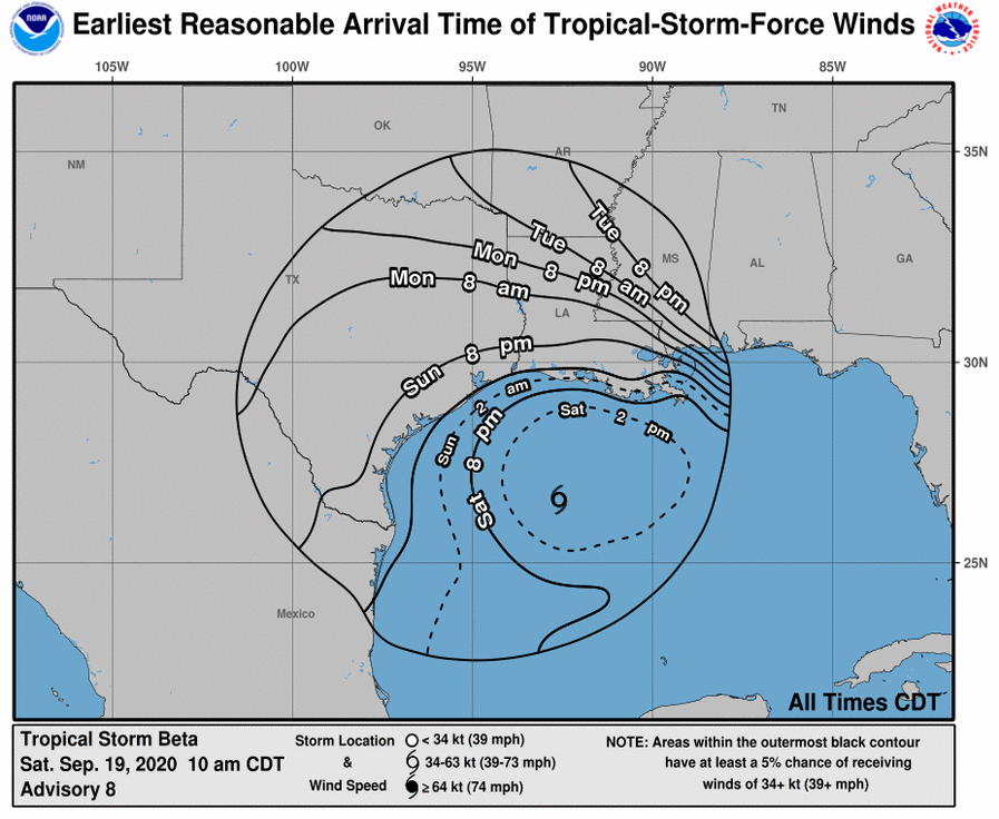
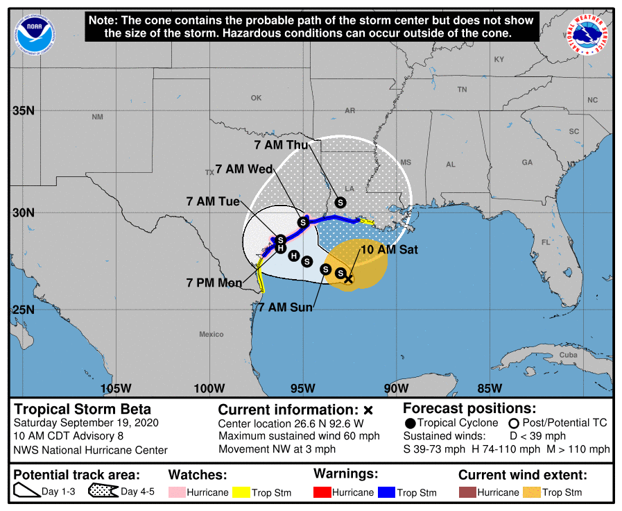
At 1 p.m. CDT, the center of Tropical Storm Beta was located about 305 miles (495 km) east-southeast of Corpus Christi, Texas. Beta is moving toward the west near 2 mph (3 km/h), and a slow motion toward the west should continue into Sunday. A slow northwestward motion is forecast to begin late Sunday or Sunday night and continue through late Monday. On the forecast track, the center of Beta will slowly approach the Texas coast into early next week.
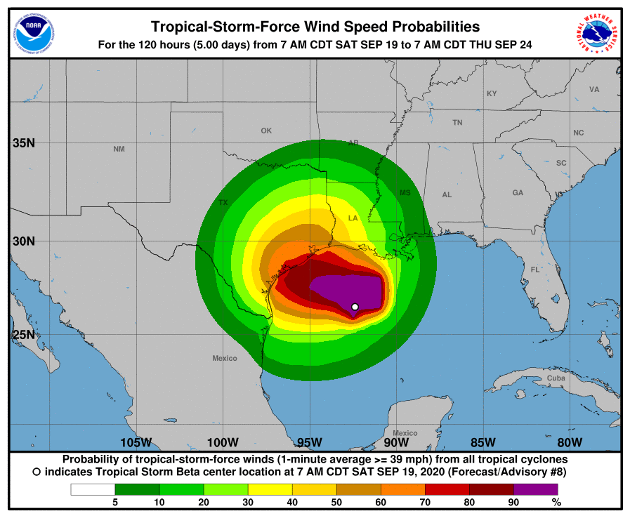
Maximum sustained winds are near 60 mph (95 km/h) with higher gusts. Tropical-storm-force winds extend outward up to 175 miles (280 km) from the center. Little change in strength is expected today. After that, slow strengthening is forecast, and Beta is expected to be at or near hurricane strength Sunday night or Monday.

The combination of a dangerous storm surge and the tide will cause normally dry areas near the coast to be flooded by rising waters moving inland from the shoreline. The water could reach the following heights above ground somewhere in the indicated areas if the peak surge occurs at the time of high tide:
– Port Mansfield, TX to Cameron, LA including Baffin Bay, Corpus Christi Bay, Copano Bay, Aransas Bay, San Antonio Bay, Matagorda Bay, Galveston Bay, Sabine Lake, and Calcasieu Lake…2-4 ft
– Mouth of the Rio Grande, TX to Port Mansfield, TX…1-3 ft
– Cameron, LA to Morgan City, LA incl. Vermilion Bay…1-3 ft
Beta has the potential to produce a long-lived rainfall event along the western Gulf Coast. Today through Tuesday, Beta is expected to produce rainfall accumulations of 3 to 5 inches with isolated totals of 10 inches beginning Saturday across southern Louisiana and spreading into coastal Texas on Sunday. Flash and urban flooding is likely as well as minor river flooding. Additional heavy rainfall amounts across the western Gulf Coast are possible through late week as Beta is expected to move slowly near the Texas coast.

