Terrebonne Booking Log: 05/13-05/14/2020
May 14, 2020
Elmer’s Island Refuge to Reopen to the Public Friday
May 14, 2020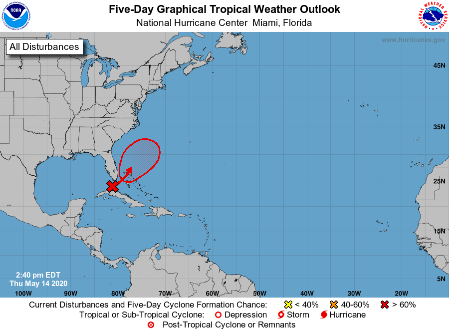
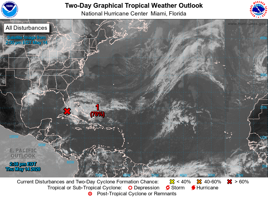
Tropical or subtropical development is likely this weekend in the vicinity of the Bahamas.
According to the National Hurricane Center, a trough of low pressure over the Straits of Florida is producing a large area of cloudiness and thunderstorms. Environmental conditions are expected to become conducive for development, and this system is likely to become a tropical or subtropical storm by late Friday or Saturday when it is located near the northwestern Bahamas. The system is then forecast to move generally northeastward over the western Atlantic early next week.
The National Hurricane Center is now giving this disturbance a 70 percent (high) chance of becoming a (sub)tropical cyclone over the next 2 days, and a 80 percent (high) chance over the next 5 days. The first name on this year’s list would be Arthur.

Regardless of development, the disturbance has the potential to bring heavy rainfall to portions of the Florida Keys, southeast Florida, and the Bahamas through Saturday. Tropical-storm-force wind gusts are also possible in the Florida Keys, southeast Florida, and the Bahamas during the next day or two. Hazardous marine conditions are also expected along the Florida east coast and in the Bahamas where Gale Warnings are in effect.
An Air Force Reserve Hurricane Hunter aircraft is scheduled to investigate this system tomorrow, if necessary. The next Special Tropical Weather Outlook on this system will be issued by 9 PM EDT today, or earlier, if necessary.