Local state rep discusses mask mandate, COVID-19 numbers and petition to void governor’s emergency orders
July 19, 2020
Cut Off Teen Charged with Felony Carnal Knowledge of Two Juveniles
July 20, 2020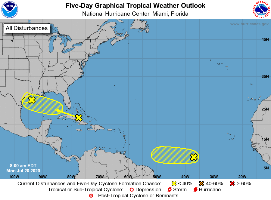
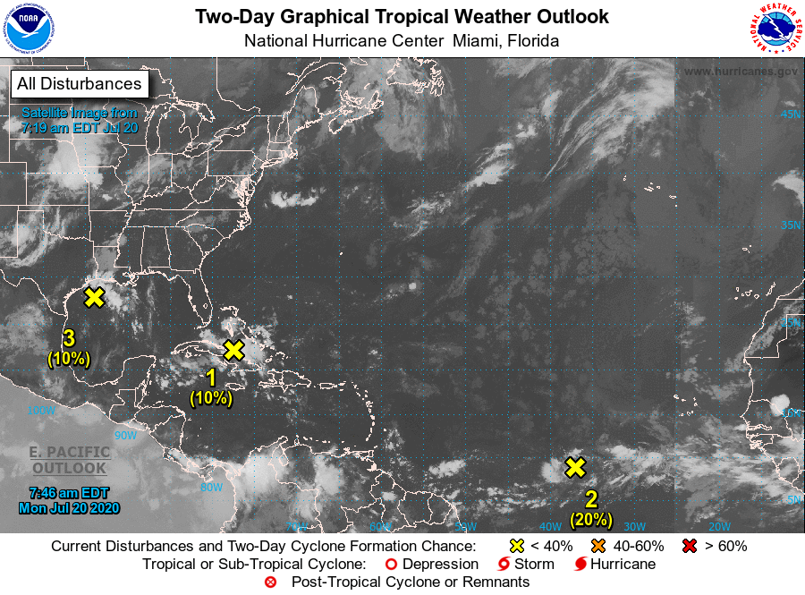
NHC is monitoring three areas over the Atlantic basin on this Monday. All three have a near zero chance of formation during the next 48 hours and a low (20 percent) chance during the next five days.
The first is an area of disorganized showers and thunderstorms over the Bahamas, central and eastern Cuba, and the adjacent Atlantic waters, associated with a tropical wave. This system is expected to move west-northwestward through the Straits of Florida today, over the southeastern Gulf of Mexico by Tuesday, across the central Gulf on Wednesday, and reach the northwestern Gulf on Thursday. Environmental conditions could become a little more conducive for development of this system once it reaches the Gulf of Mexico.
The second is another a tropical wave located about 1000 miles west-southwest of the Cabo Verde Islands. Environmental conditions are expected to be marginally conducive for development of this system during the next few days while it moves westward at 10 to 15 mph over the tropical Atlantic. By Friday and during the weekend, conditions are forecast to become less favorable for tropical cyclone formation.
The third is a weak low pressure area that has formed over the northwestern Gulf of Mexico. The associated shower and thunderstorm activity is currently disorganized, and little additional development is expected before the system moves inland over Texas tonight or Tuesday.
