
Sheriff Soignet urges preparation ahead of Tropical Storm Sally
September 12, 2020
Port Fourchon is moving Storm Phase 3, Recommended Evacuation
September 13, 2020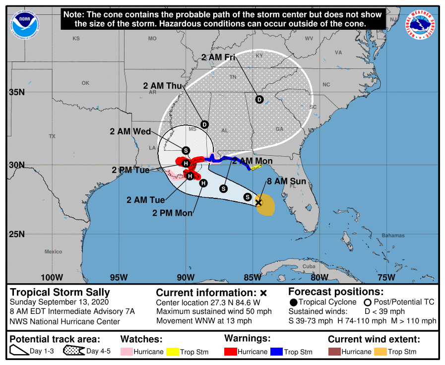
As we wake up this morning, the newest map at 7am echoes the shift back to the west Sally made over night. A Hurricane watch is in effect for Terrebonne and Lafourche, as our area falls to the west of the expected landfall position. Preparations have to be done today because impacts start Monday. Landfall is forecast late Monday into Tuesday.

At 800 AM EDT (1200 UTC), the center of Tropical Storm Sally was located near latitude 27.3 North, longitude 84.6 West. Sally is moving toward the west-northwest near 13 mph (20 km/h), and a west-northwestward or northwestward motion is expected through Monday. A decrease in forward speed and a turn toward the north-northwest is forecast on Tuesday. On the forecast track, the center of Sally will move over the southeastern and eastern Gulf of Mexico today, move over the north-central Gulf of Mexico tonight and Monday, and approach the north-central Gulf Coast within the hurricane warning area late Monday and Tuesday.
Maximum sustained winds are near 50 mph (85 km/h) with higher gusts. Strengthening is expected over the next couple of days, and Sally is forecast to become a hurricane on Monday, with some
additional strengthening possible through early Tuesday.
Tropical-storm-force winds extend outward up to 90 miles (150 km) from the center. A buoy located about 25 miles offshore of Venice, Florida, has reported sustained winds of 45 mph and a gust to 58 mph within the past few hours. The latest minimum central pressure based on data from an Air Force Reserve reconnaissance aircraft is 996 mb (29.41 inches).

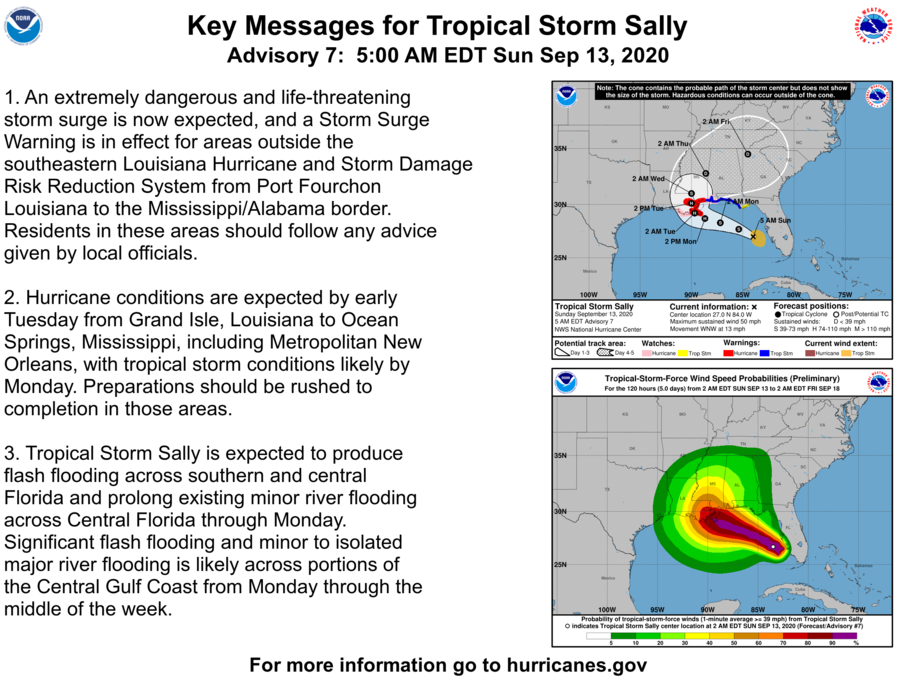
The combination of a dangerous storm surge and the tide will cause normally dry areas near the coast to be flooded by rising waters moving inland from the shoreline. The water could reach the following heights above ground somewhere in the indicated areas if the peak surge occurs at the time of high tide:
Mouth of the Mississippi River to Ocean Springs including Lake Borgne…7-11 ft
Port Fourchon to Mouth of the Mississippi River…4-7 ft
Ocean Springs to MS/AL Border…4-7 ft
Lake Pontchartrain and Lake Maurepas…4-6 ft
MS/AL Border to AL/FL Border including Mobile Bay…2-4 ft
AL/FL Border to Chassahowitzka including Pensacola Bay,
Choctawhatchee Bay, and Saint Andrew Bay…1-3 ft