
Houma native serves with Navy’s Weather Command Headquarters at Stennis Space Center
August 28, 2019
Polk Street Bridge to close Thursday and Friday and at times next week
August 28, 2019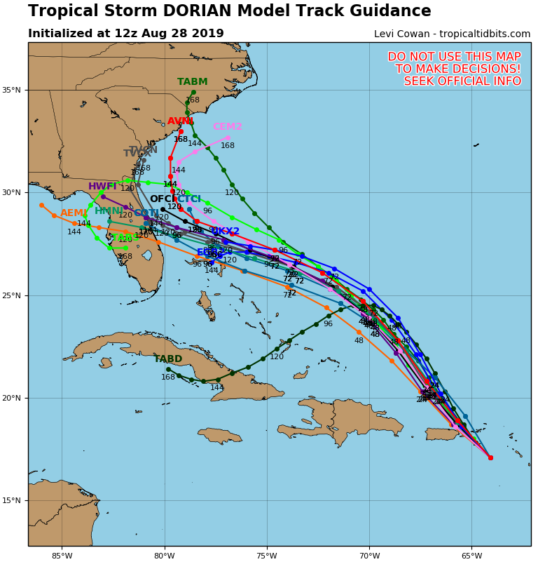
Tropical Storm Dorian may become Hurricane Dorian soon.
The tropical storm grew over night and is approaching hurricane strength. As of 10 a.m. on Wednesday, the storm was located at 17.5 N and 64.5 W. It’s moving northwest at 13 mph, in line with forecast predictions for the past several days.
Satellite images of the storm show growth – both in sheer size of the storm, but also in thunderstorms wrapping around the center. Because of that organization, storm winds have grown from 50 mph yesterday to 70 mph on Wednesday morning.

So what happens next?
Forecasts for Dorian still call for the storm to continue moving to the northwest over the next 24-48 hours. The storm is going to make landfall over Puerto Rico today, then be mostly over open water for several days.
Because of that lack of interaction with landfall, the National Hurricane Center now says Dorian will rapidly strengthen and will become a Category 3 hurricane at the time of landfall.

Computer models call for the storm to hit the middle of Florida’s peninsula, before jutting off to the north and east up the East Coast.
If that happens, impacts to Louisiana should be virtually non-existent, though the NHC warns that this far out, there is still variance in the track and the entire Gulf South should be on alert.

