
Nicholls Sales Program Among the Best in North America
June 18, 2021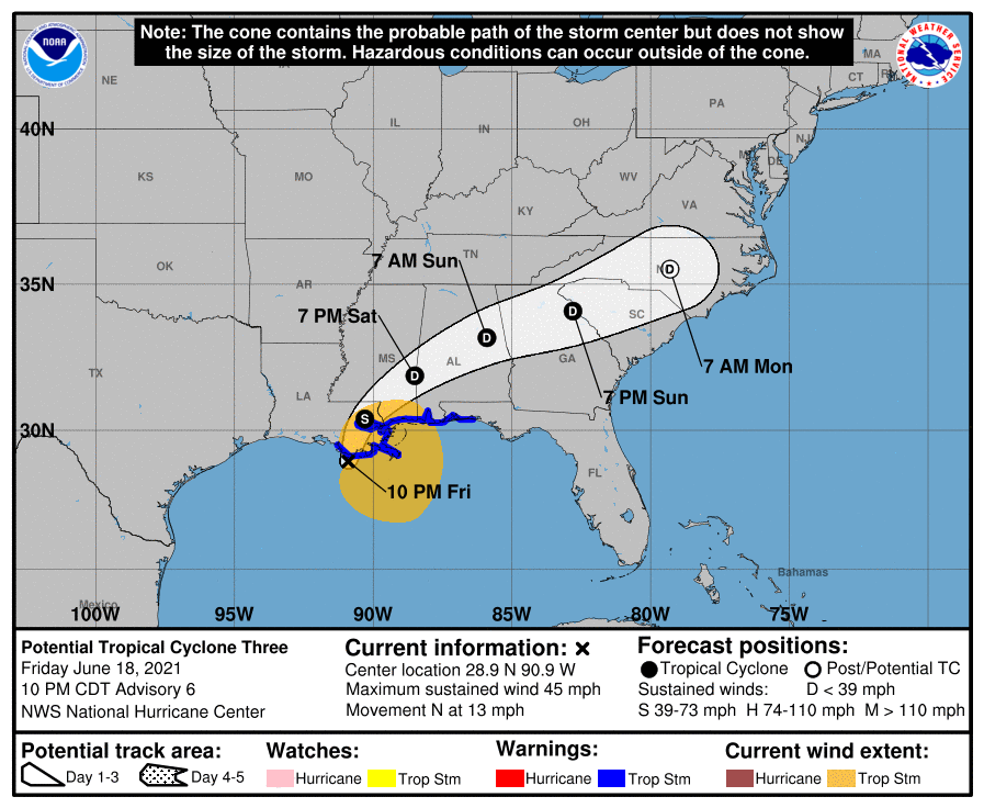
Disturbance yet to develop into tropical cyclone, but still has a ‘high chance’ to
June 18, 2021
…DISTURBANCE APPROACHING THE NORTH-CENTRAL GULF COAST…
…HEAVY RAINFALL AND TROPICAL-STORM-FORCE WINDS CONTINUING TO SPREAD ACROSS THE REGION…

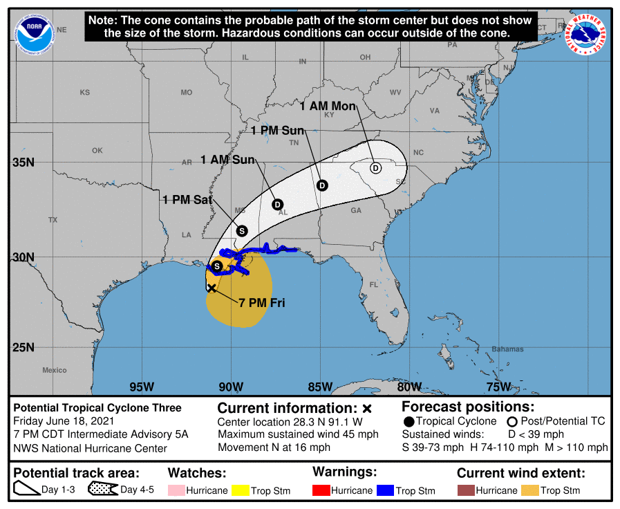
Potential Tropical Cyclone Three is located as of 7 p.m. CDT over the north-central Gulf of Mexico about 100 miles (160 km) south of Morgan City, La. The system is moving toward the north near 16 mph (26 km/h) and a north to north-northeast motion is expected during the next day or so. On the forecast track, the system will make landfall along the north-central Gulf Coast tonight or early Saturday. A northeastward or east-northeastward motion across the southeastern United States is forecast after landfall through the weekend.
Maximum sustained winds are near 45 mph (75 km/h) with higher gusts. Satellite images and surface observations indicate that the circulation is slowly becoming better defined, and the system still is likely to become a tropical or subtropical storm before landfall. If that occurs, it will be named Dolores. Regardless of its status, little change in strength is expected through landfall. Weakening is forecast to begin after the system crosses the coast.
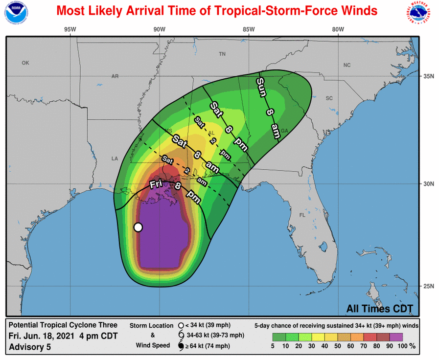
A Tropical Storm Warning continues from east of Morgan City, Louisiana, to the Okaloosa/Walton County line, Florida, including Lake Pontchartrain, Lake Maurepas, and Metropolitan New Orleans. Tropical storm conditions are beginning to reach the coast within the warning area, and these winds will continue into Saturday.
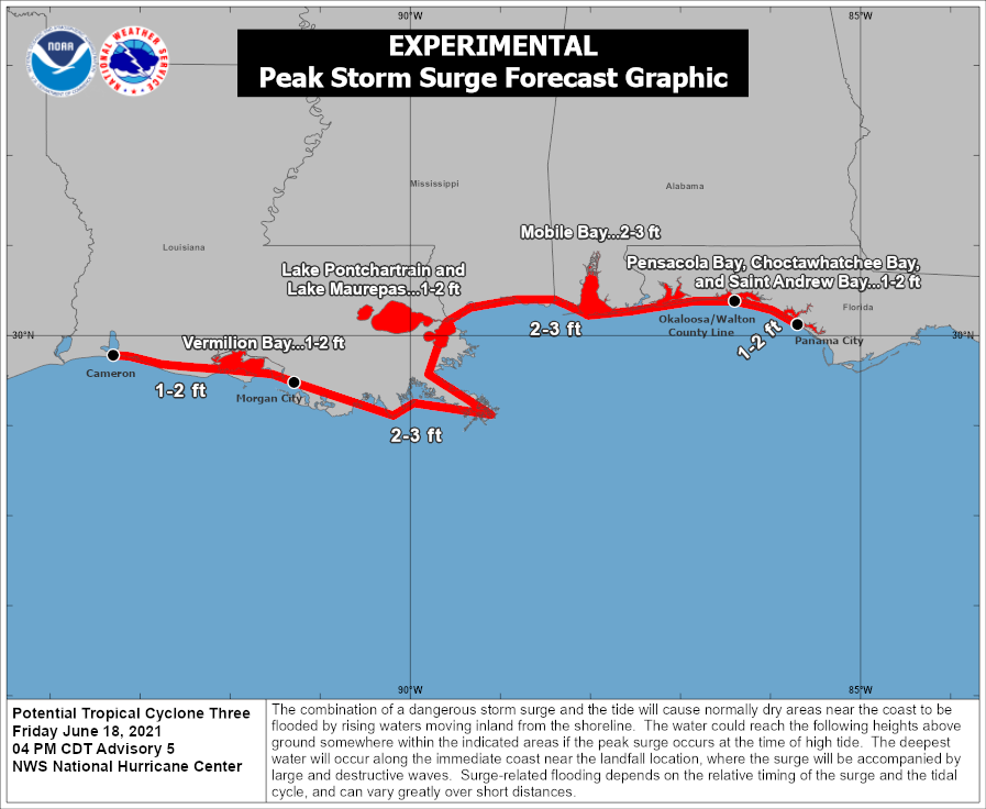
The combination of storm surge and the tide will cause normally dry areas near the coast to be flooded by rising waters moving inland from the shoreline. The water could reach the following heights above ground somewhere in the indicated areas if the peak surge occurs at the time of high tide…
– Morgan City, LA to Okaloosa/Walton County Line, FL…2-3 ft
– Lake Borgne and Mobile Bay…2-3 ft
– Lake Pontchartrain and Lake Maurepas…1-2 ft
– Okaloosa/Walton County Line, FL to Panama City, FL…1-2 ft
– Pensacola Bay, Choctawhatchee Bay and St. Andrew Bay…1-2 ft
– Cameron, LA to Morgan City, LA…1-2 ft
– Vermilion Bay…1-2 ft
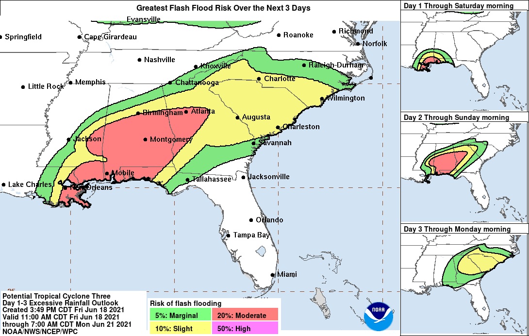
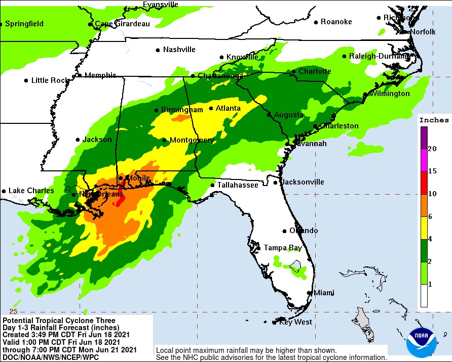
The potential tropical cyclone is expected to produce rainfall totals of 4 to 8 inches with isolated maximum amounts of 12 inches across portions of the Central Gulf Coast. Considerable flash, urban and small stream flooding impacts as well as new and renewed minor to isolated moderate river flooding are likely. As the system continues to lift northeast through the weekend, heavy rain will expand across southeastern Mississippi, southern and central Alabama, central to northern Georgia, far western North Carolina and western South Carolina, resulting in rainfall totals of 3 to 5 inches with isolated maximum amounts of 7 inches. Flash, urban, small stream and isolated minor river flooding impacts are possible.
There is a threat for a tornado or two tonight across coastal Louisiana. A few tornadoes are possible on Saturday across southern portions of Louisiana, Mississippi, Alabama, and the western Florida Panhandle.

