
Garbage pickup scheduled to run Friday, Saturday in Lafourche
October 8, 2020
Edwards: Louisiana Will Stay in Phase 3 to Continue to Slow the Spread of COVID-19
October 8, 2020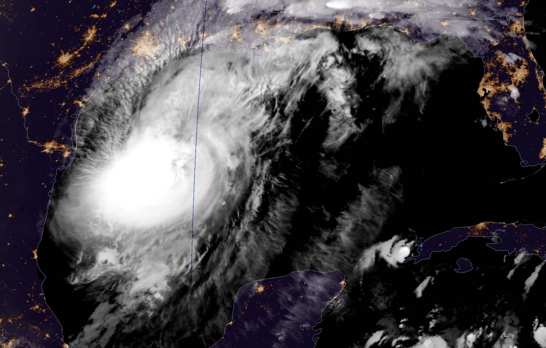
The intermediate advisory shows Hurricane Delta is still a category 3 storm. It is slowly starting to make a turn towards the north, but the track remains unchanged. The eye of the storm has formed and is 30 nautical miles across.


At 7 p.m. CDT, the center of Hurricane Delta was located over the western Gulf of Mexico about 310 miles (500 km) south of Cameron, Louisiana. Delta is moving toward the north-northwest near 12 mph (19 km/h). On the forecast track, the center of Delta will move over the northwestern Gulf of Mexico on Friday, and then move inland within the hurricane warning area Friday afternoon or Friday night.
Maximum sustained winds are near 115 mph (185 km/h) with higher gusts – a category 3 hurricane on the Saffir-Simpson Hurricane Wind Scale. Hurricane-force winds extend outward up to 35 miles (55 km) from the center and tropical-storm-force winds extend outward up to 160 miles (260 km). NOAA buoy 42002, just to the north of Delta’s center, recently measured a sustained wind of 54 mph (86 km/h) and a wind gust to 65 mph (104 km/h). Additional strengthening is possible tonight. Some weakening is anticipated as Delta approaches the northern Gulf coast on Friday, with rapid weakening expected after the center moves inland.
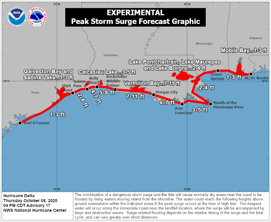
The combination of a dangerous storm surge and the tide will cause normally dry areas near the coast to be flooded by rising waters moving inland from the shoreline. The water could reach the following heights above ground somewhere in the indicated areas if the peak surge occurs at the time of high tide…
– Rockefeller Wildlife Refuge, LA to Morgan City, LA including
Vermilion Bay…7-11 ft
– Holly Beach, LA to Rockefeller Wildlife Refuge, LA…5-8 ft
– Sabine Pass to Holly Beach, LA…4-7 ft
– Morgan City, LA to Port Fourchon, LA…4-7 ft
– Port Fourchon, LA to the Mouth of the Mississippi River…3-5 ft
– Calcasieu Lake…3-5 ft
– High Island, TX to Sabine Pass…2-4 ft
– Mouth of the Mississippi River to Ocean Springs, MS…2-4 ft
– Lake Borgne, Lake Pontchartrain, & Lake Maurepas…2-4 ft
– Ocean Springs, MS to the AL/FL state line including Mobile Bay…1-3 ft
– Sabine Lake…1-3 ft
– Port O’Connor, TX to High Island, TX including Galveston Bay…1-3 ft

Friday through Saturday, Delta is expected to produce 5 to 10 inches of rain, with isolated maximum totals of 15 inches, from southwest into south-central Louisiana. These rainfall amounts will lead to significant flash, urban, small stream flooding, along with minor to major river flooding. For extreme east Texas into northern Louisiana, southern Arkansas and western Mississippi, Delta is expected to produce 3 to 6 inches of rain, with isolated maximum totals of 10 inches. These rainfall amounts will lead to flash, urban, small stream and isolated minor river flooding.
The next complete advisory will be issued by NHC at 10 p.m. CDT

