
Glorietta Liner Lovell
August 26, 2020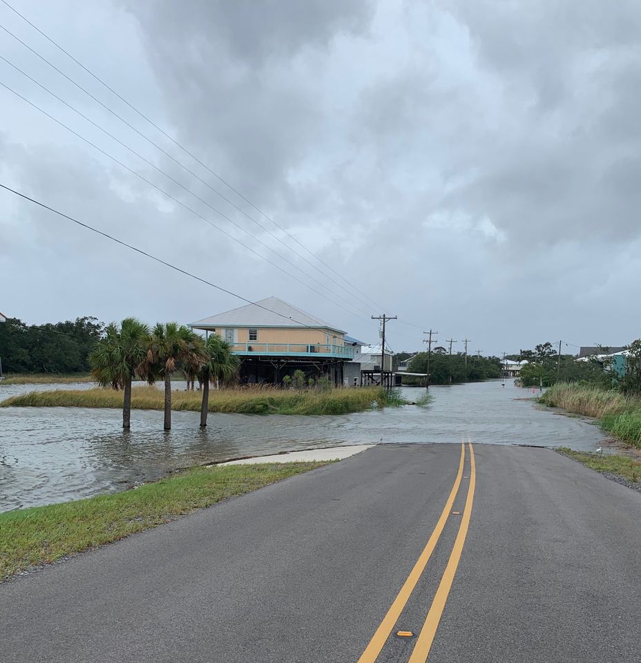
SLECA to de-energize lines in area south of levee system for safety
August 26, 2020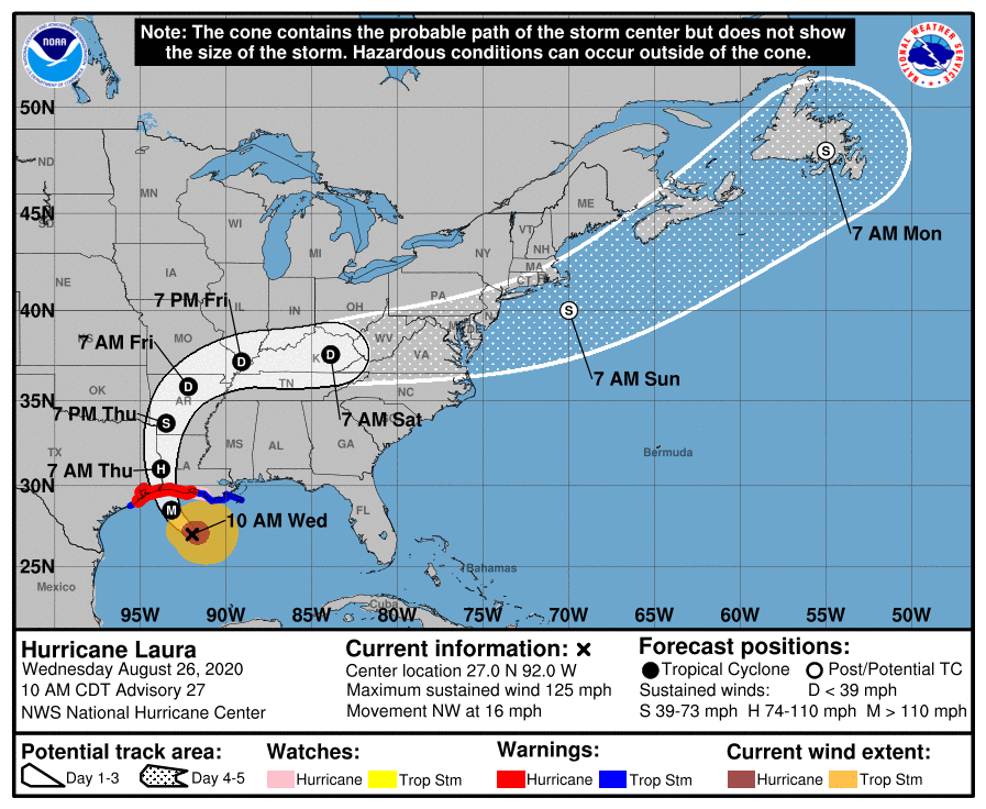
Hurricane Laura continues to rapidly strengthen and it is expected to become an extremely dangerous category 4 hurricane. Catastrophic storm surge, extreme winds and flash flooding is expected along the western Gulf Coast tonight. Laura’s winds are up to 125 mph and expected to strengthen more to a powerful Cat 4 with winds of 145 mph.

At 1000 AM CDT (1500 UTC), the eye of Hurricane Laura was located near latitude 27.0 North, longitude 92.0 West. Laura is moving toward the northwest near 16 mph (26 km/h). A gradual turn toward the north-northwestward and north is expected later today and tonight. On the forecast track, Laura will approach the Upper Texas and southwest Louisiana coasts this evening and move inland within that area tonight. The center of Laura is forecast to move over northwestern Louisiana tomorrow, across Arkansas Thursday night, and over the mid-Mississippi Valley on Friday.
Data from NOAA and Air Force Hurricane Hunter aircraft indicate that maximum sustained winds have increased to near 125 mph (205 km/h) with higher gusts. Laura is a category 3 hurricane on the Saffir-Simpson Hurricane Wind Scale. Additional strengthening in expected and Laura is forecast to become a category 4 hurricane this afternoon. Rapid weakening is expected after Laura makes landfall. Hurricane-force winds extend outward up to 70 miles (110 km) from the center and tropical-storm-force winds extend outward up to 175 miles (280 km). The latest minimum central pressure estimated from reconnaissance aircraft data is 956 mb (28.23 inches).


