
‘Citywide Call to Prayer and Worship’ event set for Friday night
August 25, 2020
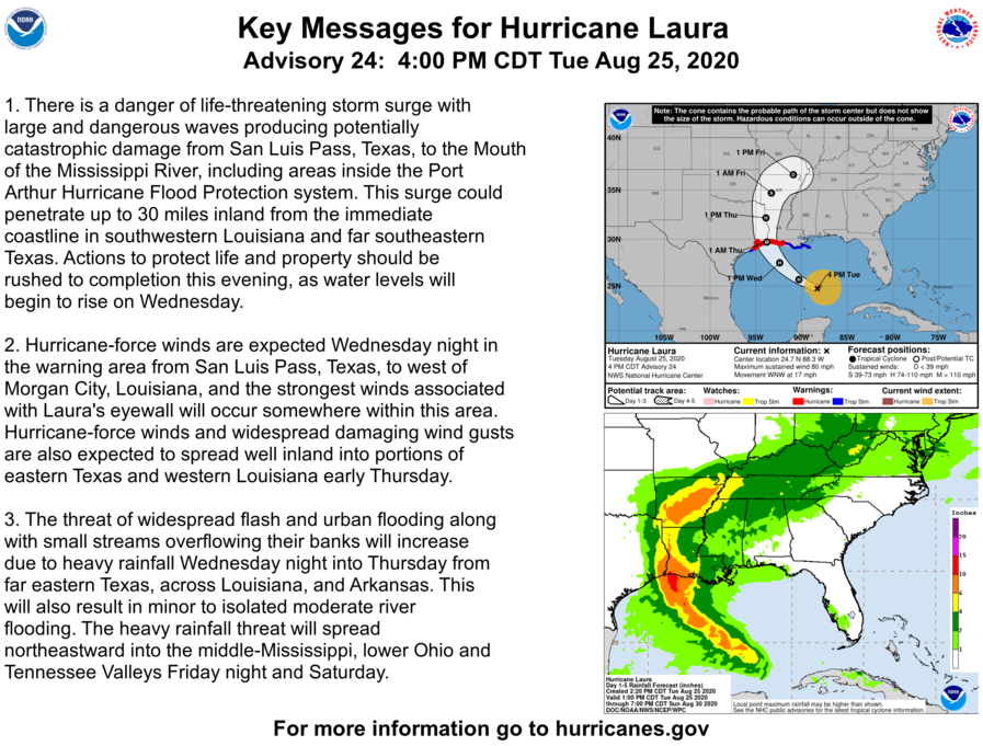
Evacuations ordered ahead of Hurricane Laura
August 25, 2020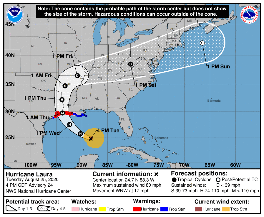
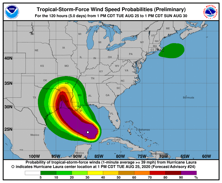
Hurricane Laura is moving West-Northwest across the central Gulf of Mexico and is expected to strengthen into a major hurricane before landfall Wednesday night or Thursday morning.

At 400 PM CDT (2100 UTC), the center of Hurricane Laura was located near latitude 24.7 North, longitude 88.3 West. Laura is moving toward the west-northwest near 17 mph (28 km/h), and this general
motion should continue tonight. A turn toward the northwest is forecast by Wednesday, and a northwestward to north-northwestward motion should continue through Wednesday night. On the forecast
track, the center of Laura will move across the central Gulf of Mexico tonight and the northwestern Gulf of Mexico on Wednesday. The hurricane should approach the Upper Texas and Southwest
Louisiana coasts on Wednesday night and move inland near those areas late Wednesday night or Thursday morning.

Maximum sustained winds are near 80 mph (130 km/h) with higher gusts. Significant strengthening is forecast during the next 36 hours, and Laura is expected to be a major hurricane at landfall. Rapid weakening is expected after Laura makes landfall.
Hurricane-force winds extend outward up to 45 miles (75 km) from the center and tropical-storm-force winds extend outward up to 175 miles (280 km). The estimated minimum central pressure is 990 mb (29.24 inches).

