
LA 1 to Grand Isle now open
September 15, 2020
Terrebonne Booking Log: 09/16/2020
September 16, 2020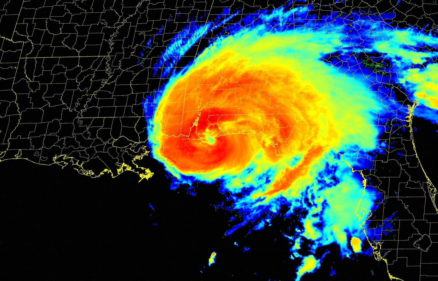
At approximately 445 AM CDT, the center of Hurricane Sally’s eye made landfall near Gulf Shores, Alabama, as a Category 2 hurricane, with maximum sustained winds of 105 mph (165 km/h) and a minimum central pressure of 965 mb (28.50 inches).

At 6 a.m. CDT, Hurricane Sally was located over Gulf Shores, AL, with maximum sustained winds of 105 mph – still a category 2 hurricane on the Saffir-Simpson Hurricane Wind Scale. A sustained wind of 81 mph (130 km/h) and a gust to 99 mph (159 km/h) has been reported at Dauphin Island, Alabama, within the past hour or so. A sustained wind of 61 mph (98 km/h) and a gust to 86 mph (139 km/h) has been observed at the Pensacola Naval Air Station, in Pensacola, Florida.
Elsewhere, there are three areas we continue to watch for potential development. One is an area of low pressure over the southwestern Gulf of Mexico, producing showers and thunderstorms that have become a little better organized during the past several hours. Upper-level winds are forecast to gradually become more conducive for development, and a tropical depression could form late this week or over the weekend while the low meanders over the southern Gulf of Mexico for the next several days. It has a medium (60 percent) chance of formation during the next five days.
There’s an area of low pressure located a few hundred miles south-southeast of the Cabo Verde Islands. Environmental conditions are conducive for development of this system and a tropical depression is likely to form during the next few days while the system moves generally westward at 10 to 15 mph.It has a high (70 percent) chance of formation during the next five days.
The third is a non-tropical area of low pressure located over the far northeastern Atlantic Ocean a few hundred miles northeast of the Azores. This system could acquire some subtropical characteristics while it moves southeastward and eastward at about 10 mph during the next few days. It has a low (20 percent) chance of formation during the next five days.


