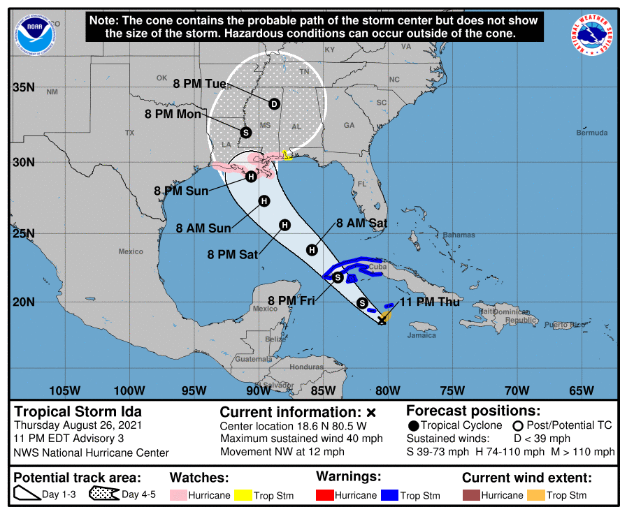
Hurricane Watch issued for coastal Louisiana
August 26, 2021
WEATHER UPDATE: Local Jamborees welcome back high school football
August 27, 2021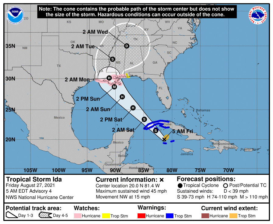
The 4am CT advisory shows signs of Ida continuing to organize. The NHC now has it making landfall on Sunday as a Category 3 hurricane. Experts recommend preparing for at least one category higher. The storm is expected to enter the Gulf of Mexico tonight and rapidly intensify. Wind, rain and storm surge are all a threat at this time.
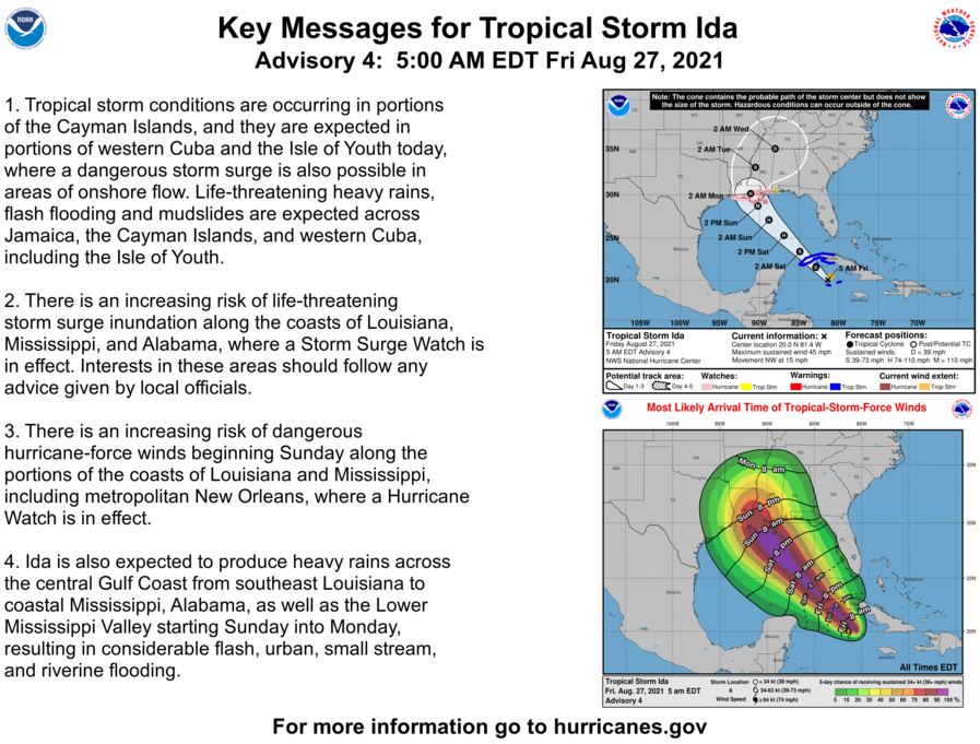
At 5 a.m. EDT, the center of Tropical Storm Ida was located over the west-central Caribbean Sea about 50 miles (80 km) north-northwest of Grand Cayman and about 145 miles (230 km) southeast of the Isle of Youth. Ida is depression is moving toward the northwest near 15 mph (24 km/h) and this general motion should continue over the next few days. On the forecast track, the center of Ida will move away from the Cayman Islands this morning, pass near or over the Isle of Youth and western Cuba later today, and over the southeastern and central Gulf of Mexico tonight and Saturday. The system is forecast to approach the U.S. northern Gulf coast on Sunday.
Maximum sustained winds have increased to near 45 mph (75 km/h) with higher gusts. Tropical-storm-force winds extend outward up to 80 miles (130 km) from the center. The estimated minimum central pressure is 1001 mb (29.56 inches). Grand Cayman Island recently reported a pressure of 1003 mb (29.62 inches). Additional steady to rapid strengthening is expected to occur during the next few days. Ida is forecast to become a hurricane over the southeastern Gulf of Mexico in a day or two, and to be at or near major hurricane strength when it approaches the northern Gulf coast.
The combination of a dangerous storm surge and the tide will cause normally dry areas near the coast to be flooded by rising waters moving inland from the shoreline. The water could reach the following heights above ground somewhere in the indicated areas if the peak surge occurs at the time of high tide…
– Morgan City, LA to Ocean Springs, MS including Lake Borgne…7-11 ft
– Rockefeller Wildlife Refuge, LA to Morgan City, LA incl. Vermilion Bay…4-7 ft
– Ocean Springs, MS to MS/AL border…4-7 ft
– MS/AL border to AL/FL state line including Mobile Bay…3-5 ft
– Lake Pontchartrain…3-5 ft
– Lake Maurepas…2-4 ft
– Sabine Pass to Rockefeller Wildlife Refuge, LA…2-4 ft
As Ida approaches the central Gulf Coast Sunday afternoon, total rainfall accumulations of 8 to 16 inches with isolated maximum amounts of 20 inches are possible from southeast Louisiana to coastal Mississippi and Alabama through Monday morning. Ida is forecast to turn northeast as it moves inland later Monday with rainfall totals of 4 to 8 inches possible across southern and central Mississippi. This is likely to result in considerable flash, urban, small stream, and riverine flooding.

Related posts

April 18, 2024