Category 2 hurricane Laura now expected to strengthen to a category 4 storm
August 26, 2020
ROAD CLOSURE: LA 1 Closed South of the Golden Meadow Lock
August 26, 2020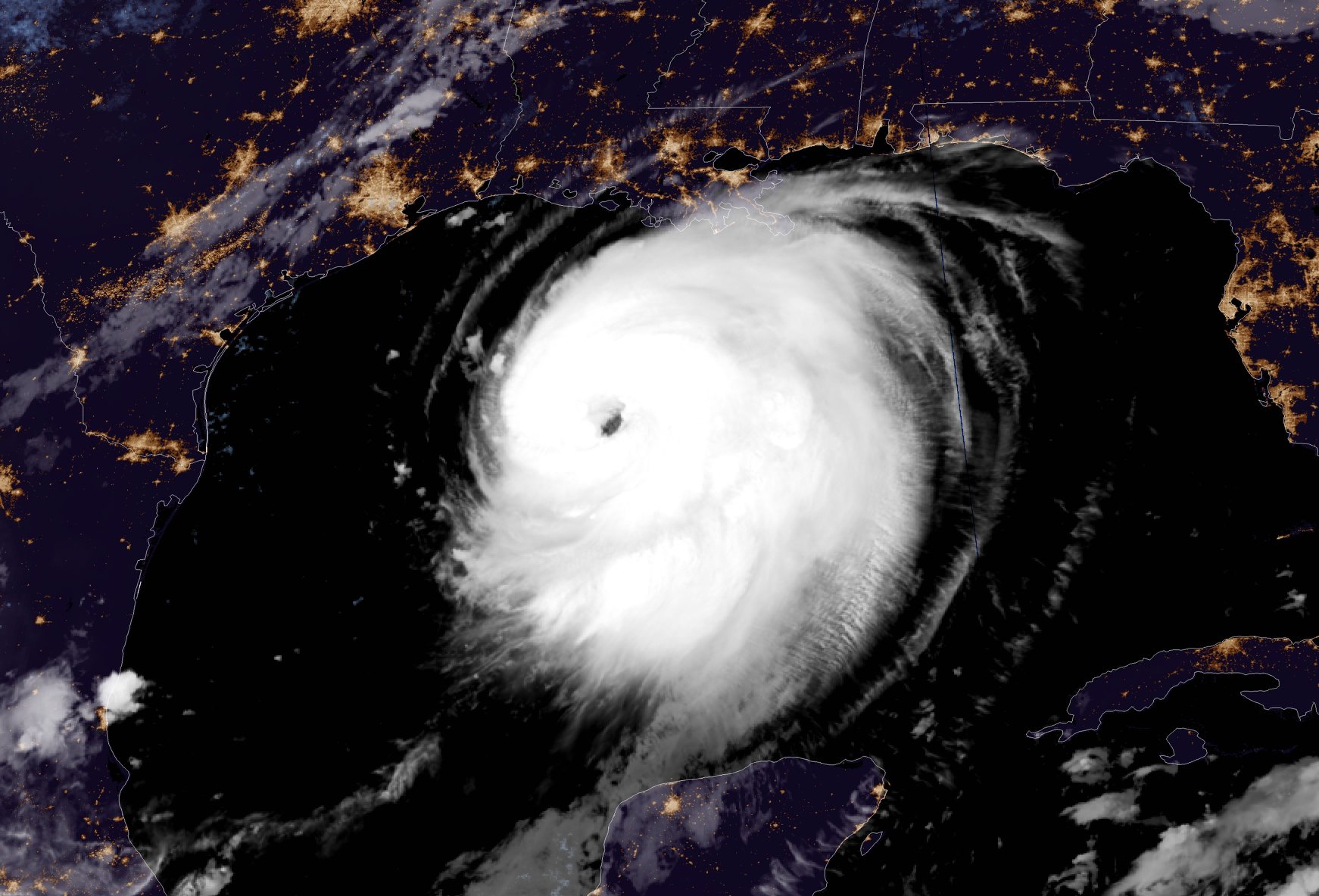
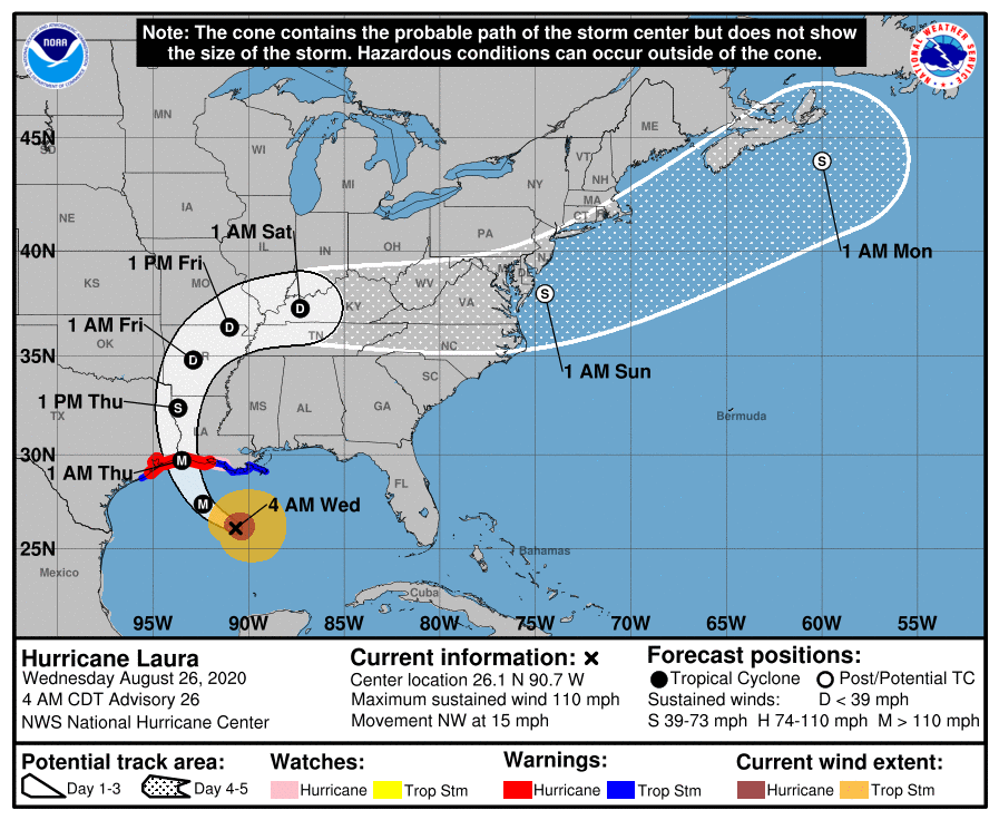
Hurricane Laura has rapidly intensified into a category 3 storm.
At 7 a.m. CDT, the center of Hurricane Laura was located about 280 miles (450 km) south-southeast of Lake Charles, La. It’s moving toward the northwest near 15 mph (24 km/h) and this general motion should continue today, followed by a north-northwestward motion tonight. On the forecast track, Laura should approach the Upper Texas and southwest Louisiana coasts this evening and move inland near those areas tonight or Thursday morning.

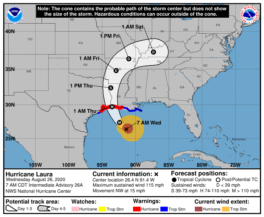
Data from NOAA and Air Force Hurricane Hunter aircraft indicate that maximum sustained winds have increased to near 115 mph (185 km/h) with higher gusts – a dangerous category 3 hurricane on the Saffir-Simpson Hurricane Scale. It is forecast to continue strengthening into a category 4 hurricane later today. Rapid weakening is expected after Laura makes landfall.
Laura is a large hurricane. Hurricane-force winds extend outward up to 70 miles (110 km) from the center and tropical-storm- force winds extend outward up to 175 miles (280 km). Buoy 42395, located just east of Laura’s eye, recently reported a sustained wind of 74 mph (119 km/h) and a wind gust of 107 mph (172 km/h) and a wave height of 37 feet (11 meters).

