
GLPC enters Phase 5, Storm in Port at Port Fourchon
August 23, 2020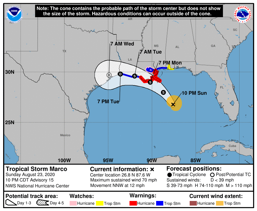
Marco downgraded to a Tropical Storm
August 23, 2020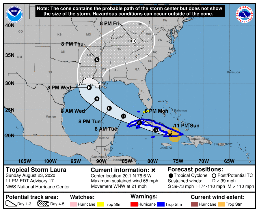
The 10pm update indicated Laura is stronger. Track has shifted back to the East some, placing Terrebonne back into the cone.
At 1100 PM EDT (0300 UTC), the center of Tropical Storm Laura was located near latitude 20.1 North, longitude 76.6 West. Laura is moving toward the west-northwest near 21 mph (33 km/h) and this general motion with some decrease in forward speed is expected over the next couple of days. A turn toward the northwest is forecast by Wednesday. On the forecast track, the center of Laura will move near or over the southern coast of Cuba tonight and Monday, and move over the southeastern Gulf of Mexico Monday night and Tuesday. Laura is expected to move over the central and northwestern Gulf of Mexico Tuesday night and Wednesday.

Maximum sustained winds have increased to near 65 mph (100 km/h) with higher gusts. Gradual strengthening is expected, and Laura is forecast to become a hurricane by early Tuesday.
Tropical-storm-force winds extend outward up to 140 miles (220 km) from the center. The estimated minimum central pressure is 1000 mb (29.53 inches).

