
LDH now breaking out confirmed and probable COVID-19 deaths on dashboard
April 22, 2020
Edwards: “I’m calling on Louisiana to mask up”
April 22, 2020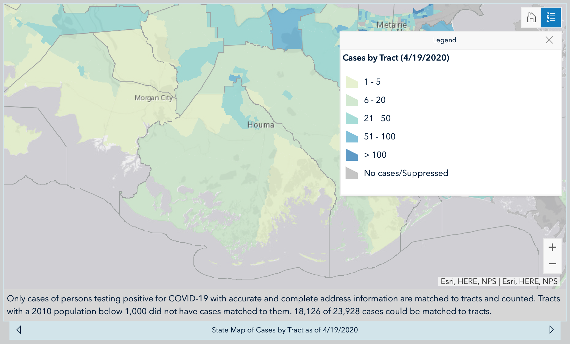
The Louisiana Department of Health is now reporting cases on a map by parish, and down to a certain “tract.” The map shows an estimate of how many cases are in each small area of the parish.

According to LDH, only cases of persons testing positive for COVID-19 with accurate and complete address information are matched to tracts and counted. Tracts with a 2010 population below 1,000 did not have cases matched to them. 18,126 of 23,928 cases could be matched to tracts.
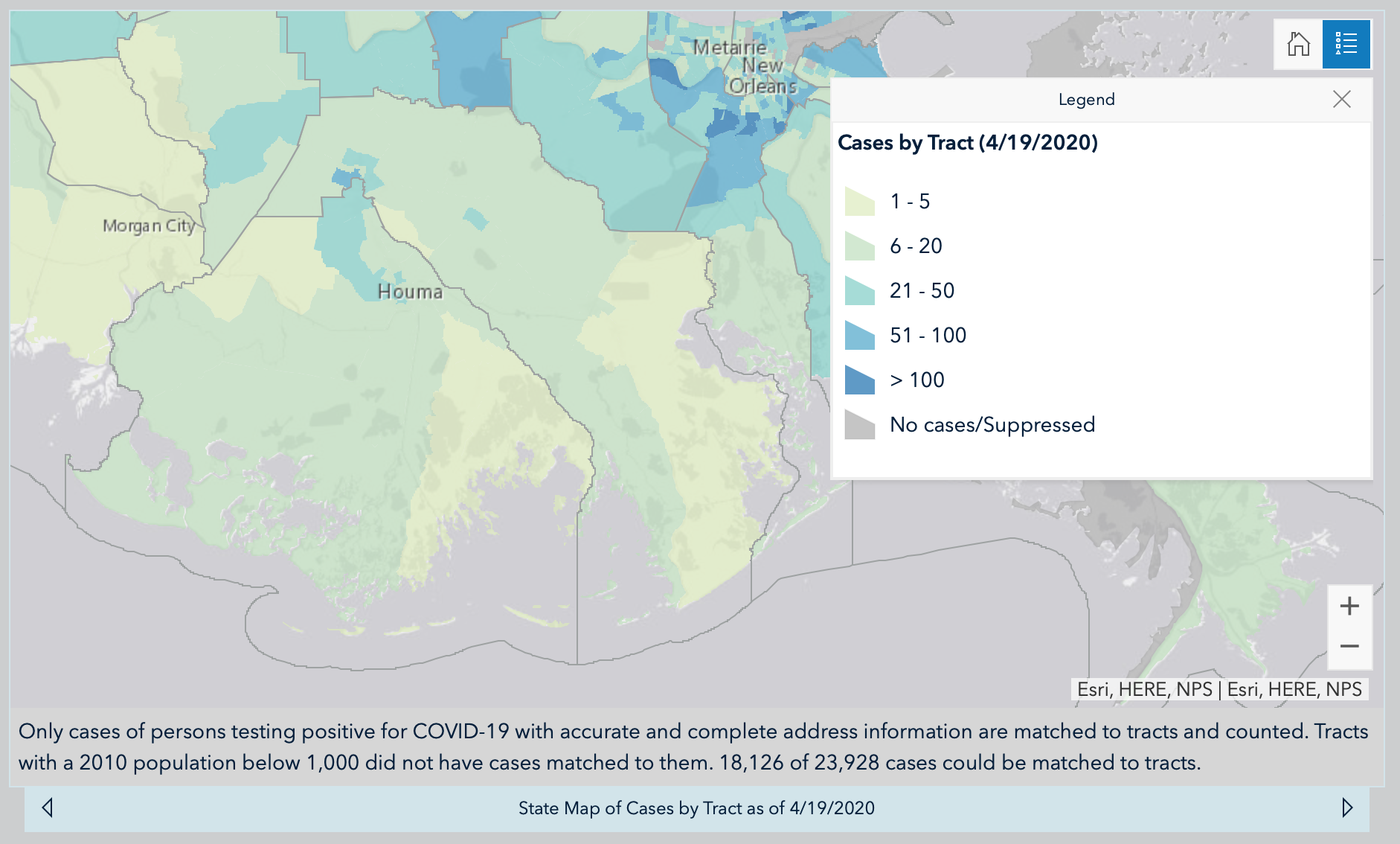
Now, I’ll admit, map reading was never my strongest subject. But I’m giving my best guess as to the communities highlighted on these maps.
It seems the majority of Terrebonne cases are in the more north and central area of the parish, in Schriever and Gray and a bit into northern Houma. These areas show 21-50 cases. The vast remainder of Terrebonne shows areas of 6-20 cases, with the outlying regions showing 1-5 cases.


In Lafourche parish, the majority of cases are in the northern part of the parish as well, near the shared border with Terrebonne, where their cases see a spike.

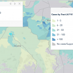
At the Terrebonne/Lafourche border, in the Schriever and Thibodaux area, there are two areas show 50-100 cases. In Thibodaux and the surrounding communities, there are another two areas that both list 21-50 cases. There is one other area around Raceland, that is showing 21-50 cases. As you travel further south, the parish fades from 6-20 cases to 1-5 cases.

