Vehicle crashes into retail store in Thibodaux
November 9, 2020
Beginner Handgun Course set for Nov. 21 at LPSO Shooting Range
November 10, 2020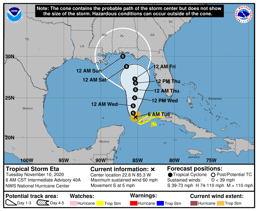
The 6 a.m. advisory for Tropical Storm Eta stretched the cone of uncertainty more to the west, to include Louisiana, Terrebonne and Lafourche parishes. The storm is forecast to enter the Gulf of Mexico today, and is expected to near hurricane strength over the next 24-48 hours as it drifts northward. However, it is then expected to weaken to depression as it nears the Gulf coast this weekend. As much as this storm’s track has changed over the last 24 hours, it is worth keeping an eye on.

At 600 AM CST (1200 UTC), the center of Tropical Storm Eta was located near latitude 22.6 North, longitude 85.3 West. Eta has been drifting southward this morning, but it is expected to become stationary again later today. A slow northward motion is forecast to begin tonight and continue through Thursday.
Maximum sustained winds have increased to near 60 mph (100 km/h) with higher gusts. Additional strengthening is forecast during the next day or two, followed by weakening likely starting on Thursday. Tropical-storm-force winds extend outward up to 60 miles (95 km) from the center. The estimated minimum central pressure is 992 mb (29.29 inches).