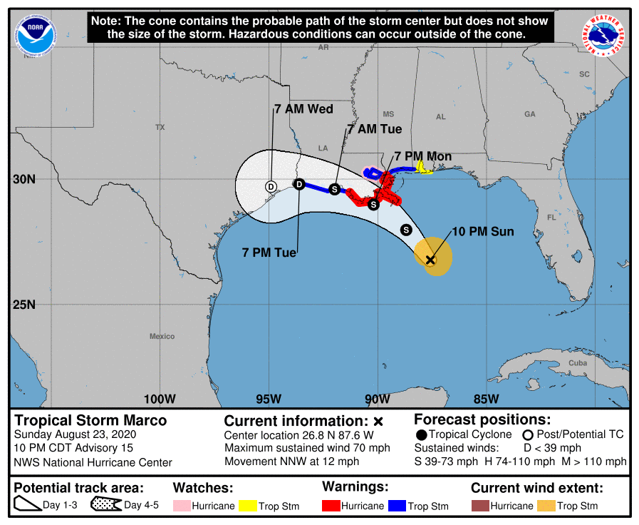
Marco downgraded to a Tropical Storm
August 23, 2020
All eyes on Laura as it moves towards the US
August 24, 2020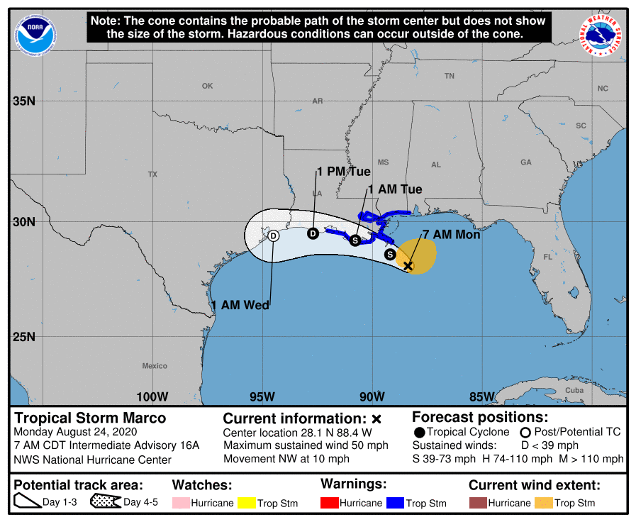
This morning, Tropical Storm Marco is dumping rain and wind from Florida to Louisiana as it approaches the Louisiana coast. A storm surge of 2-4 feet is still possible.
At 700 AM CDT (1200 UTC), the center of Tropical Storm Marco was located near latitude 28.1 North, longitude 88.4 West. Marco is moving toward the northwest near 10 mph (17 km/h). Marco is forecast to approach the coast of Louisiana this afternoon, and then turn westward and move very close to the coast of Louisiana through Tuesday night.

Data from an Air Force Reserve Hurricane Hunter aircraft indicate that maximum sustained winds have decreased to near 50 mph (80 km/h) with higher gusts. Further weakening is expected, and Marco is
forecast to become a tropical depression late on Tuesday and dissipate on Wednesday.
Tropical-storm-force winds extend outward up to 105 miles (165 km), primarily northeast of the center. The estimated minimum central pressure is 1005 mb (29.68 inches).

