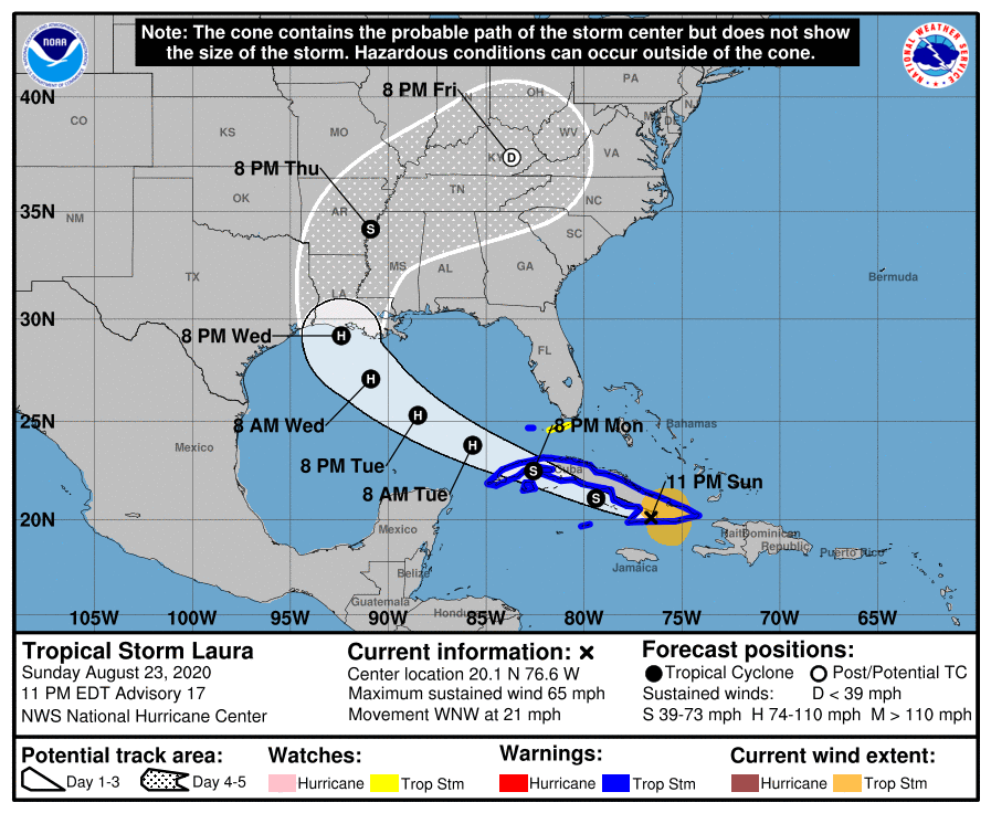
Laura gains strength; Track has shifted back to the East
August 23, 2020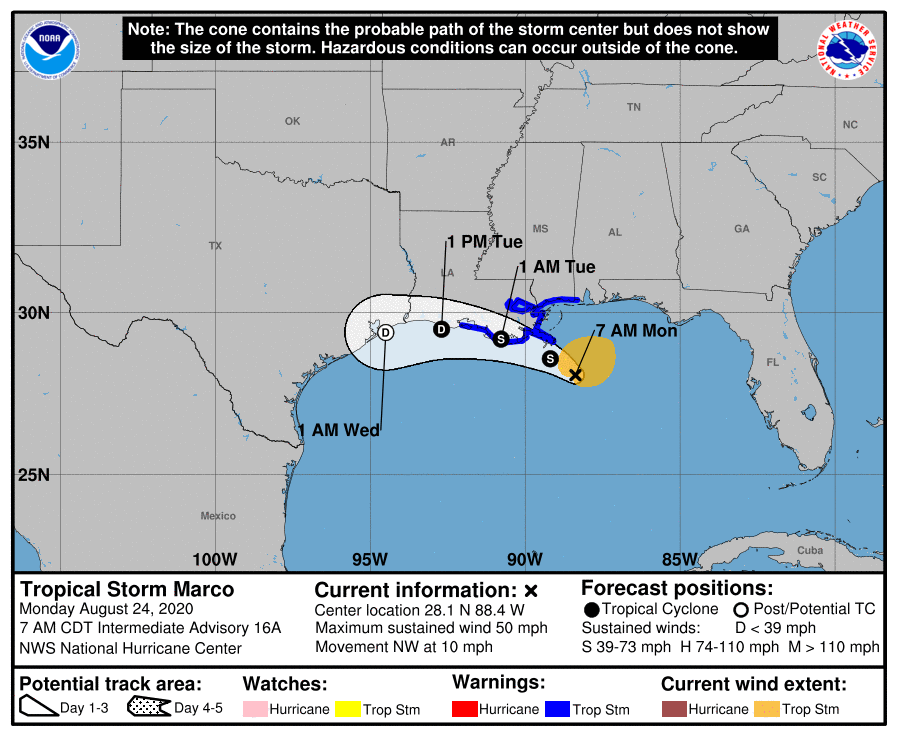
Marco delivering severe weather along the Gulf coast
August 24, 2020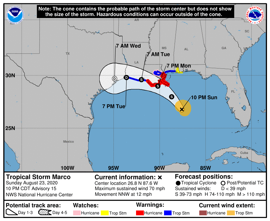
At the 10pm update, Marco has been downgraded back to a tropical storm. The Hurricane Watch from Intracoastal City to west of Morgan City has been canceled. Terrebonne and Lafourche remain under a storm and hurricane warning with this update. The tropical storm should make landfall around 7pm tomorrow.
At 1000 PM CDT (0300 UTC), the center of Tropical Storm Marco was located by an Air Force Reserve Hurricane Hunter plane near latitude 26.8 North, longitude 87.6 West. Marco is moving toward the
north-northwest near 12 mph (19 km/h). A continued north-northwestward motion is possible tonight, but a turn toward the northwest is expected by Monday morning. Marco is forecast to approach the coast of Louisiana by Monday afternoon, and then turn westward and move near or over the coast through Tuesday.

Data from the Hurricane Hunter plane indicate that maximum sustained winds have decreased to near 70 mph (110 km/h) with higher gusts. Fluctuations in intensity are possible during the next 24 hours, but
Marco is forecast to weaken rapidly by early Tuesday.
Tropical-storm-force winds extend outward up to 70 miles (110 km) from the center. The estimated minimum central pressure based on data from the reconnaissance aircraft is 1000 mb (29.53 inches).
The combination of a dangerous storm surge and the tide will cause normally dry areas near the coast to be flooded by rising waters moving inland from the shoreline. The water could reach the following heights above ground somewhere in the indicated areas if the peak surge occurs at the time of high tide…

Morgan City LA to Mouth of the Mississippi River…4-6 ft
Mouth of the Mississippi River to Ocean Springs MS including Lake Borgne…3-5 ft
Lake Pontchartrain and Lake Maurepas…2-4 ft
Intracoastal City LA to Morgan City LA…2-4 ft
Sabine Pass to Intracoastal City…1-3 ft
Ocean Springs MS to the AL/FL Border including Mobile Bay…1-3 ft
The deepest water will occur along the immediate coast in areas of onshore winds, where the surge will be accompanied by large and dangerous waves. Surge-related flooding depends on the relative timing of the surge and the tidal cycle, and can vary greatly over short distances.
