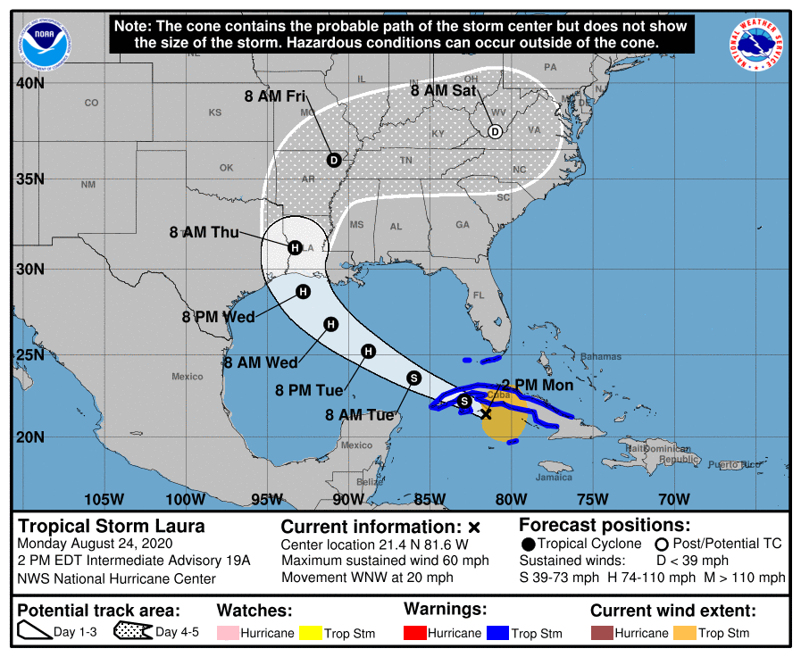
TS Laura holding steady on track, forecast to make landfall in Louisiana as Category 2
August 24, 2020
Terrebonne Parish Monday, Tuesday curfews lifted
August 24, 2020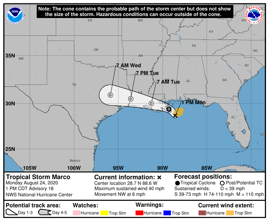
The 1pm advisory for TS Marco shows the Tropical Storm Warning and Storm Surge Warning for the U.S. Gulf Coast have been discontinued. There are no coastal watches or warnings in effect.
Gusty winds, heavy rainfall, and lingering coastal flooding are expected from Marco along portions of the Gulf Coast through this evening.

Tropical cyclone wind and surge watches or warnings are likely to be issued for portions of the U.S. Gulf Coast later today for Tropical Storm Laura.
At 100 PM CDT (1800 UTC), the center of Tropical Storm Marco was located near latitude 28.7 North, longitude 88.6 West. Marco is moving toward the northwest near 6 mph (9 km/h). A turn to the west-northwest is expected to occur by Tuesday, and this motion should continue until the system dissipates in a couple of days.
Aircraft and satellite derived wind data indicate that maximum sustained winds are near 40 mph (65 km/h) with higher gusts. Further weakening is expected, and Marco is forecast to become a tropical depression tonight and degenerate to a remnant low on Tuesday.

Tropical-storm-force winds extend outward up to 80 miles (130 km) to the northeast of the center over water. A National Ocean Service weather station located on Petit Bois Island, Mississippi recently reported a wind gust to 35 mph (58 km/h).
The latest minimum central pressure reported by aircraft reconnaissance is 1008 mb (29.77 inches).

