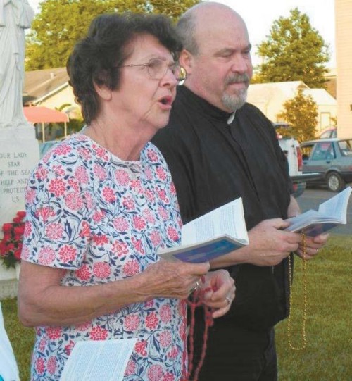
Those in water’s path unite in prayer
May 19, 2011Tuesday, May 24
May 23, 2011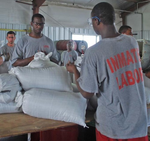
Lafourche Parish President Charlotte Randolph declared a state of emergency for the parish last Tuesday in anticipation of potential flood risks that could arise after the opening of the Morganza Spillway Saturday.
Randolph said the parish is monitoring the situation and she hopes a more detailed flood projection map would be released soon. She asked the public to be aware of the risks and keep informed with developments.

“I think what we’ve heard is the worst-case scenario in each area,” Randolph told the parish council Tuesday night. “That’s a good way to prepare. You prepare for the worst and hope that [the water] will have a way of trickling out into abandoned areas, into non-developed areas.”

The opening of the spillway caused a diversion of water from the Mississippi River, which had heightened water elevation due to heavy rain and snow over the winter, into the Atchafalaya River and its tributaries. Lafourche Parish faces a threat of backwater flooding.
The parish president said the declaration was not meant to cause alarm and was the next step in the parish’s diligence in preparing for floodwaters. She said the parish is contemplating evacuation plans, but nothing will be determined until more is known.
“We are certainly not going to let it get to a level that we can’t manage,” she said. “It’s a circumstance that we have not experienced, so we will continue to monitor it very closely.

“None of that is necessary right now, but the governor is saying there needs to be some thought of that, in particularly vulnerable areas.”
Chris Boudreaux, the parish’s director of emergency preparedness, echoed the parish president’s comments and said his office is monitoring the situation and identifying at-risk areas that would need reinforcement.

“Right now, the way it’s looking, I don’t think Lafourche will really see much water from this, but there is no guarantee,” Boudreaux said. “We have to prepare for the worst, and that’s what we’re looking at for the areas that could be impacted and what we can do to resolve the situation.”
The state of emergency declaration came in response to maps released this past weekend by the U.S. Army Corps of Engineers. The color-coded map indicates that parts of Lafourche Parish could have between 5 and 10 feet of water inundation and portrays the eastern banks of Bayou Lafourche to be in a zero- to 5-foot zone.
North Lafourche Levee District Executive Director Dwayne Bourgeois, after meeting with the corps officials who designed the map, called the dissemination of the maps correct but inaccurate.

“[Newspaper] articles say that areas west of Mathews and west of Larose could see 5 or 10 feet, according to the maps,” Bourgeois said last Wednesday. “That is correct. It’s not accurate, because the corps didn’t know anything about our levees in this area.”

Bourgeois met with the corps officials, a hydrologist and geographic information system engineers, on Tuesday. The meeting, Bourgeois said, gave him a sense of cautious optimism.
When designing the map, corps officials started with the Atchafalaya River in St. Mary Parish and worked east in determining water surface elevation levels. Along the Gulf Intracoastal Waterway (GIWW), the corps assumed a 5-foot water elevation near Morgan City and tabbed it at 3 feet near both Houma and Larose, Bourgeois said.

From there, the corps used the state LIDAR system to determine land surface elevations, and without taking ring levee and pump systems in the lower-lying areas of west Lafourche, combined the assumed water elevations with the believed land height.
“They didn’t want this map to be too precise, so anything that yielded a result between 0 and 5 [feet], they called it one thing (purple), and if something yielded a result between 5 and 10, they called it another (blue),” Bourgeois said. “They weren’t looking for people to be as close to these maps as people ultimately got.”
Bourgeois said he left the meeting cautiously optimistic. “As long as things don’t get out of hand and they maintain control and they do it to 50 percent or less, I think we’ll have some water, we’ll have some high water against levees and we’ll be able to combat it from getting to any populated areas,” he said.
The levee director refrained from placing blame on the corps but did say he did not expect to see the release of updated maps. “These maps caused so much concern and conflict and everything else, I’m not even sure they’re going to release another map in the near future.
“I think there was a lot of uncertainty in their production of this map, not only including not knowing about levees and things like that, but kind of a broad-based, cover-your-butt kind of approach. Considering the little amount of time they had to produce it, I think it’s fair enough.”
The maps were based on the assumption that Morganza would be opened to 50 percent of its capacity. The corps released a new map Monday based on the spillway opened at 25 percent of its capacity, but there were no changes to the projected Lafourche impact.
The Department of Public Works is working at capacity to fill sand bags, which would be made available to the public when the parish determines what areas are most susceptible to flood, Randolph said.
If the Morganza Spillway were opened to 50 percent of its capacity, as it has been suggested, water would gush through at a rate of 300,000 cubic feet per second as it is diverted into the Atchafalaya River.
From there, it would flow through outlets, specifically the Wax Lake Outlet and Atchafalaya Basin before it reaches the GIWW. It is the water that reaches the Intracoastal Canal that would present the biggest threat to Lafourche.
South Lafourche Levee District General Manager Windell Curole said if the water elevation in the GIWW were heightened by 1.5 feet, it would cause higher elevations on Bayou Lafourche.
“The higher the Intracoastal is, the higher the water is farther up the bayou,” Curole said. “You add rainfall to that, and then you start having some problems.
“But we think, unless there is extreme south winds holding up tidal water or heavy local rainfall, that typically shouldn’t be too much of a problem in our area. In the Larose area, Lafourche, we think a foot and a half is not going to cause major problems.”
Boudreaux said the parish is working with the NLLD to reinforce levees on the west side of Bayou Lafourche between Lockport and Larose. Boudreaux said they would utilize tiger dams.
Tiger dams are akin to an oversized water balloon, 50 feet in length and 18 inches high, Boudreaux said. “We’re going to pyramid them to get about a 5-foot height and put them in, that way the pressure of the water hits the tiger dams and not the levees themselves,” he said.
Curole said the floodgate in Larose would likely be closed, but could not foresee any other major impacts to the surrounding area.
Councilman Rodney Doucet suggested the parish speak with the corps about sinking a barge in Bayou Lafourche to prevent elevated water from threatening Mathews and Lockport. Randolph said it was something that could be discussed.
Bourgeois said he is monitoring the situation in Thibodaux, but unless water levels eclipse 5 feet, the area should be safe.
“We do have, in the northwest Thibodaux area the Leighton Morvant and Little Al Pump Station areas, which are areas that are exposed to high water in the Atchafalaya every time the Atchafalaya gets high,” Bourgeois said. “Most of the levee elevations in that area are over 5-foot. Some are considerably over 5-foot.”
Residents, homes and land inside the Larose-to-Golden Meadow ring levee system would not be impacted.
“We’re still a long ways away,” Curole said. “Some things can change, positively or negatively, and at this time we need to pay attention. We have some time to look at this thing. The key thing is to stay up to date with what the situation is.”
The federal government said it would reimburse 22 parishes in their preparation for potential flooding. Lafourche is not one of the parishes and, as of now, any money it spends would be parish funds.
The state is working to add Lafourche to the list, according to a press release from the Governor’s Office of Homeland Security and Emergency Preparedness.
After the meeting, Randolph deflected a question about funding concerns and said the focus needs to be on St. Mary and Terrebonne parishes.
“Whatever we do for them will minimize what happens to us,” she said.
Lafourche Sheriff Craig Webre said his deputies would notify residents to evacuate if the need arises.
“In the even we do have to call for an evacuation for a specific community, our deputies will go door to door to ensure everyone gets the message,” he said in a joint press release with Lafourche Parish Government. “If and when we call an evacuation, residents will still have plenty of time to act, but you should make your plans now. We encourage all families in the threatened areas to have a plan, stay informed and be ready to take action if necessary.”
Lafourche Parish Jail trusties fill sandbags at the parish field office in Thibodaux. In addition to deploying sandbags in vulnerable areas, the parish plans to use tiger dams to reinforce the levee from Larose to Lockport on the west side of Bayou Lafourche. COURTESY PHOTO

