
Hurricane and Storm Surge Warnings Issued Along the Gulf Coast
August 23, 2020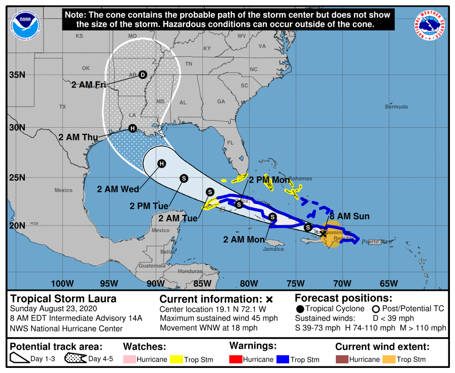
TS Laura’s track shifts to the west; expected to make landfall as Cat. 2 storm
August 23, 2020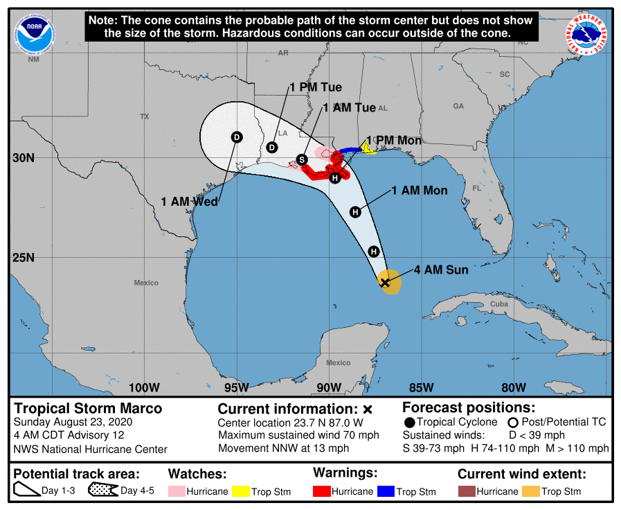
Not much has changed with the newest advisory. Our area is now under a hurricane warning, was Marco is expected to hit near Lafourche Parish on Monday afternoon.

At 4 a.m. CDT, the center of Tropical Storm Marco was located about 395 miles (635 km) south-southeast of the mouth of the Mississippi River. It’s moving toward the north-northwest near 13 mph (20 km/h). Marco is forecast to continue moving north-northwestward across the central Gulf of Mexico today and will approach southeastern Louisiana on Monday. A gradual turn toward the west with a decrease in forward speed is expected after Marco moves inland on Monday and on Tuesday.
Maximum sustained winds are near 70 mph (110 km/h) with higher gusts. Tropical-storm-force winds extend outward up to 60 miles (95 km) from the center.Some strengthening is anticipated and Marco is forecast to become a hurricane today. Marco is expected to be a hurricane when it approaches the northern Gulf Coast on Monday. Rapid weakening is expected after Marco moves inland.
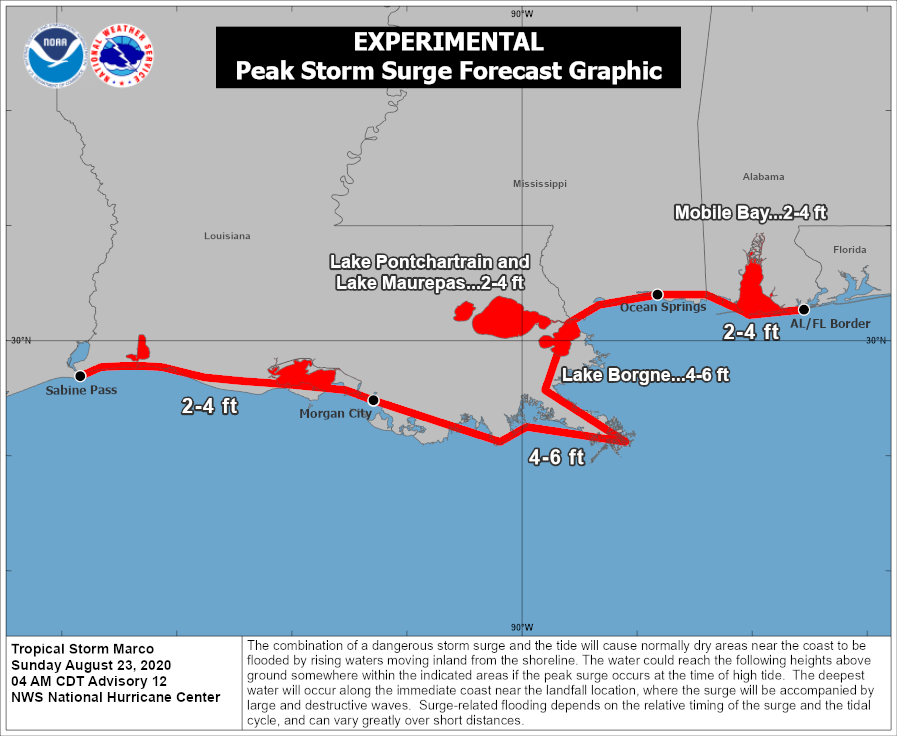
The combination of a dangerous storm surge and the tide will cause normally dry areas near the coast to be flooded by rising waters moving inland from the shoreline. The water could reach the following heights above ground somewhere in the indicated areas if the peak surge occurs at the time of high tide…
– Sabine Pass to Morgan City…2-4 ft
– Morgan City to Ocean Springs including Lake Borgne…4-6 ft
– Ocean Springs to the AL/FL Border incl.- Mobile Bay…2-4 ft
– Lake Pontchartrain and Lake Maurepas…2-4 ft
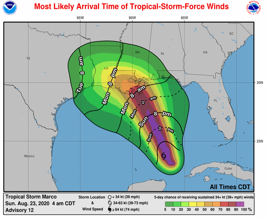
Marco is expected to produce rainfall accumulations of 2 to 4 inches with isolated maximum amounts of 6 inches across the Central U.S. Gulf coast through Tuesday. This rainfall may result in isolated areas of flash and urban flooding along the Central U.S. Gulf Coast.
The next complete advisory will be issued by NHC at 10 a.m. CDT with intermediate advisory at 7 a.m. CDT

