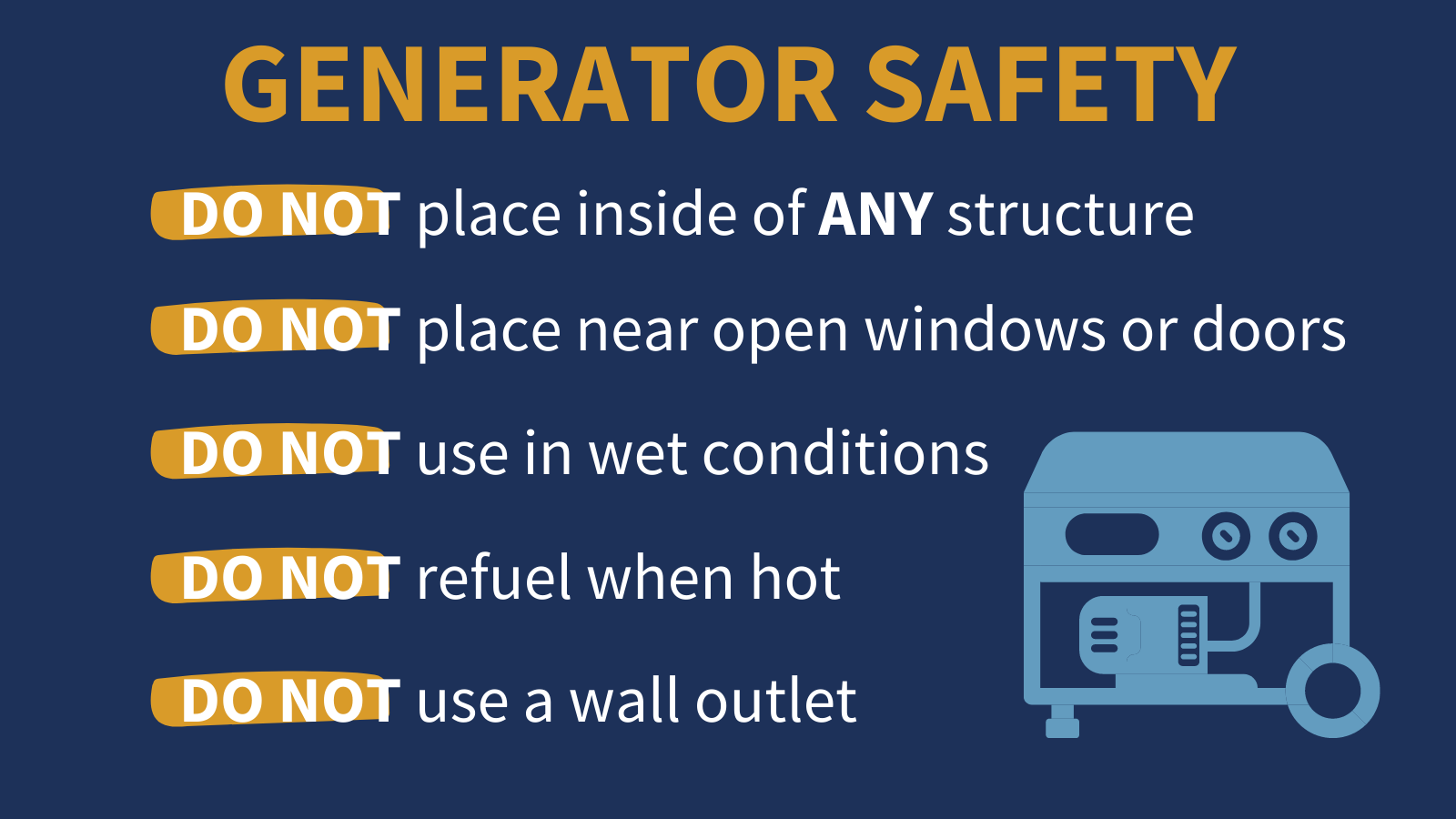
8 Tips on Running a Portable Generator During a Power Outage
October 8, 2020
Terrebonne Booking Log: 10/08/2020
October 8, 2020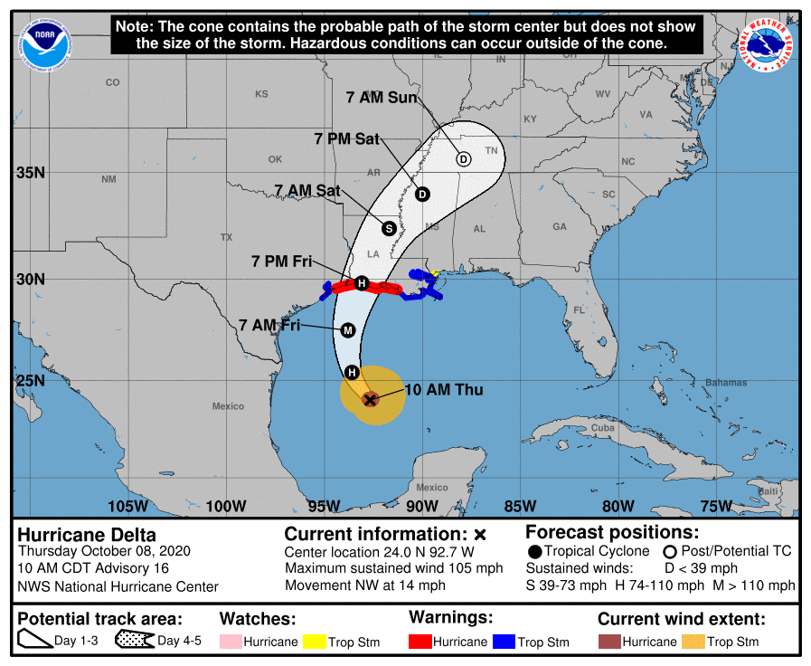
Hurricane Delta is beginning the process of intensifying, which had been expected. There was no major adjustment to the track with landfall still anticipated in southwest Louisiana in the early evening hours of tomorrow. Preparations in our area for tropical storm force winds and a strong storm surge should be made by nightfall today, as winds may be felt as early as 7 a.m. tomorrow.
At 10 a.m. CDT, the center of Hurricane Delta was located over the Gulf of Mexico about 400 miles (645 km) south of Cameron, Louisiana. Delta is moving toward the northwest near 14 mph (22 km/h), and this motion with a reduction in forward speed is expected today. A turn toward the north is forecast to occur by late tonight, followed by a north-northeastward motion by Friday afternoon or Friday night. On the forecast track, the center of Delta will move over the central Gulf of Mexico today, over the northwestern Gulf of Mexico on Friday, and then move inland within the hurricane warning area Friday afternoon or Friday night.
Reports from NOAA and Air Force Reserve Hurricane Hunter aircraft indicate that maximum sustained winds have increased to near 105 mph (165 km/h) with higher gusts – a category 2 hurricane on the Saffir-Simpson Hurricane Wind Scale. Hurricane-force winds extend outward up to 35 miles (55 km) from the center and tropical-storm-force winds extend outward up to 125 miles (205 km). Additional strengthening is forecast to occur, and Delta is expected to become a major hurricane again by tonight. Some weakening is possible as Delta approaches the northern Gulf coast on Friday, with rapid weakening expected after the center moves inland.

The combination of a dangerous storm surge and the tide will cause normally dry areas near the coast to be flooded by rising waters moving inland from the shoreline. The water could reach the following heights above ground somewhere in the indicated areas if the peak surge occurs at the time of high tide…
– Rockefeller Wildlife Refuge, LA to Port Fourchon, LA including Vermilion Bay…7-11 ft
– Holly Beach, LA to Rockefeller Wildlife Refuge, LA…4-7 ft

– Port Fourchon, LA to the Mouth of the Mississippi River…4-6 ft
– Sabine Pass to Holly Beach, LA…3-5 ft
– Calcasieu Lake…3-5 ft
– High Island, TX to Sabine Pass…2-4 ft
– Mouth of the Mississippi River to Ocean Springs, MS…2-4 ft
– Lake Borgne, Lake Pontchartrain & Lake Maurepas…2-4 ft

– Ocean Springs, MS to the AL/FL state line incl. Mobile Bay…1-3 ft
– Sabine Lake…1-3 ft
– Port O’Connor, TX to High Island, TX including Galveston Bay…1-3 ft
Friday through Saturday, Delta is expected to produce 5 to 10 inches of rain, with isolated maximum totals of 15 inches, from southwest into south-central Louisiana. These rainfall amounts will lead to significant flash, urban, small stream flooding, along with minor to isolated moderate river flooding. For extreme east Texas into northern Louisiana, southern Arkansas and western Mississippi, Delta is expected to produce 3 to 6 inches of rain, with isolated maximum totals of 10 inches. These rainfall amounts will lead to flash, urban, small stream and isolated minor river flooding.
The next complete advisory will be issued by NHC at 4 p.m. CDT with an intermediate advisory at 1 p.m. CDT

