
TPSO Tropical Storm Sally Update: Road patrols to be doubled; courts to open on Monday
September 13, 2020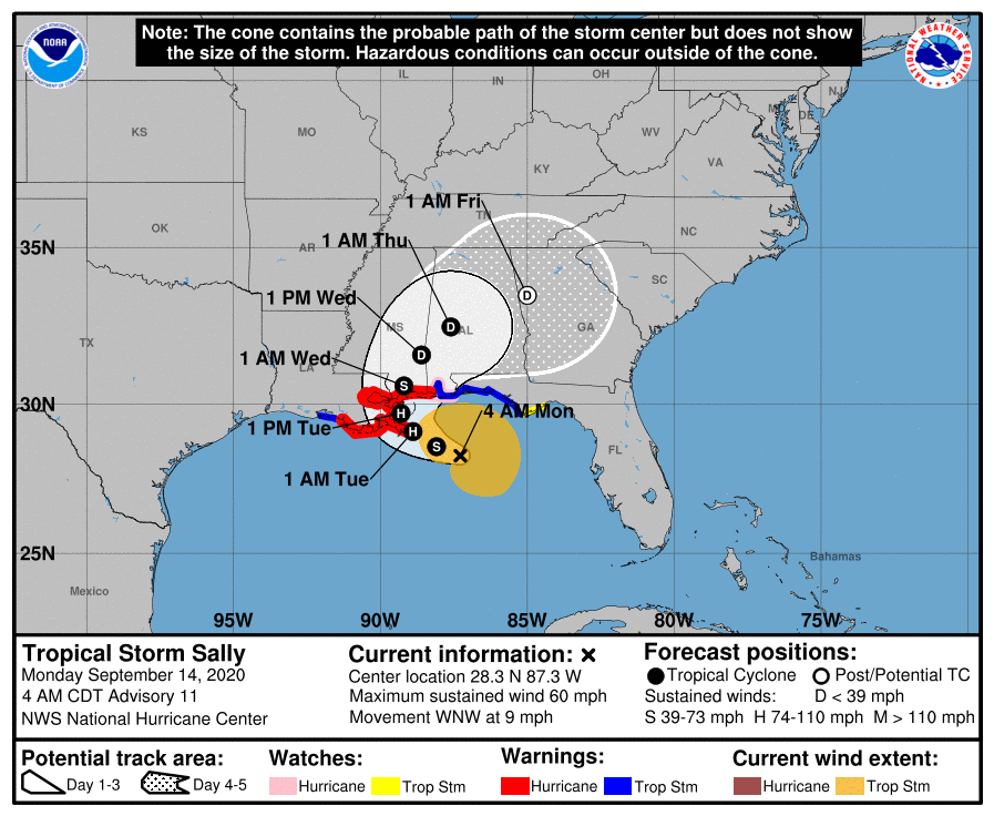
Tropical Storm Sally continues to shift east; landfall now near LA/MS line
September 14, 2020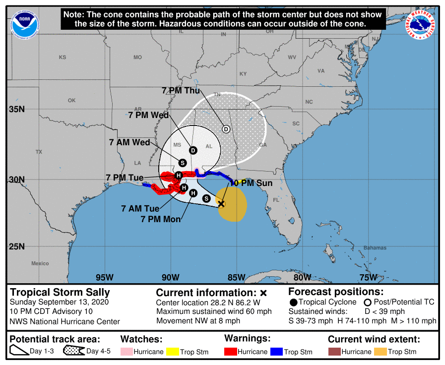
Sally’s forecast has made a shift to the east. A turn is now expected to occur prior to a previously forecasted landfall at the mouth of the Mississippi River, with landfall now forecast to be around Bay St. Louis. Sally is still moving very slowly, so continued changes may occur.
The Hurricane Warning has been extended eastward from Ocean Springs, Mississippi to the Mississippi/Alabama Border. A Hurricane Warning is in effect from Morgan City Louisiana to the Mississippi/Alabama Border. A Storm Surge Warning has been extended eastward from the Mississippi/Alabama border to the Alabama/Florida Border, including Mobile Bay.
At 1000 PM CDT (0300 UTC), the center of Tropical Storm Sally was located near latitude 28.2 North, longitude 86.2 West. Sally is moving toward the northwest near 8 mph (13 km/h). A slower west-northwestward motion is expected Monday and Monday night, followed by a further decrease in forward speed and a turn to the northwest Monday night and Tuesday. On the forecast track, the center of Sally will move over the north-central Gulf of Mexico on Monday, and approach the northern Gulf Coast within the hurricane warning area on Tuesday. Sally is expected to move slowly northward
near the northern Gulf Coast through Wednesday.

Maximum sustained winds are near 60 mph (95 km/h) with higher gusts. Strengthening is expected over the next day or so, and Sally is forecast to become a hurricane by Monday night, with some
additional strengthening possible before the center crosses the northern Gulf Coast.
Tropical-storm-force winds extend outward up to 125 miles (205 km), from the center. The estimated minimum central pressure based on data from the Air Force Hurricane Hunters is 996 mb (29.42 inches).

