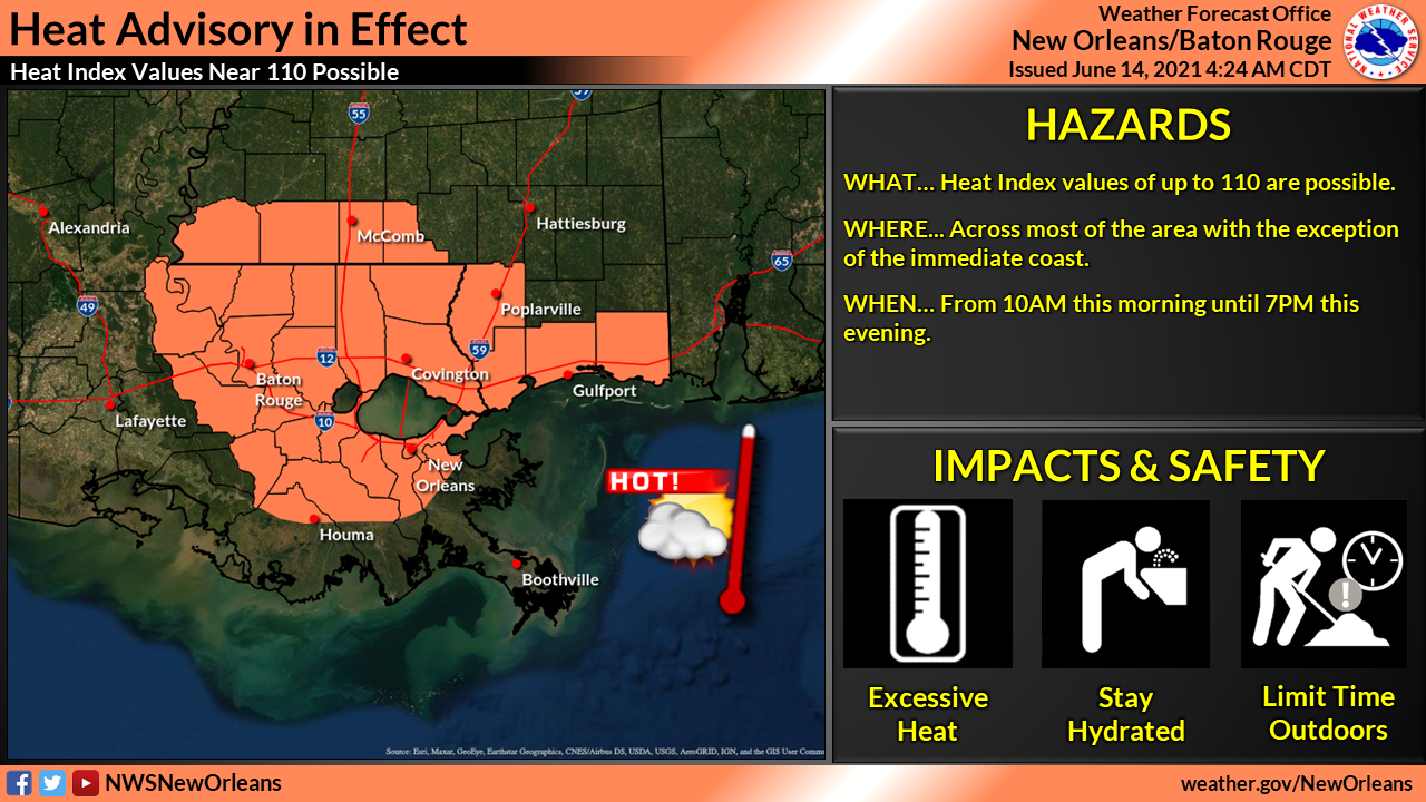
Heat advisory in effect through 7pm
June 14, 2021
Terrebonne Parish providing financial assistance for residents pursuing higher education
June 14, 2021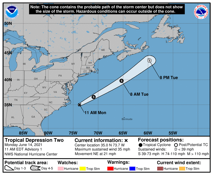
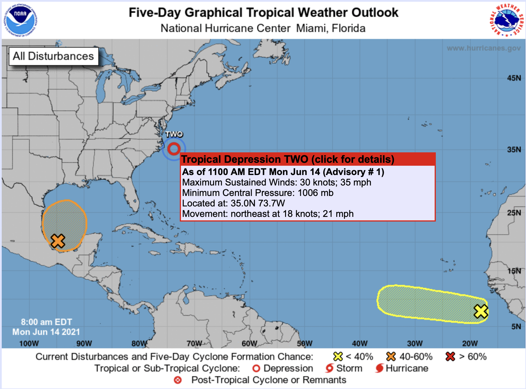
Tropical Depression Two has formed off the coast of North Carolina.
Satellite and radar images show that the low pressure area that NHC has been following since yesterday off the coast of North Carolina has become better organized, with a small central dense overcast over the center and more prominent banding features. The depression has about 24 hours over marginally warm waters in low-to-moderate shear to strengthen before it moves north of the Gulf Stream and decays. Almost all of the intensity guidance shows the system becoming a tropical storm tonight, and considering the healthy initial structure, the official forecast follows that guidance. The low should lose tropical characteristics in about 36 hours due to very cold waters and dissipate near Newfoundland in about 2 days.

The low also has advanced ahead of a nearby diffuse stationary front, with that boundary lying northwest of the center. Considering the small core of the low, ample deep convection, satellite pattern, and that the low is feeding off of the thunderstorm activity (and not the front) — it is now classified as a tropical depression. The initial intensity is set to 30 kt, which is our best estimate assuming strengthening from the 20-25 kt overnight ASCAT and surface observations.
The depression is moving northeastward at about 18 kt. A large mid-latitude trough digging across eastern North America should cause the cyclone to continue moving generally northeastward, but faster, over the next couple of days. In about 48 hours, the system is forecast to dissipate near Newfoundland as it is absorbed by a larger extratropical low. Model guidance is in very good agreement on this scenario, and the NHC forecast lies near the track consensus.