A multi-parish problem: Barry’s worst impacts came to Pointe-aux-Chenes community
July 23, 2019
Suspect charged in Village East gunshots, investigation ongoing
July 23, 2019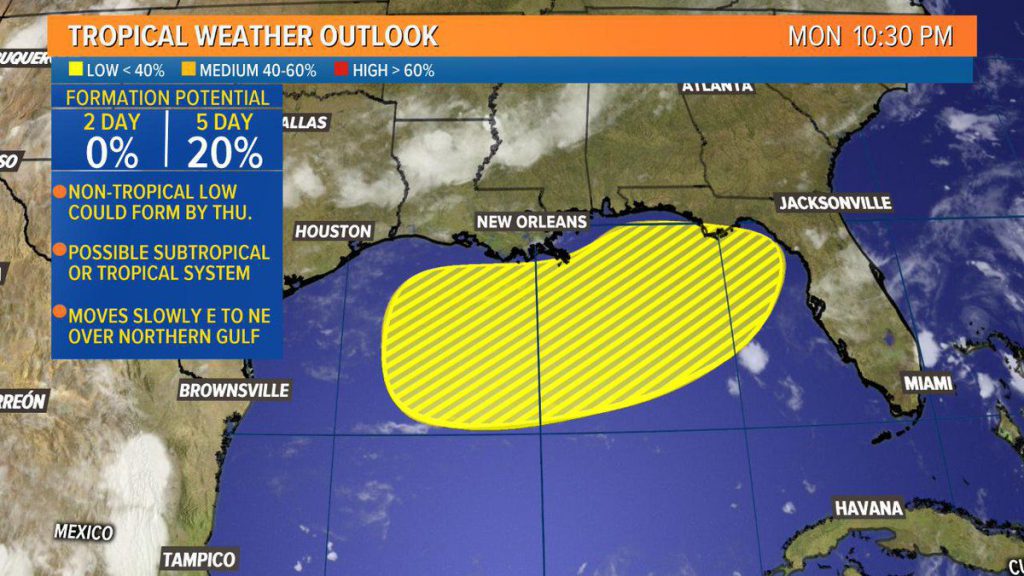
A cold front sweeps through the area late tonight, which will bring us more comfortable weather tomorrow and Thursday.
As the front dips into the Gulf of Mexico, it will then reverse-course and head back toward the shore.

And the National Hurricane Center thinks there’s a small chance it could develop tropically before landfall.
The NHC said today there’s a 20 percent chance an area in the Gulf of Mexico develops in the next 5 days with the greatest impacts likely to be toward Alabama and Florida.
The area is supposed to drift to the east, then northeast, before making landfall. NHC says it’s likely to be a subtropical low, but there’s a small chance it can become a depression or tropical storm.

The area is not supposed to feel impacts from the system, though it could raise seas for the International Grand Isle Tarpon Rodeo.

