
National Guard Offering Free COVID Vaccines Daily at Nicholls
August 15, 2021
Authorities investigating fatal Houma apartment fire
August 15, 2021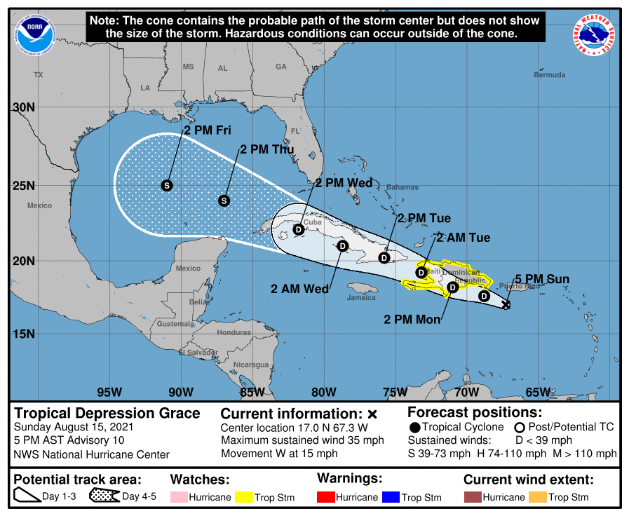
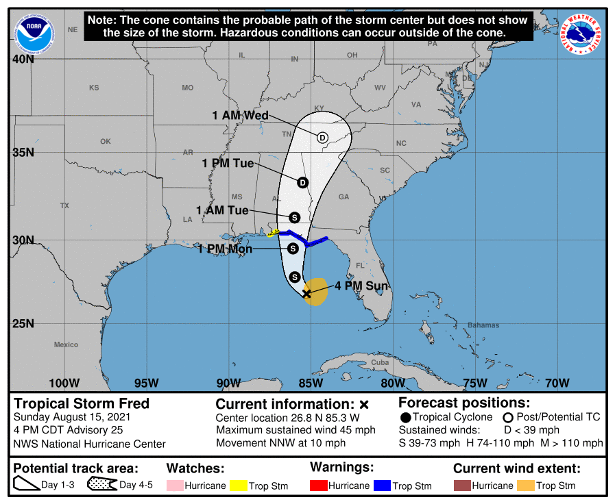
The 4pm tropical update shows an active week for the Gulf of Mexico. Tropical Storm Fred continues to approach the Florida coast, eyeing an area between Navarre to the Wakulla/Jefferson County line. Landfall is expected Monday afternoon into the evening hours. Grace has been downgraded to a Tropical Depression as it moves over Hispaniola on Monday, near or over eastern Cuba on Tuesday, and near or over west-central Cuba on Wednesday. The cone of uncertainty lives up to its name, as it straightens out from this morning’s version, to more of a western track instead of west north-west.
Tropical Storm Fred approaches Florida
At 4 p.m. CDT, the center of Tropical Storm Fred was located over the eastern Gulf of Mexico about 235 miles (380 km) south of Panama City, Florida. It’s moving toward the north-northwest near 10 mph (17 km/h), and this motion should continue through tonight. A turn toward the north is expected on Monday. On the forecast track, the center of Fred should move across the eastern and northern Gulf of Mexico through Monday, then make landfall in the western Florida Panhandle Monday afternoon or Monday night.
Maximum sustained winds are now near 45 mph (75 km/h) with higher gusts. Tropical-storm-force winds extend outward up to 90 miles (150 km) mainly to the east of the center.
The estimated minimum central pressure is 1007 mb (29.74 inches). Additional strengthening is expected until landfall. After landfall, Fred is expected to quickly weaken.
Tropical Depression Grace
At 5 p.m. AST, the center of now Tropical Depression Grace was located about 85 miles (135 km) south of San Juan, Puerto Rico, and about 200 miles (320 km) east-southeast of Santo Domingo, Dominican Republic, and about 345 miles (560 km) east-southeast of Port Au Prince, Haiti. The depression is moving toward the west near 15 mph (24 km/h). A generally west-northwestward motion is expected during the next few days. On the forecast track, Grace will move over Hispaniola on Monday, near or over eastern Cuba on Tuesday, and near or over west-central Cuba on Wednesday.
Maximum sustained winds have decreased to near 35 mph (55 km/h) with higher gusts. The estimated minimum central pressure is 1011 mb (29.86 inches). Little change in strength is forecast during the next 48 hours.

