
Terrebonne Sheriff: Inmates temporarily relocating due to potential power outages
August 24, 2020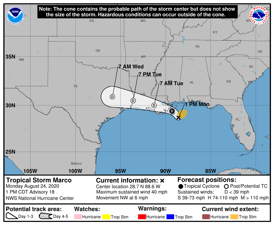
Marco: Tropical Storm Warning and Storm Surge Warning have been discontinued
August 24, 2020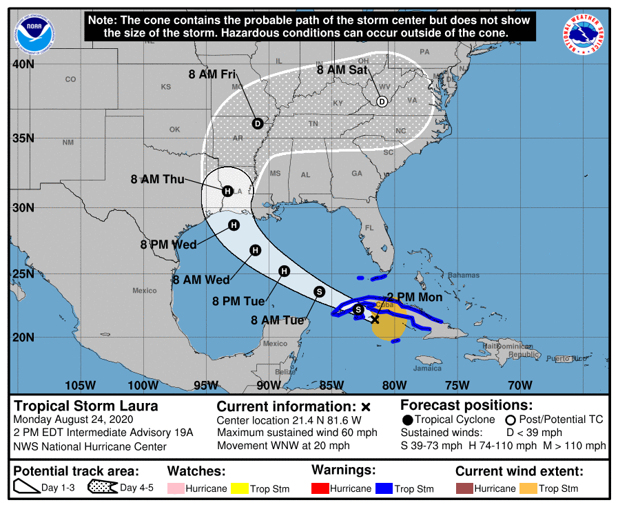
The 1pm advisory holds steady with the previous forecasts, not much change at this point. For our area, it’s just still too early to be sure. Forecast shows Laura making landfall as a Category 2.

At 2 p.m. EDT, the center of Tropical Storm Laura was located about 80 miles (125 km) east of the Isle of Youth. It’s moving toward the west-northwest near 20 mph (31 km/h), and this general motion with some decrease in forward speed is expected over the next day or so. A turn toward the northwest is forecast by Wednesday, and a northwestward to north-northwestward motion should continue through Wednesday night. On the forecast track, the center of Laura will move over the Caribbean Sea just offshore of the southern coast of Cuba this afternoon, cross western Cuba this evening, move into the southeastern Gulf of Mexico overnight, move over the central and northwestern Gulf of Mexico Tuesday night and Wednesday, and approach the northwestern coast of the Gulf of Mexico Wednesday night.
Maximum sustained winds are near 60 mph (95 km/h) with higher gusts. Tropical-storm-force winds extend outward up to 175 miles (280 km) primarily to the northeast and east of the center. An elevated observing site at Sand Key located south of Key West, Florida, has recently reported a wind gust of 41 mph (67 km/h). A wind gust of 47 mph (76 km/h) has been observed at Santa Clara, Cuba, within the past few hours. Little change in strength is forecast today, but strengthening is expected when the storm moves over the Gulf of Mexico. Laura is forecast to become a hurricane on Tuesday, with additional strengthening forecast on Wednesday.

