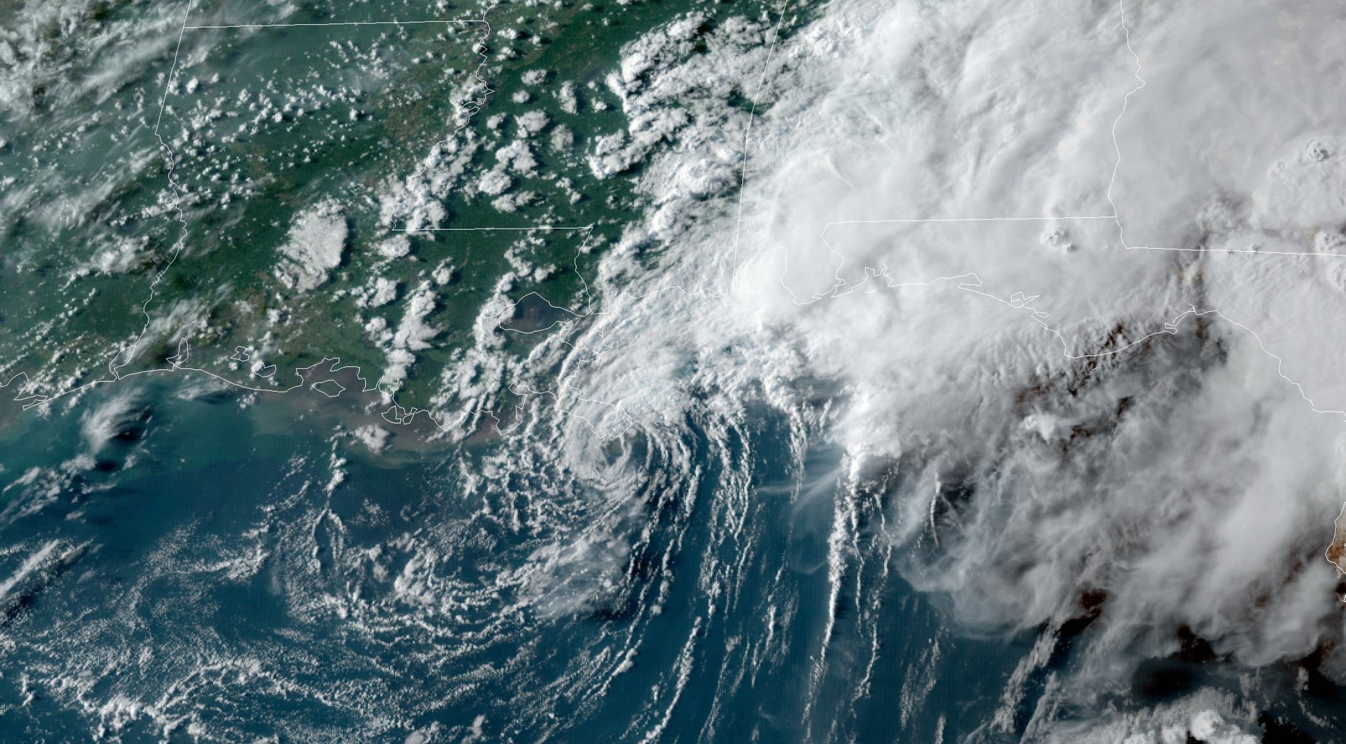
TS Marco makes landfall near mouth of Mississippi River
August 24, 2020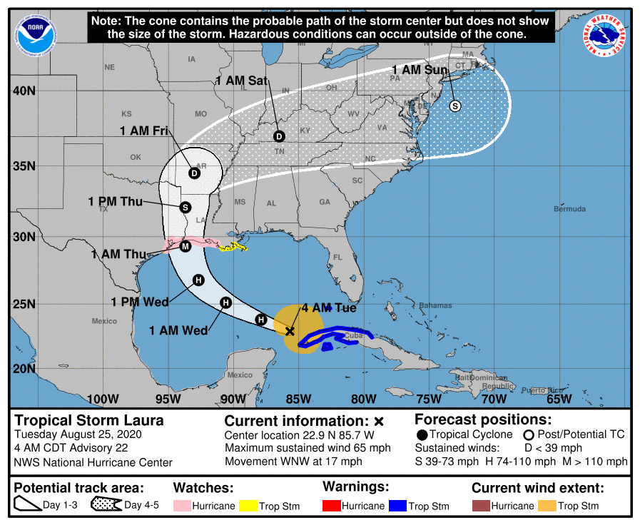
Laura forecast to make landfall as a major storm at a Category 3
August 25, 2020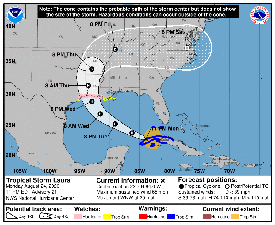
Tropical Storm Laura is moving into the warm waters of the Gulf and is expected to strengthen into a hurricane tomorrow. With this advisory, Laura is expected to be a very strong Category 2, or even a major Category 3 storm by landfall.
The storm surge with Laura is forecast to be between 7-11 feet in the area of High Island, TX to Morgan City, LA including Sabine Lake, Calcasieu Lake, and Vermilion Bay.

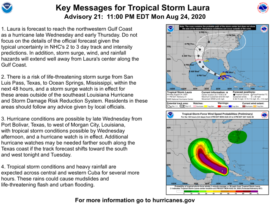
At 1100 PM EDT (0300 UTC), the center of Tropical Storm Laura was located near latitude 22.7 North, longitude 84.0 West. Laura is moving toward the west-northwest near 20 mph (31 km/h) and this general motion with some decrease in forward speed is expected over the next day or so. A turn toward the northwest is forecast by Wednesday, and a northwestward to north-northwestward motion should continue through Wednesday night. On the forecast track, the center of Laura will move away from Cuba and over the southeastern Gulf of Mexico overnight. Laura is then forecast to move over the central and northwestern Gulf of Mexico Tuesday night and Wednesday, and approach the northwestern coast of the Gulf of Mexico Wednesday night.

Maximum sustained winds are near 65 mph (105 km/h) with higher gusts. Strengthening is expected, and Laura is forecast to become a hurricane on Tuesday. Additional strengthening is forecast on Wednesday, and Laura could be near major hurricane strength when it approaches the coast.
Tropical-storm-force winds extend outward up to 175 miles (280 km) from the center. The estimated minimum central pressure based on data from the NOAA and Air Force Hurricane Hunters is 996 mb (29.42 inches).
The combination of a dangerous storm surge and the tide will cause normally dry areas near the coast to be flooded by rising waters moving inland from the shoreline. The water could reach the following heights above ground somewhere in the indicated areas if the peak surge occurs at the time of high tide…

High Island TX to Morgan City LA including Sabine Lake, Calcasieu Lake, and Vermilion Bay…7-11 ft
Port Bolivar TX to High Island TX…4-6 ft
Morgan City LA to Mouth of the Mississippi River…4-6 ft
Mouth of the Mississippi River to Ocean Springs MS including Lake Borgne…3-5 ft
San Luis Pass TX to Port Bolivar TX…2-4 ft
Galveston Bay…2-4 ft
Lake Pontchartrain and Lake Maurepas…2-4 ft
The deepest water will occur along the immediate coast near and to the right of the landfall location, where the surge will be accompanied by large and destructive waves. Surge-related flooding depends on the relative timing of the surge and the tidal cycle, and can vary greatly over short distances.
