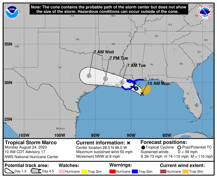
TS Marco continues to weaken and drift north; no landfall yet
August 24, 2020
Looking ahead: Nicholls soccer program to focus on team chemistry in coming months
August 24, 2020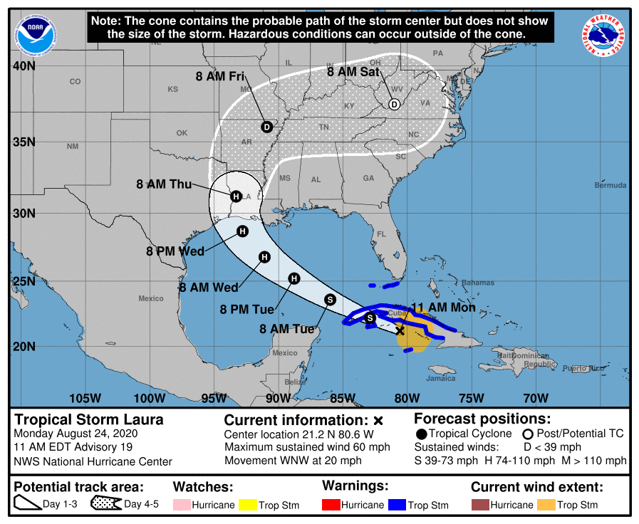
Little change in strength is forecast today, but strengthening is expected when the storm moves over the Gulf of Mexico, and Laura is forecast to become a hurricane on Tuesday, with additional strengthening forecast on Wednesday.

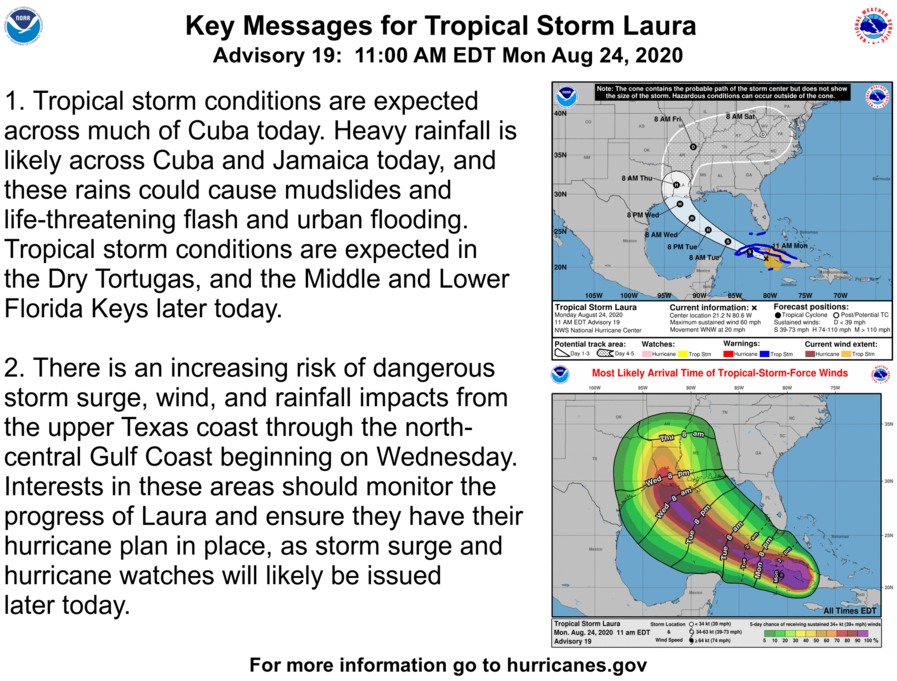

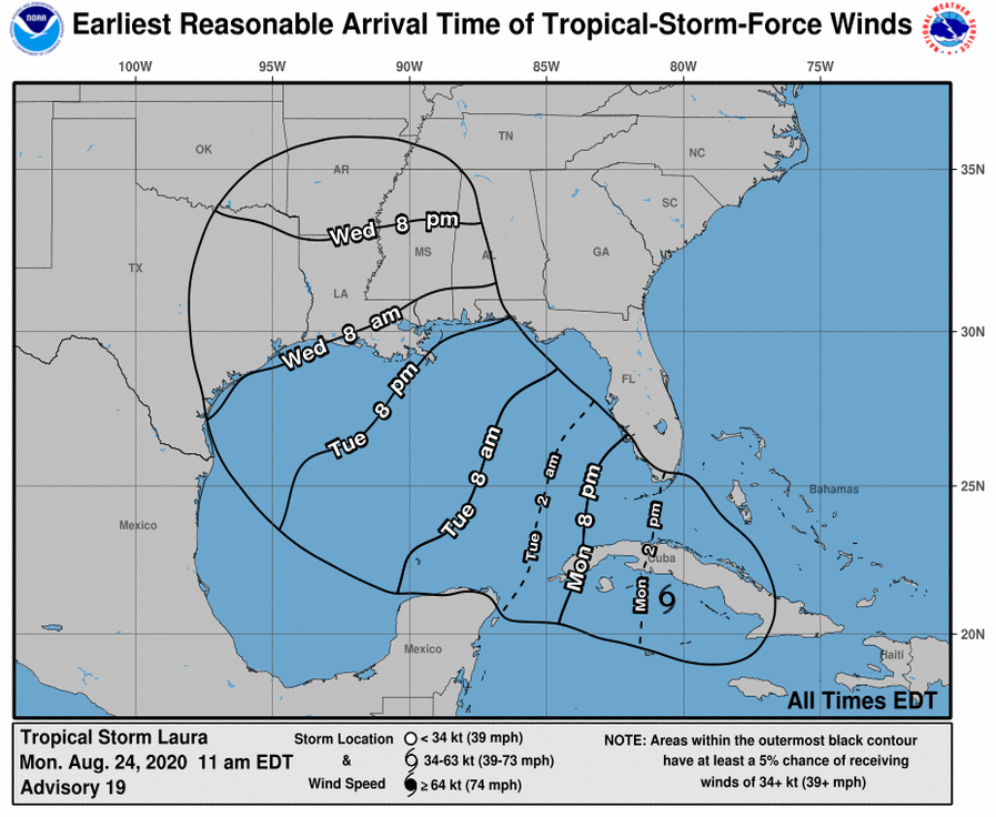
At 11 a.m. EDT, the center of Tropical Storm Laura was located about 145 miles (230 km) east of the Isle of Youth. It’s moving toward the west-northwest near 20 mph (31 km/h), and this general motion with some decrease in forward speed is expected over the next day or so. A turn toward the northwest is forecast by Wednesday, and a northwestward to north-northwestward motion should continued through Wednesday night. On the forecast track, the center of Laura will move over the Caribbean Sea just offshore of the southern coast of Cuba this afternoon, cross western Cuba this evening, move into the southeastern Gulf of Mexico overnight, move over the central and northwestern Gulf of Mexico Tuesday night and Wednesday, and then approach the northwestern coast of the Gulf of Mexico Wednesday night.
NOAA and Air Force reconnaissance aircraft indicate that the maximum sustained winds are near 60 mph (95 km/h) with higher gusts. Tropical-storm-force winds extend outward up to 175 miles (280 km) from the center.

