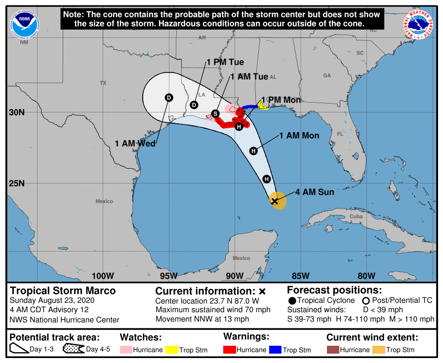
No big changes at 4am update; Marco still aiming for Lafourche parish
August 23, 2020
Marco still aiming for a Lafourche landfall as Cat. 1 storm
August 23, 2020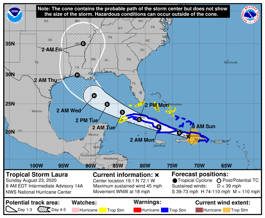
With the newest update this morning, Tropical Storm Laura’s track has shifted the storm’s expected landfall more to the west of Terrebonne Parish. The storm is now expected to strengthen to a Category 2 storm at landfall, striking the coast around 1am on Thursday.

At 8 a.m. EDT, the center of Tropical Storm Laura was located about 40 miles (65 km) north-northeast of Port Au Prince, Haiti. It’s moving toward the west-northwest near 18 mph (30 km/h), and this general motion is expected over the next few days. On the forecast track, the center of Laura will move across Hispaniola this morning, be near or over Cuba tonight and Monday, and over the southeastern Gulf of Mexico Monday night and Tuesday.

Maximum sustained winds are near 45 mph (75 km/h) with higher gusts. Tropical-storm-force winds extend outward up to 140 miles (220 km) from the center. No significant change in strength is forecast during the next 36 to 48 hours while Laura moves over or near Hispaniola and Cuba. Strengthening is forecast once Laura moves into the Gulf of Mexico Monday night and Tuesday.
The next complete advisory will be issued by NHC at 11 a.m. EDT