
Sheriff Webre Announces LPSO Storm Operations Due to Marco and Laura
August 23, 2020
Looking ahead: Nicholls cross country program ready to run this spring
August 23, 2020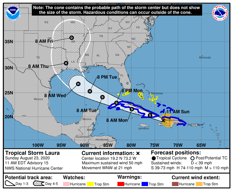
The new update shows a significant shift in Laura’s track to the west. While it is still too far out to be sure, landfall is now aiming for an area near Sabine Pass, La. to the Texas border. Laura is still anticipated to be a Cat. 2 storm at landfall.

At 11 a.m. EDT, the center of Tropical Storm Laura was located about 70 miles (115 km) northwest of Port Au Prince, Haiti. It’s moving toward the west-northwest near 21 mph (33 km/h), and this general motion with some decrease in forward speed is expected over the next couple of days. A turn toward the northwest is foreast on Wednesday. On the forecast track, the center of Laura will move near or over Cuba tonight and Monday, and move over the southeastern Gulf of Mexico Monday night and Tuesday. Laura is expected to move over the central and northwestern Gulf of Mexico Tuesday night and Wednesday.
Recent data from a NOAA reconnaissance aircraft indicate that maximum sustained winds are near 50 mph (85 km/h) with higher gusts. Tropical-storm-force winds extend outward up to 140 miles (220 km) from the center. The strongest winds are primarily occurring over water to the northeast of the center. Little change in strength is forecast while Laura moves near Cuba. Strengthening is forecast after the storm moves over the Gulf of Mexico, and Laura is forecast to become a hurricane late Tuesday or Tuesday night.

