
Got the blue tarp blues? Follow these suggestions when replacing your roof
September 12, 2021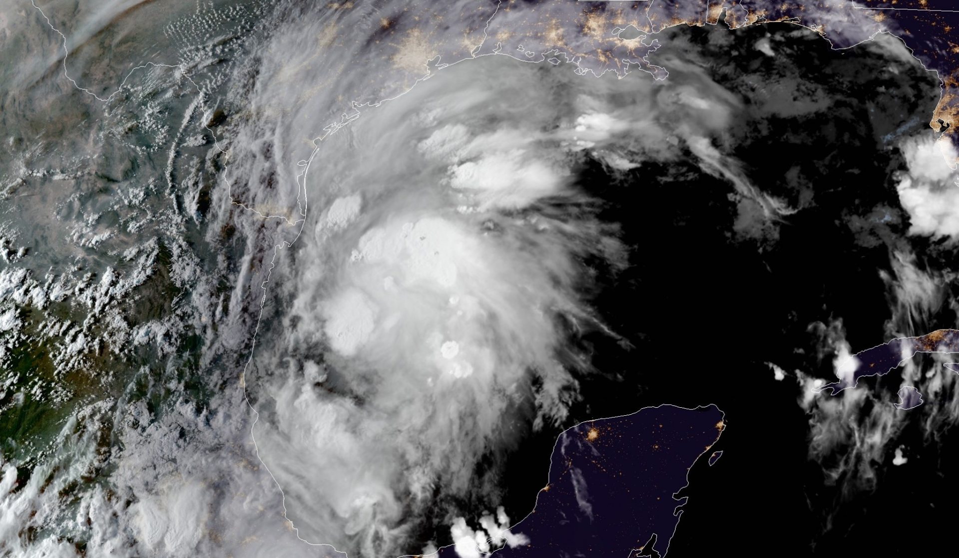
Gov. Edwards Declares State of Emergency in Advance of Tropical Storm Nicholas
September 12, 2021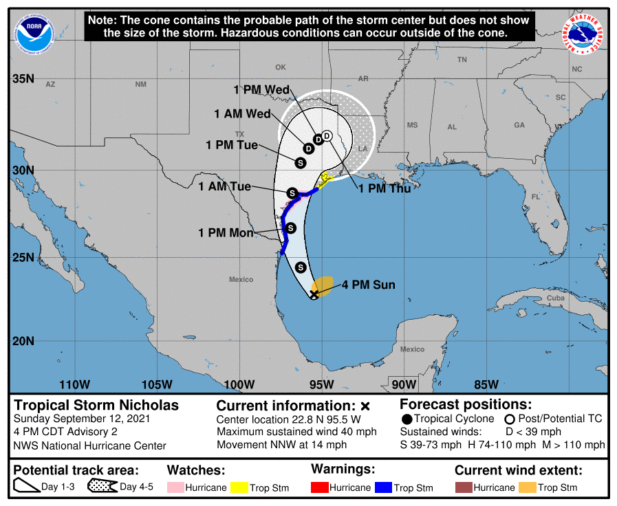
At 4 pm. CDT, the center of Tropical Storm Nicholas was located over the southwest Gulf of Mexico about 160 miles (260 km) north-northeast of La Pesca, Mexico, and about 240 miles (385 km) south-southeast of the mouth of the Rio Grande River. Nicholas is moving toward the north-northwest near 14 mph (22 km/h), and this general motion is expected through tonight. A slower northward or north-northeastward motion is forecast by late Monday or Monday night. On the forecast track, the center of Nicholas will pass near or just offshore the coasts of northeastern Mexico and South Texas on Monday, and move onshore along the coast of south or central Texas coast Monday night or early Tuesday.
Maximum sustained winds are near 40 mph (65 km/h) with higher gusts. Tropical-storm-force winds extend outward up to 105 miles (165 km) from the center. The estimated minimum central pressure is 1008 mb (29.77 inches). Strengthening is forecast to take place until Nicholas reaches the northwest Gulf coast Monday night or early Tuesday.
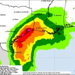
The combination of a dangerous storm surge and the tide will cause normally dry areas near the coast to be flooded by rising waters moving inland from the shoreline. The water could reach the following heights above ground somewhere in the indicated areas if the peak surge occurs at the time of high tide:
– Port O’Connor to San Luis Pass TX including Matagorda Bay…3-5 ft
– Mouth of the Rio Grande to Port O’Connor, TX…2-4 ft
– San Luis Pass to High Island, TX including Galveston Bay…2-4ft
– Baffin Bay, Corpus Christi Bay, Aransas Bay and San Antonio Bay…2-4 ft
– High Island, TX to Intracoastal City including Sabine Lake and Calcasieu Lake..1-3 ft
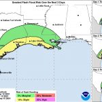
Nicholas is expected to produce storm total rainfall of 8 to 16 inches, with isolated maximum amounts of 20 inches, across portions of the middle and upper Texas coastal areas today through the middle of the week. Across the rest of coastal Texas into southwest Louisiana rainfall of 5 to 10 inches is expected. This rainfall may produce areas of considerable flash and urban flooding, especially in highly urbanized metropolitan areas. Additionally, there is the potential for isolated minor to moderate river flooding. Over the northeastern portions of the Mexican state of Tamaulipas rainfall amounts of 2 to 5 inches can be expected today into Monday.
The next complete advisory will be issued by NHC at 10 p.m. CDT with an intermediate advisory at 7 p.m. CDT

