
LDH reports over 1,000 new cases this weekend; hospitalizations continue to decrease
August 16, 2020
Clayton “Sonny” Lovell
August 16, 2020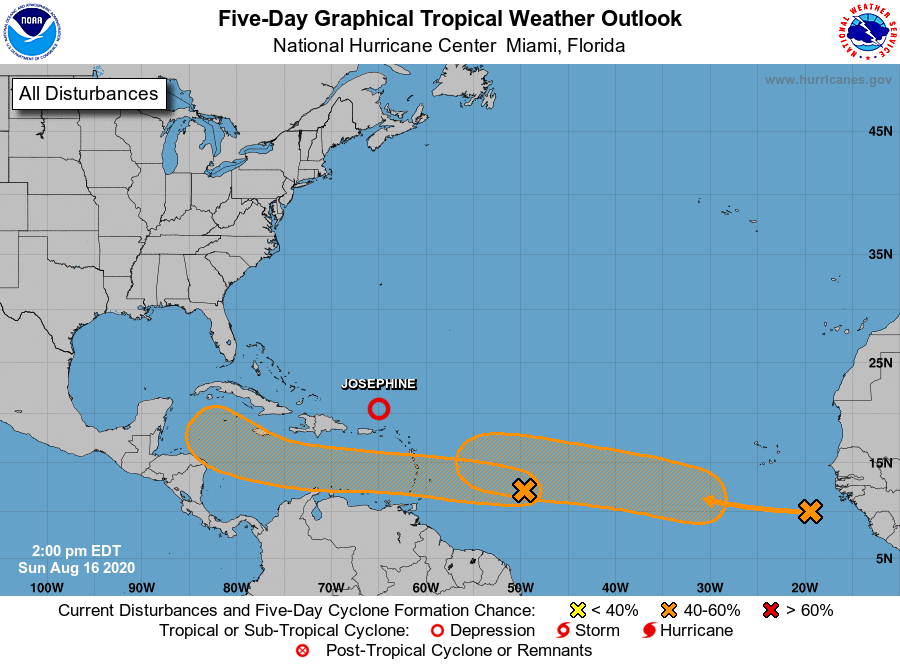
As Josephine and Kyle see their last advisories issued today, two new tropical waves are showing increased probability of formation.

From the National Hurricane Center:
At 5 p.m. AST, the remnants of Josephine were located over the Atlantic Ocean about 255 miles (410 km) northwest of the northern Leeward Islands, moving toward the west-northwest near 12 mph (19 km/h) with a toward the northwest expected tonight. The remnants areorecast to recurve toward the north and northeast Tuesday and Tuesday night.
Maximum sustained winds are near 35 mph (55 km/h) with higher gusts. The maximum winds associated with the remnants are forecast to continue to decrease during the next day or two.

This is the last public advisory issued by the National Hurricane Center on this system.
Elsewhere over the Atlantic basin on this Sunday afternoon, the shower and thunderstorm activity in association with a fast-moving tropical wave, located about 700 miles east of the Windward Islands, has increased. This system is expected to move westward at about 20 mph during the next few days, and that fast speed is likely to limit significant development while the system approaches the Windward and southern Leeward Islands Monday, and moves across the eastern Caribbean Sea on Tuesday. After that time, the system is expected to move more slowly westward across the central and western Caribbean Sea, and upper-level winds could be conducive for development during the middle to latter part of this week. It has a low (20 percent) chance of formation during the next 48 hours and medium (40 percent) chance during the next five days.
Another tropical wave is located over the far eastern tropical Atlantic, producing a large area of cloudiness and showers. This wave is forecast to move westward at 15 to 20 mph during the next few days, and some development will be possible by the middle to latter part of the week as environmental conditions become more conducive while the system is over the central tropical Atlantic. It has a near zero chance of formation during the next 48 hours and a medium (40 percent) during the next five days.

