Terrebonne General Partners with Local Businesses Through Workplace Readiness Program
August 27, 2020
Port Fourchon moves to Recovery Phase after Hurricane Laura
August 27, 2020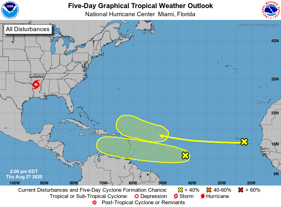
This morning, we had one tropical wave to keep an eye on. This afternoon, there are two.
We are in the most active part of hurricane season and it’s important to stay aware of the possible tropical systems that are forming.

A westward-moving tropical wave located over the far eastern tropical Atlantic near the Cabo Verde Islands, just off the coast of Africa, continues to produce disorganized shower activity. Although environmental conditions are not expected to be conducive for development during the next couple of days, they are forecast to gradually become more favorable over the weekend and into early next week when the wave moves into the central and then western tropical Atlantic. Formation chance through 48 hours is low, near 0 percent. Formation chance through 5 days is low, but increases to 20 percent.
Shower and thunderstorm activity has increased today in association with a tropical wave over the central tropical Atlantic. Gradual development of this system is possible over the next several days as it moves westward at 15 to 20 mph. Formation chance through 48 hours is low at 10 percent. Formation chance through 5 days is low, but increases to 30 percent.

