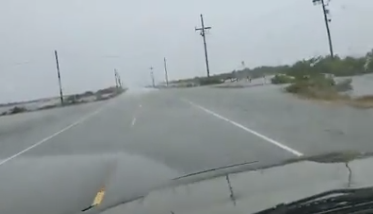
LA 1 closed to small car traffic as water overtops road south of Golden Meadow; Trucks, SUVs allowed
September 20, 2020
928 cases reported by LDH in weekend’s two-day total
September 20, 2020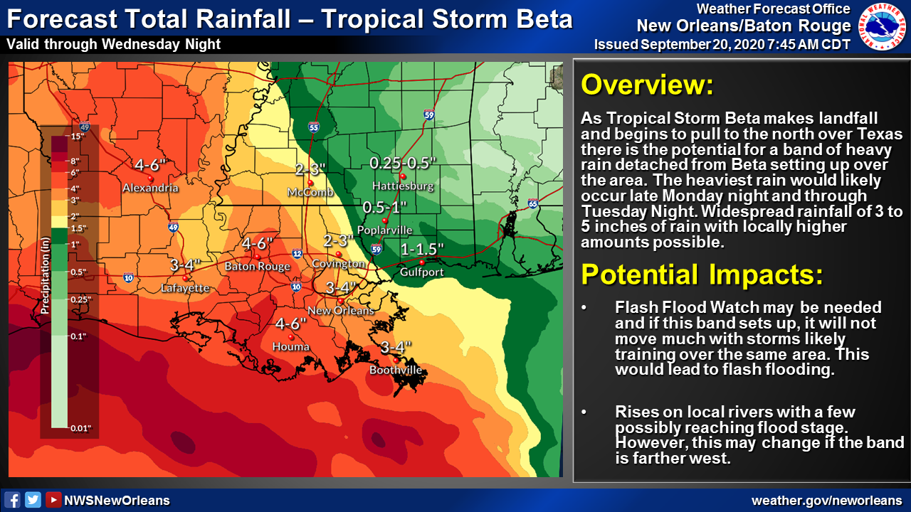
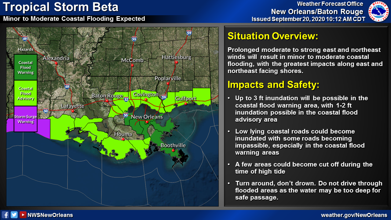
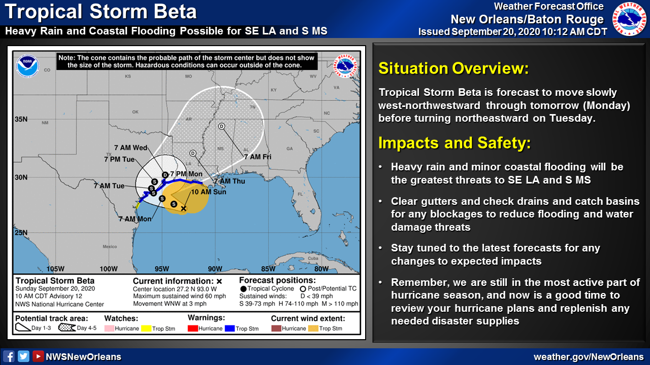
With the 10 a.m. update, TS Beta is forecast to move generally west-northwestward toward the Texas coast through tomorrow (Monday) before turning to the north and then northeast Tuesday. The system is forecast to remain a tropical storm until it makes landfall in Texas and will then rapidly weaken to a remnant low as it moves into Louisiana. Prolonged east and northeast winds will result in minor to moderate coastal flooding with the greatest impact along east and northeast facing shores. Inundation of around 3 ft will be possible in the coastal flood warning area during the time of high tide. Several low lying coastal roads could become impassible and a few locations could become cut off. (As of 10 a.m., LA 1 below the floodgate is closed to small car traffic.)

In Terrebonne Parish, the following floodgates have been closed as of 11 a.m.: Humble Canal; Boudreaux Canal; Bush Canal; Bayou Petit Caillou; Placid Canal; Bayou Black; and Upper Little Caillou Auxiliary Gate. The following gates are scheduled to close today: Pointe aux Chenes Marina Sluicegate; Bayou Terrebonne Sector Gate; Pointe aux Chenes; and Bayou Dularge.
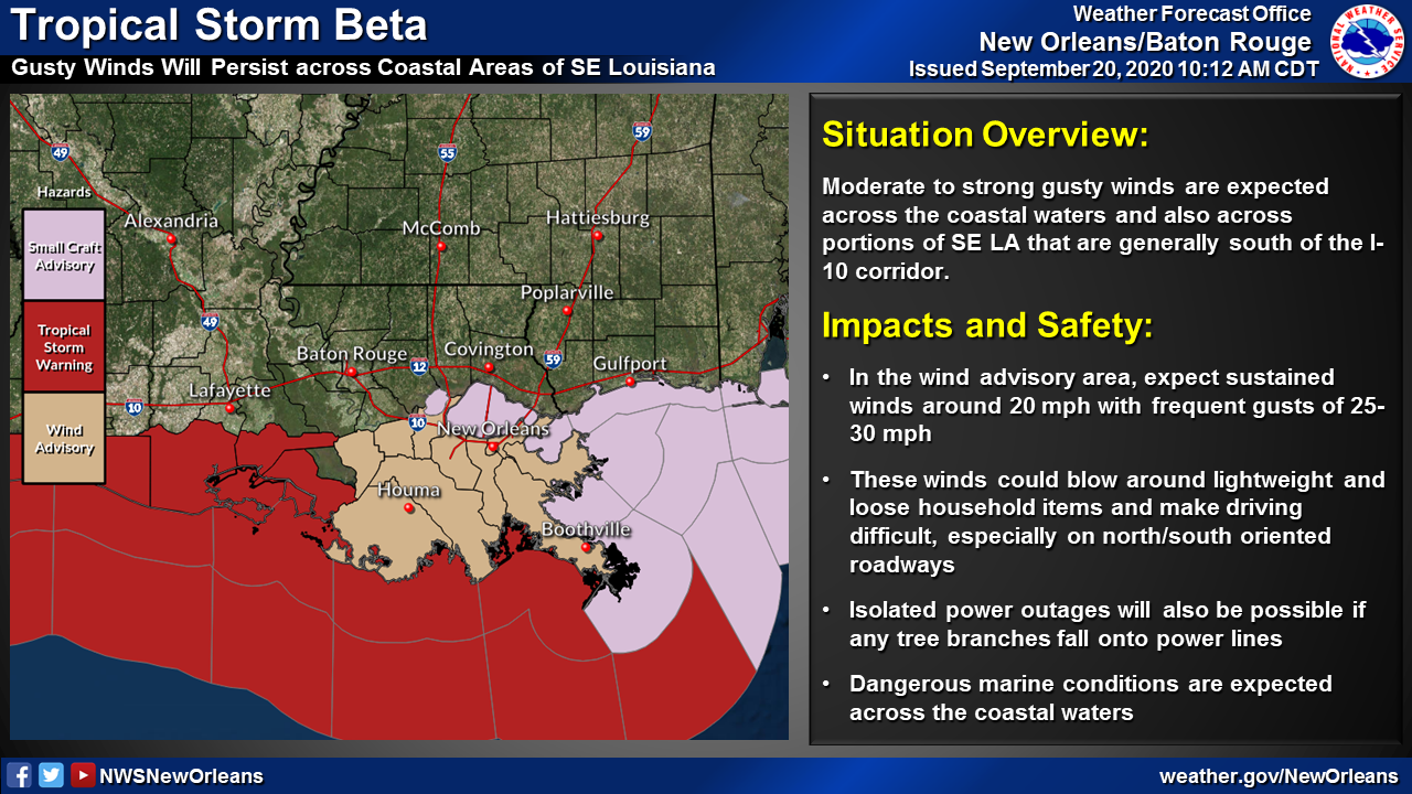
Sustained winds of around 20 mph with frequent gusts of 25 to 30 mph will persist across areas generally south of I-10 in southeast Louisiana. These gusty winds can blow around loose and lightweight household items, and lead to isolated power outages if any branches are downed onto power lines.