
7pm update: No major changes; Houma remains in crosshairs of the eye wall
August 28, 2021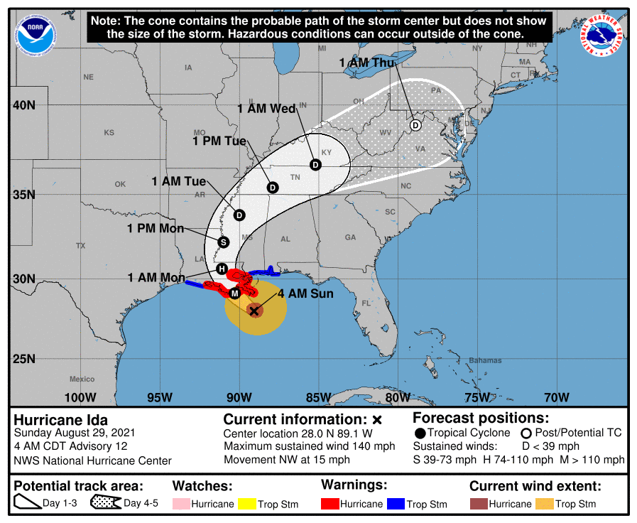
Ida is a very dangerous Category 4 storm
August 29, 2021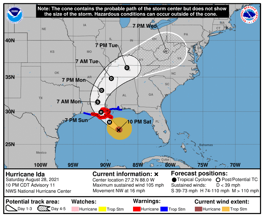
The 10pm update brings a little “good news” for our area. Ida is still quickly approaching, now about 235 miles southeast of Houma. Winds are still at 105 mph, a category 2 storm. The track shifted ever so slightly to the east with this update.
At 1000 PM CDT (0300 UTC), the center of Hurricane Ida was located near latitude 27.2 North, longitude 88.0 West. Ida is moving toward the northwest near 16 mph (26 km/h), and this general motion should continue through late Sunday or early Monday, followed by a slower northward motion on Monday. A northeastward turn is forecast by Monday night. On the forecast track, the center of Ida will continue moving across the central and northern Gulf of Mexico tonight and early Sunday, and make landfall along the coast of Louisiana within the hurricane warning area Sunday afternoon or evening. Ida is then forecast to move well inland over portions of Louisiana and western Mississippi on Monday and Monday night.
Maximum sustained winds are near 105 mph (165 km/h) with higher gusts. Rapid strengthening is forecast during the next 12 to 18 hours and Ida is expected to be an extremely dangerous major hurricane when it makes landfall along the Louisiana coast on Sunday. Rapid weakening is expected after landfall.

Hurricane-force winds extend outward up to 40 miles (65 km) from the center and tropical storm-force winds extend outward up to 140 miles (220 km).
The estimated minimum central pressure based on data from the NOAA Hurricane Hunter aircraft is 964 mb (28.47 inches).

