
Sen. Cassidy tours hurricane damage in Terrebonne, speaks with residents: ‘There’s a real sense of resiliency’
September 11, 2021
Motorcyclist Killed in Terrebonne Parish Crash
September 11, 2021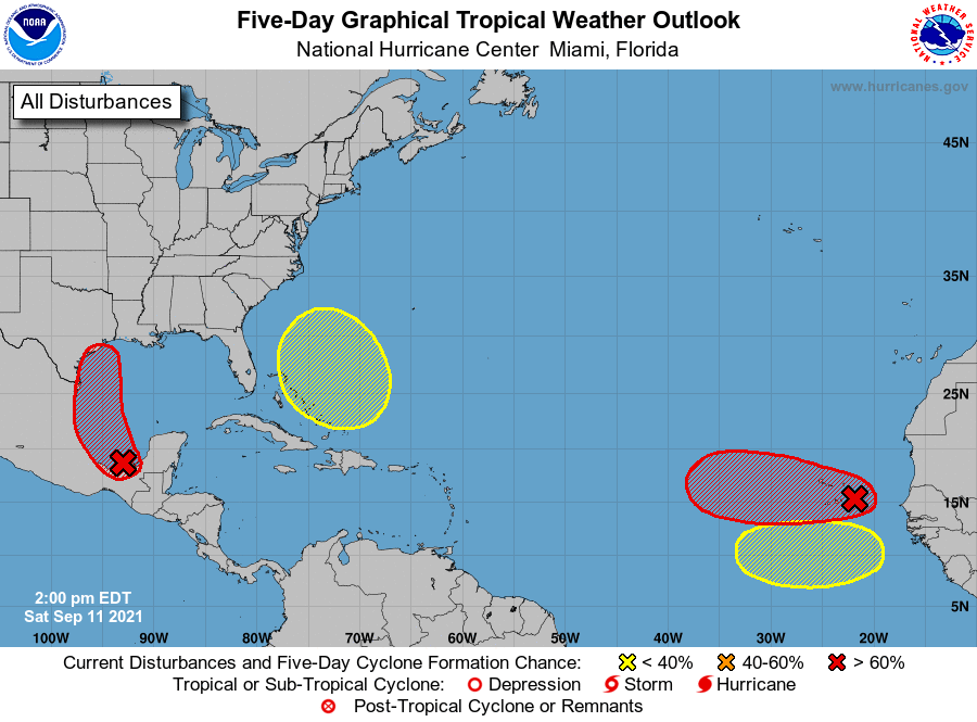
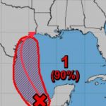
The race for the name “Nicholas” is on. Two areas have over an 70 percent chance of formation in the next five days.
The area we are watching is the red reaching into the Gulf of Mexico. This system is likely to become a tropical depression by Monday. If it remains over water, further development is likely.

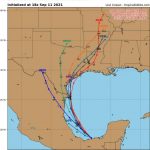
By Sunday we’ll start to see rain totals increase across Texas and Louisiana coasts. The system will organize as it moves north along the Texas Coast. We also know this depression/storm will be moving slowly so rain will likely be the headline for this one Sunday through Wednesday for parts of Texas and Louisiana.
From NHC:
For the North Atlantic…Caribbean Sea and the Gulf of Mexico:

1. A tropical wave and an upper-level trough continue to produce large area of disorganized showers and thunderstorms over portions of southeastern Mexico and the southern and central Gulf of Mexico. Although upper-level winds are not conducive for development
currently, they are expected to become more favorable for the system during the next day or so. A tropical depression is likely to form on Sunday or Monday while the disturbance moves northwestward and then northward near the coast of northeastern Mexico. Further development will be possible through the middle of next week if it remains over water, and interests along the western and northwestern Gulf coast should monitor the progress of this system. An Air Force Hurricane Hunter aircraft is scheduled to investigate the system tomorrow.
Regardless of development, this disturbance is expected to produce heavy rain across portions of Central America and the Yucatan
Peninsula through today which may lead to flash flooding and mudslides. By late this weekend, heavy rain will likely reach portions of the western Gulf coast, including coastal Texas and Louisiana through the middle of next week. Localized significant rainfall amounts will be possible, potentially resulting in areas of flflash and urban flooding.
* Formation chance through 48 hours…high…80 percent.
* Formation chance through 5 days…high…90 percent.
2. Showers and thunderstorms have not become any better organized in association with a tropical wave located just southeast of the Cabo Verde Islands. Environmental conditions appear generally conducive for gradual development, and a tropical depression is likely to form late this weekend or early next week while the system moves westward over the far eastern Atlantic. Regardless of development, this disturbance is likely to bring gusty winds and locally heavy rain across the Cabo Verde Islands later today and tonight.
* Formation chance through 48 hours…medium…50 percent.
* Formation chance through 5 days…high…70 percent.

3. Another tropical wave is expected to move off the west coast of Africa in a few days. Some development of this system will be possible through the middle of next week while it moves westward across the eastern tropical Atlantic Ocean.
* Formation chance through 48 hours…low…near 0 percent.
* Formation chance through 5 days…low…20 percent.
4. An area of low pressure is expected to form near the southeastern Bahamas in a few days. Gradual development of this system is possible thereafter as it moves northwestward across the western Atlantic.
* Formation chance through 48 hours…low…near 0 percent.
* Formation chance through 5 days…low…20 percent.

