
Crime tops worries of Louisiana residents, survey finds
May 30, 2023
Dr. Ragan Lorraine chosen as Finalist for Louisiana Principal of the Year
May 30, 2023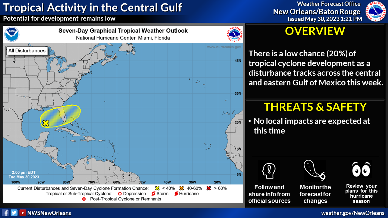
For the North Atlantic…Caribbean Sea and the Gulf of Mexico:

An area of disorganized showers and thunderstorms is associated with a surface trough of low pressure interacting with an upper-level trough over the central Gulf of Mexico. Environmental conditions appear only marginally favorable for additional development over the next several days as the system meanders over the eastern Gulf of Mexico. The system is then forecast to move across the Florida Peninsula this weekend and emerge into the southwestern Atlantic Ocean by early next week. Regardless of development, the system could produce heavy rainfall and gusty winds over portions of the Florida Peninsula later this week. Additional information on the rainfall and flooding potential can be found in products issued by your local National Weather Service forecast office and Excessive Rainfall Outlooks issued by the Weather Prediction Center.
* Formation chance through 48 hours…low…10 percent.
* Formation chance through 7 days…low…20 percent.

