
Houma Christian School hosts Academic Signing Day
April 10, 2023
Local musician Wesley Gaspard presented with first ever Cajun Preserve Award
April 10, 2023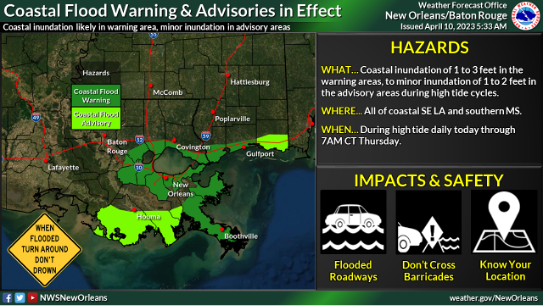
Here is an update from the National Weather Service in New Orleans concerning hazardous weather associated with a Gulf low mid to late week:

Overview:
WHAT: Coastal Flood Advisory/Warning & MARGINAL RISK of Heavy Rain
WHEN: Minor coastal flooding beginning as early as high tide cycle this afternoon, increasing for each high tide cycle thru Thursday. All day Wednesday into early Thursday for risk of excessive rainfall.

WHERE: All coastal areas for the coastal flood advisories/warnings, All of SE LA and southern MS for the Marginal Risk of excessive rainfall.
CONFIDENCE: Low in regards to heavy rain/flash flooding [area/amounts]. Moderate/High in regards to coastal flooding and high for dangerous marine conditions.
Impacts:

· Coastal Flooding:
o Inundation of 1 to 3 feet possible during peak high tide cycle in the areas under a Coastal Flood Warning.
o Minor inundation of 1 to 2 feet possible during peak high tide cycle in the areas under a Coastal Flood Advisory.

o Coastal locations in Jackson County may be upgraded to a warning in subsequent updates as impacts may occur beyond 36 hours at peak high tide Thursday and Friday.
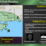
· Heavy Rainfall/Flash Flooding:
o Confidence in the potential for flooding impacts remains low, and highly dependent on the low track. A track further west may introduce a more widespread risk of heavy flash flooding from slow-moving bands of heavy rainfall.
o A track further east would reduce potential flooding impacts for most of the area.
· Marine Impacts
o Gusty winds and elevated waves/seas are likely, with Small Craft Advisories in effect. Gale conditions would be possible near and to the east / northeast of the eventual low track.
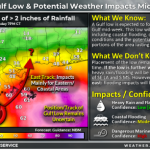
The attached graphics highlight the situation overview depicting confidence of potential impacts with the midweek system:
Attached is the current Coastal Flood Warnings/Advisories in effect and the current Excessive Rainfall Outlook. Changes in subsequent updates may be possible as we get closer to mid-week.
From the Terrebonne Levee and Conservation District:
Due to a coastal flood watch, effective from April 10, 2023 through April 13, 2023 the following floodgates will be monitored for closure. Starting Monday, April 10, 2023, Humble Canal, Bayou Terrebonne Lock, Bush Canal, Pointe Aux Chenes and Lower Dularge floodgates may be affected.
For more information go to www.tlcd.org
