
Mother charged as an accessory for allegedly lying to authorities about son’s whereabouts in murder investigation
July 10, 2019
Lafourche Booking Log – July 9, 2019
July 10, 2019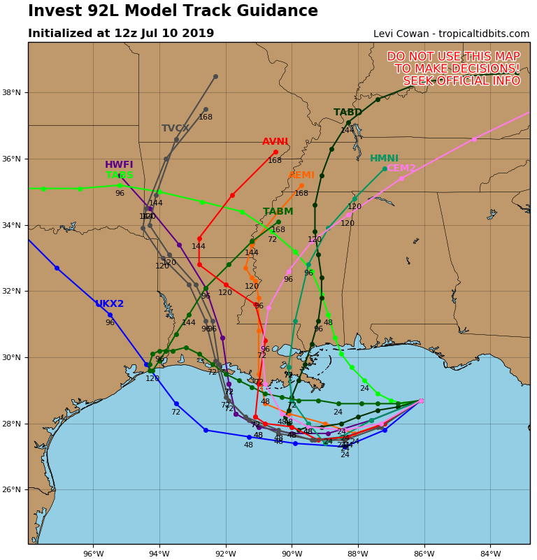
Invest 92L didn’t turn into Tropical Storm Barry overnight.

That’s the good news.
The bad is that the storm is already providing heavy rains to Southeast Louisiana – still days before expected landfall over the weekend.
Southeastern Louisiana was battered with rain last night and into this morning as convection on the western side of Invest 92L continues to break off the main core and drop rain bands onto our area.
The “center” of Invest 92L is located in the Gulf somewhere below the western Florida panhandle.
The area of weather is expected to drift to the southwest over the next 48-72 hours before making a northward turn and heading toward land. The timing of that turn will determine landfall – currently predicted between the Louisiana-Texas border and the mouth of the Mississippi River on Louisiana’s coast.
Invest 92L is expected to become a Tropical Storm by landfall, though winds are not expected to be his primary threat. Because it will be a slow mover, some areas could receive upwards of 10-12-inches of rain by next week – if not more in isolated amounts.
The Terrebonne Parish Levee and Conservation District has announced that because of the incoming weather, the following flood gates will close this morning: Humble Canal, Bush Canal, Pointe aux Chenes, Bayou Grand Caillou and lower Dularge.
The HNC Bubba Dove will close after 4 p.m. today.
The Oilman’s Rodeo set for this weekend in Fourchon has also been canceled.

Keep checking The Times for more updates.

