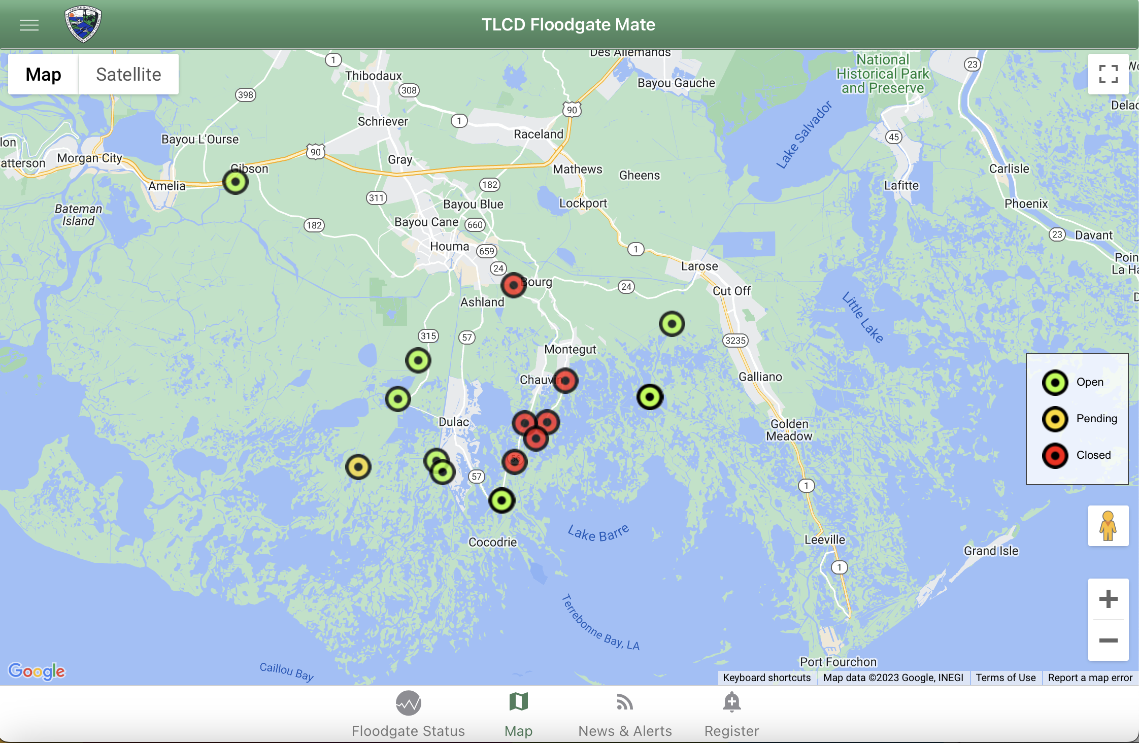
Terrebonne floodgates have started to close ahead of weather system
April 12, 2023
LPSO Public Information Officer Attains International Professional Designation
April 12, 2023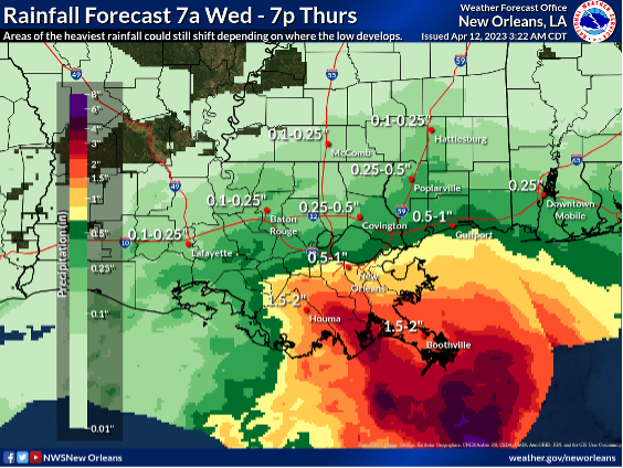
Here is an update from the National Weather Service in New Orleans concerning the heavy rain and coastal flood threats this week.
Overview:
WHAT: MINOR TO MODERATE COASTAL FLOODING & MARGINAL RISK of Heavy Rain

WHEN:
- For the heavy rain threat, mainly today through tonight.
- For the coastal flooding threat, around the time of high tide each day through at least Thursday. Tide levels will generally be highest this afternoon/evening except for areas inside Lake Pontchartrain where the highest levels may not be until Thursday night.
WHERE:
- For the heavy rain threat, most of southeast LA and southern MS, with the greatest threat across areas south of I-10.
- For the coastal flooding threat, all of coastal southeast LA and MS, with the greatest threat across east-facing shores from the mouth of the Mississippi River in Southeast LA through Hancock County in MS.
CONFIDENCE:

- For the heavy rain threat, low confidence due to uncertainties in where the low will eventually develop and move
- For the coastal flood threat, moderate to high confidence in both timing and magnitude
Impacts:
- Coastal Flooding:
-
- Minor to moderate coastal flooding is expected, with 1 to 3 ft of inundation possible around the time of high tide
- Low lying coastal roads, parking lots and sidewalks may become covered in water. A few roads may become impassable in areas with the greatest impacts.
- Heavy Rainfall/Flash Flooding:
-
- Heavy rain could lead to localized flash flooding threats
- 1-3″ of rain is currently forecast for areas generally south of I-10.
- This threat remains highly dependent on where the low eventually develops and moves
- Marine Impacts
-
- Gusty winds and elevated waves/seas are likely, with Small Craft Advisories and Gale Warnings in effect.
The attached graphics highlight the marine hazards, rainfall and tide forecasts.


Related posts

May 3, 2024