
Bayou Blue Pontoon Bridge is now closed
June 7, 2020
South Lafourche prepares for Cristobal; bridges and floodgates have closed
June 7, 2020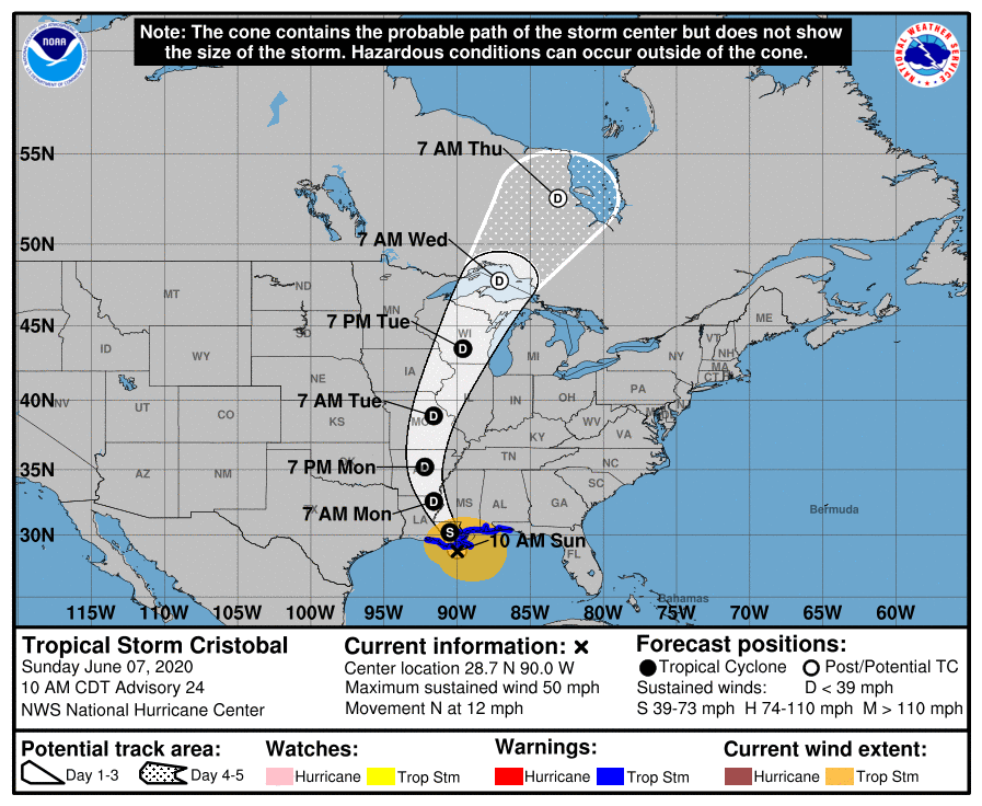
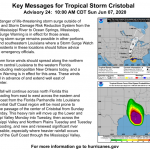
At the 10AM update, the center of Cristobal is located around 30 miles southeast of Port Fourchon, or 90 miles south of New Orleans. Maximum sustained winds remain at 50mph with higher gusts.
Landfall is still predicted to be late afternoon/early evening around Terrebonne Bay.
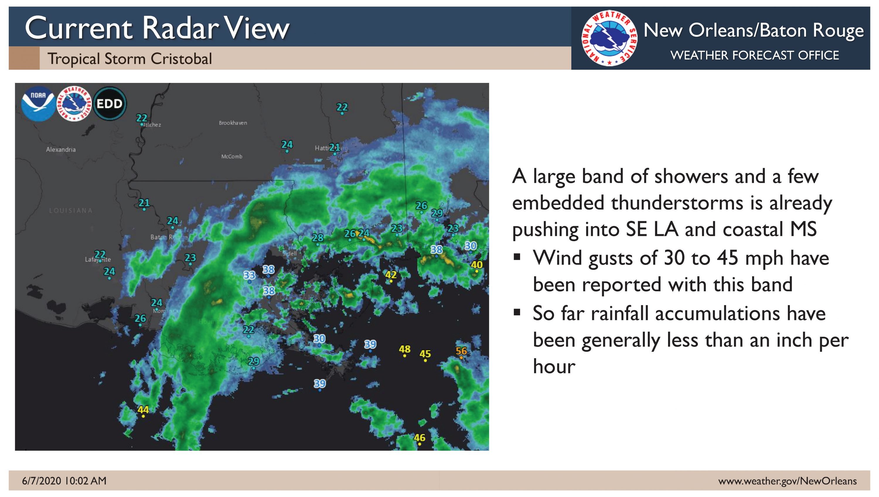
Cristobal is still struggling to overcome dry air, and is forecast to maintain its current intensity through landfall. Broken bands of showers are already affecting the area and a few observation stations have begun reporting sustained tropical storm force winds.

The heaviest of the rain is located away from the center and stretches east across the Gulf Coast into Florida. A storm surge is still possible as Cristobal approaches the coast. A 3 to 6 foot surge is possible east of Grand Isle, and 2 to 4 feet to the west. Surge-related flooding will be most likely around high tide Sunday and Monday. Flash flooding will become increasingly likely, especially Sunday and Monday as moisture increases. Rain rates at times will range from 2 to 4 inches per hour. Rain totals of 3 to 8 inches will be possible.
From the NHC:
At 1000 AM CDT (1500 UTC), the center of Tropical Storm Cristobal was located near latitude 28.7 North, longitude 90.0 West. Cristobal is moving toward the north near 12 mph (19 km/h), and this general motion is expected to continue today, followed by a gradual turn toward the north-northwest late today or tonight. On the forecast track, the center of Cristobal will approach the northern Gulf of
Mexico coast this afternoon, then move inland across Louisiana late today through Monday morning, and northward across Arkansas and Missouri Monday afternoon into Tuesday.

Data from an Air Force Reserve reconnaissance aircraft and NOAA Doppler weather radars indicate that maximum sustained winds remain near 50 mph (85 km/h) with higher gusts. Little change in strength is forecast before landfall. Gradual weakening will begin once Cristobal moves inland.
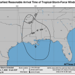
Tropical-storm-force winds extend outward up to 205 miles (335 km),mainly to the east of the center. A Weatherflow site at Bayou Bienvenue, Louisiana, recently measured a sustained wind of 37 mph
(60 km/h) and a gust to 47 mph (76 km/h). The estimated minimum central pressure is 994 mb (29.36 inches).

