
$71M of timber lost to summer wildfires; more damage expected as blazes continue
November 13, 2023Join the Great American Smoke Out
November 13, 2023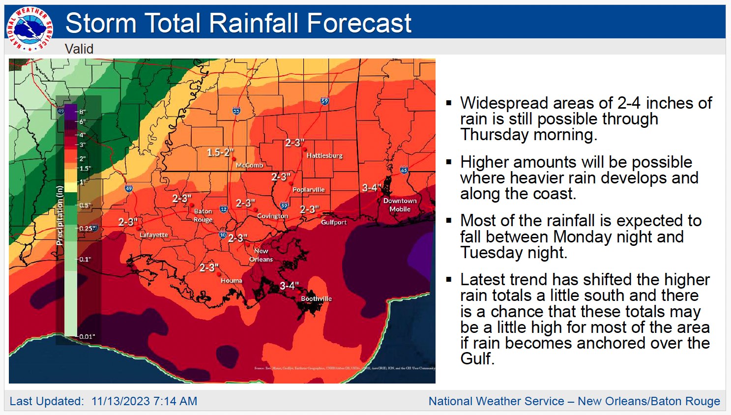
Here is an update from the National Weather Service in New Orleans on the expected impacts concerning the developing Gulf Low over the next 3 days.
Overview:
An area of low pressure has already begun to develop over the western Gulf. This low is expected to deepen some and push across the northern Gulf through Wednesday. There is still some uncertainty on the exact path of this low which will have implications on some of the impacts that could be felt across the area.
Impacts:
Moderate to heavy rainfall is expected across the area with widespread amounts of 2-4 inches mainly overnight tonight and through Tuesday night. Some higher amounts are possible, especially along and near the coast.
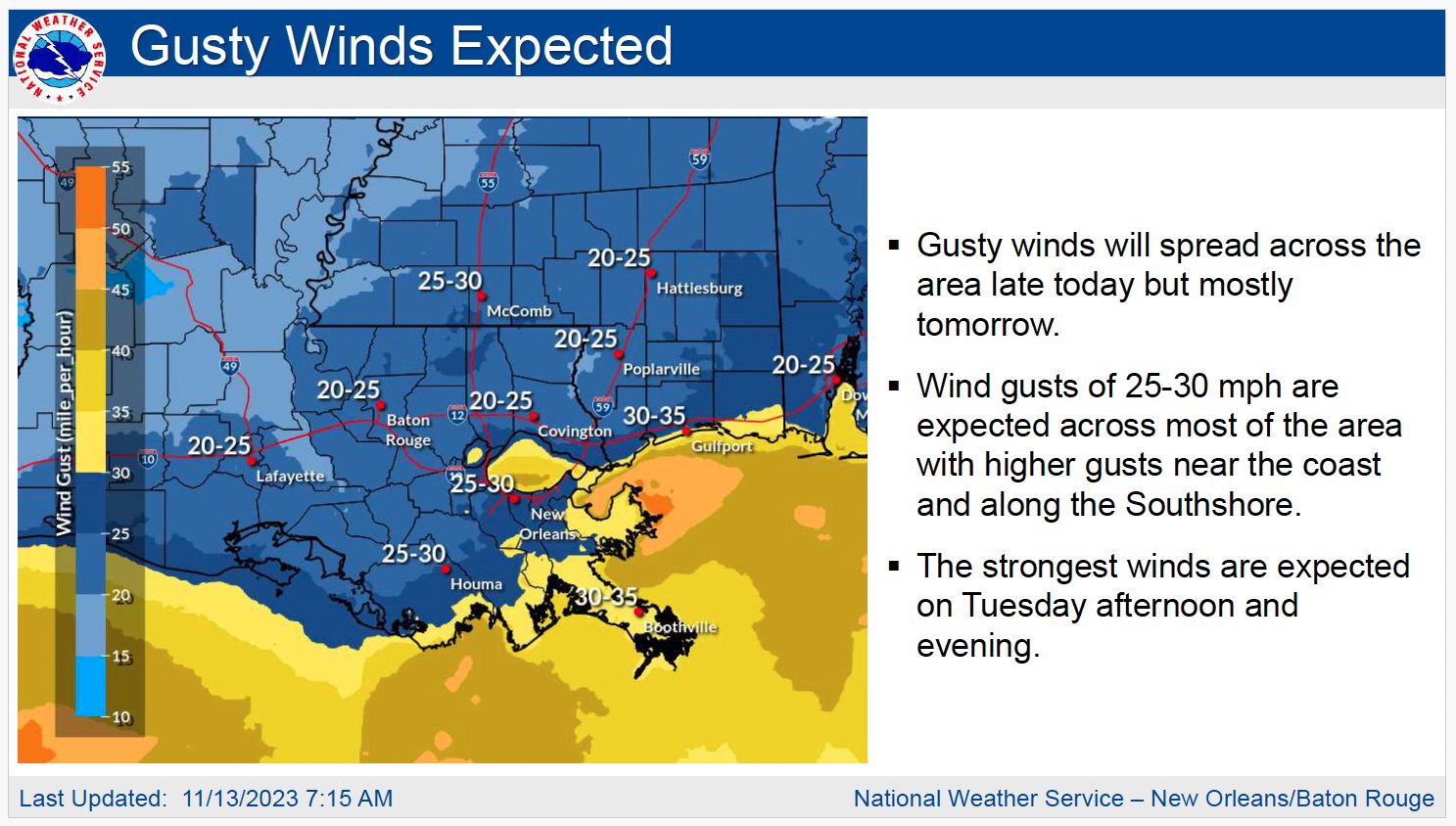
Gusty winds are expected to spread across the area late this afternoon and more so Tuesday afternoon and evening with gusts as high as 35-40 mph. Gusts will be higher near and along the coast and across the immediate Southshore.
Marine areas will see increased impacts and Gale Watches and Warning along with Small Craft Advisories have been issued for winds and seas.
Minor to moderate coastal flooding will be possible with the system. A coastal Flood Watch has been issued and will likely need to be upgraded to a warning for some portions of the watch. Advisories will be needed for areas that do not get upgraded and may need to be expanded for some areas not currently in the watch. The greatest impacts will occur Tuesday and Wednesday night going into high tide.
From the National Hurricane Center:
For the North Atlantic…Caribbean Sea and the Gulf of Mexico:
For the North Atlantic…Caribbean Sea and the Gulf of Mexico:
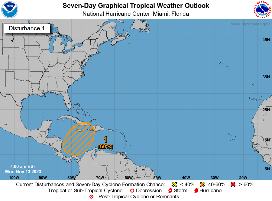
1. Southwestern Caribbean Sea:
A broad area of low pressure is expected to form over the southwestern Caribbean Sea in a few days. Gradual development of this system is possible thereafter, and a tropical depression could form late this week while the system begins moving northeastward across the western and central portions of the Caribbean Sea.
* Formation chance through 48 hours…low…near 0 percent.
* Formation chance through 7 days…medium…60 percent.

