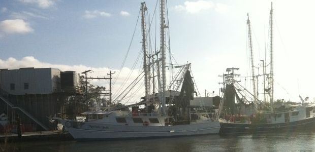
Shrimpers locked out? Terrebonne re-entry plan has no boat provisions
July 16, 2013Corps OKs Morganza: But federal build a long way off
July 16, 2013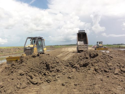
Five parishes engaged in a death-struggle with FEMA over the potential for crippling flood insurance rate increases have new hope for change, thanks to a pilot program launched by the agency for flood protection assessment.
The Federal Emergency Management Agency has chosen Plaquemines, Lafourche, Terrebonne, St. Tammany and St. Charles parishes for participation in the pilot, which will involve development of new guidelines to determine flood hazards.

The difference is that local levee systems – including those not accredited by federal officials – will be included in the determinations of how much home and business owners pay for the insurance.
“It doesn’t hurt, that’s for sure,” said Lafourche Parish President Charlotte Randolph. “It means they are going to consider coastal structures as part of the protection system. They may not give it as high a ranking but at least they are listening.”
Terrebonne Parish President Michel Claudet sees the inclusion of his communities as encouraging, and is looking forward to the outcome.

“We feel that this program will allow us to contribute our local knowledge and personal experiences as we work closely with FEMA to improve the accuracy of their flood maps,” he said.
Randolph and other local officials noted that the pilot does not currently offset problems related to new flood insurance rules passed by Congress and signed into law last year.
But it does mean that whatever formula is used, properties in affected parishes will likely have premiums lower than might otherwise be.

FEMA currently gives no credit for levees it has not accredited. That has resulted in the agency “completely wiping this protection off the map when assessing a community’s flood risk,” said a statement from the office of U.S. Sen. Mary L. Landrieu, D-La. She bolstered the contention of local officials that those parishes “have demonstrated the flaws in FEMA’s current mapping procedures.”
“These communities have made significant investments to protect themselves, but currently aren’t getting any credit from FEMA,” Landrieu said. “For too long FEMA has failed to recognize the reality on the ground along the coast; the new guidelines for these parishes are an important opportunity to improve FEMA’s understanding of coastal Louisiana’s unique topography and conditions. This is a good step in the right direction, but I will not be satisfied until all our coastal communities get the credit they deserve for their levees.”
Landrieu and U.S. Rep. Cedric Richmond, D-La., wrote to FEMA Monday calling on them to not force communities to adopt new flood insurance rate maps until the pilot is fully vetted and validated.

Officials in the flood-prone parishes have grappled with FEMA over the current maps used to determine premiums, in particular since federal re-authorization of the flood insurance program has included language that would raise rates dramatically.
U.S. Sen. David Vitter, R-La., and Landrieu have been working to have aspects of the 2012 re-authorization changed. A change in how the flood risks for communities are assessed – such as inclusion of the locally built levees – is seen as a step toward decreasing the premium increase potentials.
Terrebonne Councilman Danny Babin is among local officials encouraged by the new approach, but he warns that the pilot program is not a panacea.

“We are still a long ways away,” he said. “They are realizing now you have got to give some credit. Whether a levee is federally accredited or not it is going to hold back some water.”
Claudet has scheduled a town hall meeting on flood insurance issues for 6 p.m. July 25 at the Houma-Terrebonne Civic Center. The pilot program is expected to be included in the discussion.
Babin said acceptance of new FEMA maps could be two years in the future, noting that the pilot is in its infancy. He and other local officials said what the pilot does accomplish is throwing “everything into a holding pattern until more decisions can be made.”

He was also critical of the prior approach FEMA has taken, considering the track record of accredited systems.
“The only levees that broke so far from major storms are the federal levees,” he said.
Congressional delegation members are already rattling their sabers at the agency. Local hopes include the potential that any change in flood insurance rates be held off at least until studies related to the pilot are done.

But that will likely require congressional action.
Reps. Bill Cassidy, Rodney Alexander, John Boustany, Steve Scalise and John Fleming, along with Vitter, told FEMA Administrator Craig Fugate in the letter that pumping stations, decertified levees, nonfederal and nonstructural flood protection features, in addition to non-accredited levees should be used when calculating actual risk.
“It’s not appropriate for FEMA to unilaterally force new flood insurance rate maps on communities,” Cassidy said in a statement issued by his office. “Especially, because FEMA has not examined their methodology for creating these maps. Local stakeholders and communities must have a voice on the appropriate way to move forward. FEMA needs to account for the flood protection measures that are already successfully protecting communities from flood risk.”
Work is underway across south Terrebonne Parish on sections of the Morganza-to-the-Gulf hurricane protection system.