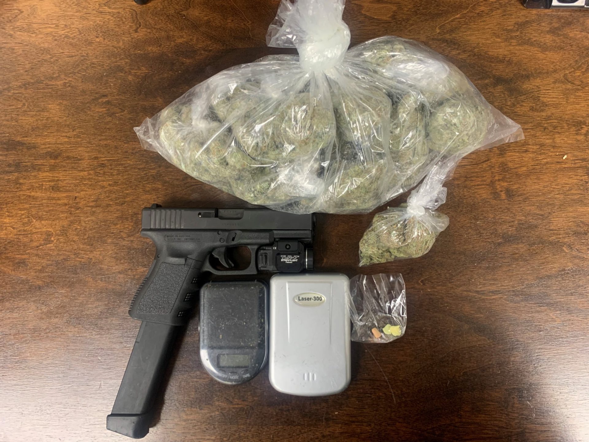
Gibson man arrested on gun, drug charges following traffic stop
May 17, 2021
Galliano man charged with rape of a juvenile
May 17, 2021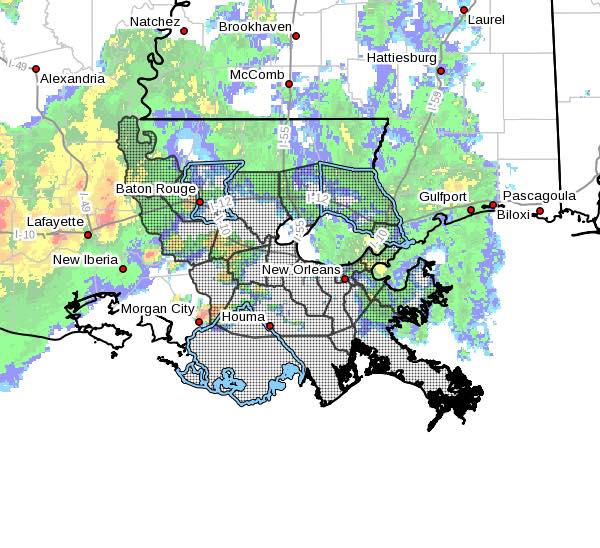
The National Weather Service in New Orleans has issued a Flash Flood Watch for a portion of southeast Louisiana, including the following areas through Wednesday morning: Ascension, Assumption, East Baton Rouge, Eastern Orleans, Iberville, Livingston, Lower Jefferson, Lower Lafourche, Lower Plaquemines, Lower St. Bernard, Lower Terrebonne, Northwest St. Tammany, Pointe Coupee, Southeast St. Tammany, Southern Tangipahoa, St. Charles, St. James, St. John The Baptist, Upper Jefferson, Upper Lafourche, Upper Plaquemines, Upper St. Bernard, Upper Terrebonne, West Baton Rouge and Western Orleans.

Rainfall of 1 to 3 inches with locally higher amounts in excess of 6 inches will be possible tonight through Wednesday morning. The most likely areas for heavy rainfall will be along and south of the I-10/12 corridor in Southeast Louisiana including portions of metro Baton Rouge and metro New Orleans. These heavier rainfall amounts could cause localized flash flooding issues.
High rainfall rates could overwhelm drainage capacity. Ponding of water in low lying and poorly drained areas will be possible, and flash flooding could occur where the heaviest rain falls. Do not enter or cross flowing water or water of unknown depth.
