Windy Arabie Adams
June 3, 2020Nicholls adjusts fall semester calendar; classes to end before Thanksgiving
June 3, 2020
At 1000 AM CDT, the center of Tropical Storm Cristobal was located near latitude 18.6 North, longitude 92.0 West.
According to the National hurricane Center, Cristobal is moving toward the south-southeast near 3 mph (6 km/h), and a turn toward the east is expected later today. A turn toward the north-northeast and north is expected on Thursday and Friday.
On the forecast track, the center will move over the land mass of eastern Mexico through Thursday. The center is forecast to move back over the Gulf of Mexico by Friday.

Maximum sustained winds are near 60 mph (95 km/h) with higher gusts. Slow weakening is forecast during the next 48 hours, and Cristobal will likely become a tropical depression by Thursday evening. Some re-strengthening is expected to begin on Friday. Tropical-storm-force winds extend outward up to 60 miles (95 km) from the center. The estimated minimum central pressure is 995 mb (29.39 inches).
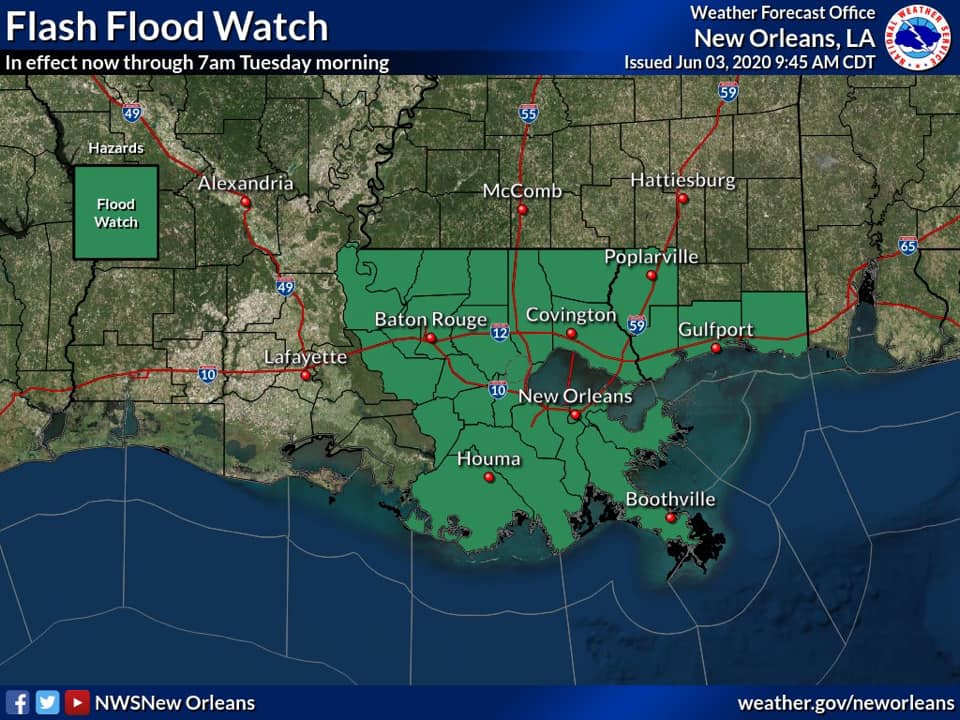
The National Weather Service New Orleans has issued a Flood Watch in effect now (10AM CDT Wednesday) through Tuesday morning. Rainfall totals could exceed 10 inches during this period of time. Locally higher rainfall totals are possible.