
Luau brunch to raise funds for local service projects
March 24, 2021
Coast Guard rescues two fishermen from vessel taking on water near Grand Isle
March 24, 2021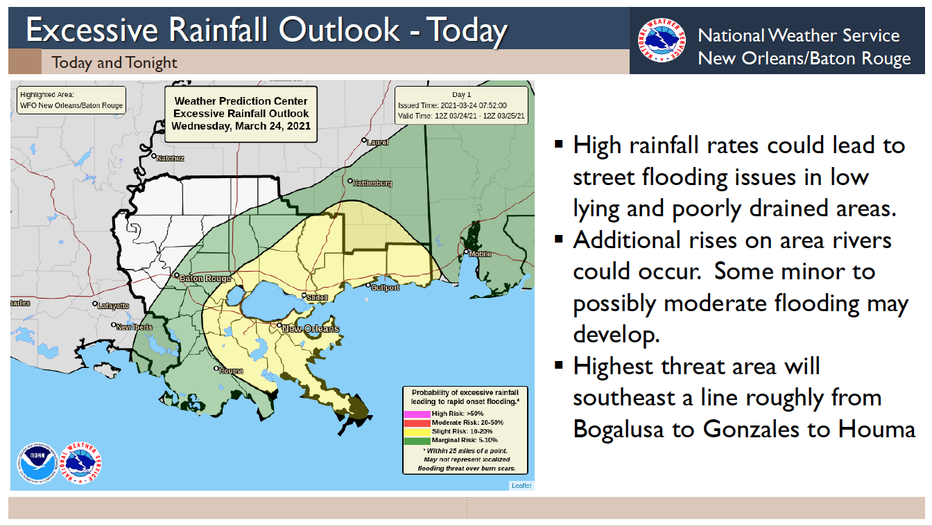
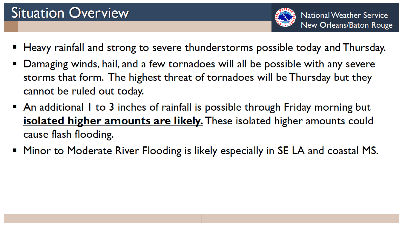
The National Weather Service has forecast a SLIGHT RISK of Heavy Rain and Severe Thunderstorms.
The heavy rain threat continues to be high through mid-day Wednesday with rain continuing through Thursday. Isolated severe thunderstorms are possible on Wednesday but a higher threat of severe weather is possible on Thursday. The risk of heavy rainfall that could produce flooding issues and severe thunderstorms will exist across all of southern MS and southeast LA.
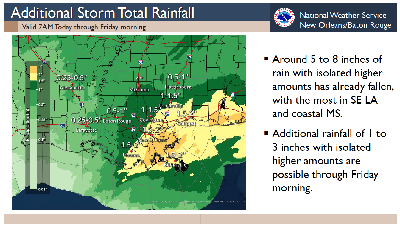
Additional rainfall of 1 to 3 inches is currently forecast. Locally higher amounts will be possible. Expect ponding of water in low lying areas and some potential for localized flash flooding. As water drains into area waterways, minor to moderate flooding could develop.

Damaging winds in excess of 60 mph, hail, and a few tornadoes will be possible with any severe storms; with the greatest risk on Thursday.
See slides from this morning’s weather briefing below:

