
Terrebonne Sheriff: Inmates moved from jail in advance of Hurricane Delta’s approach
October 7, 2020
Lafourche Parish schools to open Thursday; decision on potential Friday closures to come later
October 7, 2020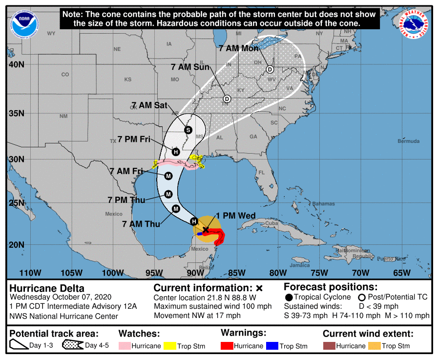
Delta has emerged into the southern Gulf with steady strengthening expected. Our biggest concern currently is the storm surge, which for Terrebonne Parish is forecast to be 7-11 feet.
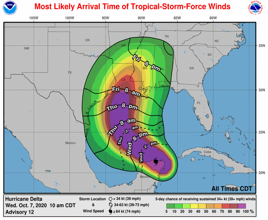
At 1 p.m. CDT, the center of Hurricane Delta was located about 115 miles (185 km) west of Cabo Catoche, Mexico. Delta is moving toward the northwest near 17 mph (28 km/h). On the forecast track, the center of Delta will move over the southern Gulf of Mexico this afternoon, be over the southern or central Gulf of Mexico through Thursday, and approach the northern Gulf coast within the hurricane watch area on Friday.
Maximum sustained winds are near 100 mph (155 km/h) with higher gusts – a category 2 hurricane on the Saffir-Simpson Hurricane Wind Scale. Hurricane-force winds extend outward up to 30 miles (45 km) from the center and tropical-storm-force winds extend outward up to 125 miles (205 km). Re-strengthening is forecast when the hurricane moves over the southern and central Gulf of Mexico through Thursday, and Delta is expected to become a major hurricane again. Some weakening is forecast as Delta approaches the northern Gulf coast on Friday.
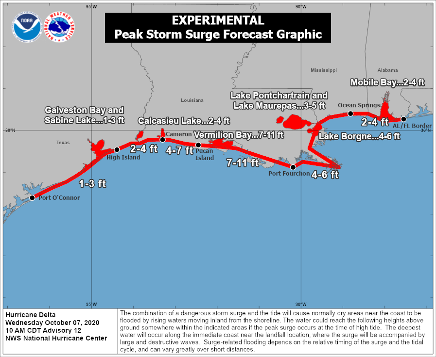
The combination of a dangerous storm surge and the tide will cause normally dry areas near the coast to be flooded by rising waters moving inland from the shoreline. The water could reach the following heights above ground somewhere in the indicated areas if the peak surge occurs at the time of high tide…
– Pecan Island, LA to Port Fourchon, LA including Vermilion Bay…7-11 ft
– Cameron, LA to Pecan Island, LA…4-7 ft
– Port Fourchon, LA to Ocean Springs, MS including Lake Borgne…4-6 ft
– Lake Pontchartrain and Lake Maurepas…3-5 ft
– Ocean Springs, MS to AL/FL state line incl. Mobile Bay…2-4 ft
– High Island, TX to Cameron, LA incl. Calcasieu Lake…2-4 ft
– Sabine Lake…1-3 ft
– Port O’Connor, TX to High Island, TX incl. Galveston Bay…1-3 ft
On Friday through Saturday, Delta is expected to produce 4 to 8 inches of rain, with isolated maximum totals of 12 inches, across portions of the central Gulf Coast north into portions of the Lower to Middle Mississippi Valley. These rainfall amounts will lead to flash, urban, small stream, and minor river flooding. As Delta moves farther inland, 1 to 3 inches of rain, with locally higher amounts, is expected in the Ohio Valley and Mid-Atlantic this weekend.
The next complete advisory will be issued by NHC at 4 p.m. CDT

