
Celebrate National Coffee Day with Thibodaux Regional Fitness Center
September 28, 2022
Pink perseverance in the wake of the storm
September 28, 2022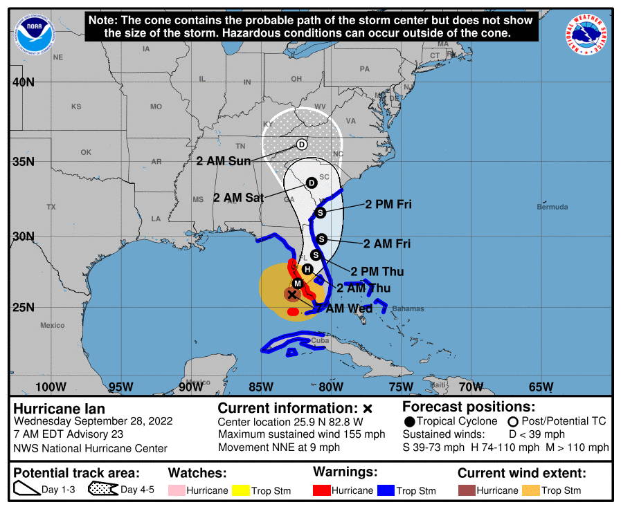
Ian is a Category 4 hurricane packing maximum sustained winds of 155 mph as of 7:00 a.m. EDT Wednesday morning. (Category 5 is 157mph) Landfall is expected later today between Sarasota and Fort Myers, Florida.

At 700 AM EDT (1100 UTC), the eye of Hurricane Ian was located by Air Force and NOAA Hurricane Hunter data near latitude 25.9 North, longitude 82.8 West. Ian is moving toward the north-northeast near 9 mph (15 km/h). This general motion with a reduction in forward speed is forecast today, followed by a turn toward the north on Thursday. On the forecast track, the center of Ian is expected to
approach the west coast of Florida within the hurricane warning area this morning, and move onshore later today. The center of Ian is forecast to move over central Florida tonight and Thursday
morning and emerge over the western Atlantic by late Thursday.
Maximum sustained winds have increased to near 155 mph (250 km/h) with higher gusts. Ian is a category 4 hurricane on the Saffir-Simpson Hurricane Wind Scale. Ian is forecast to make landfall on the west coast of Florida as a catastrophic category 4 hurricane. Weakening is expected after landfall.

Hurricane-force winds extend outward up to 40 miles (65 km) from the center and tropical-storm force winds extend outward up to 175 miles (280 km).
The minimum central pressure is 937 mb (27.67 inches) based on Air Force Hurricane Hunter dropsonde data.

