
POLL: National Pancake Day
September 26, 2022
LDWF to host Mother Child Families Understanding Nature Camp
September 26, 2022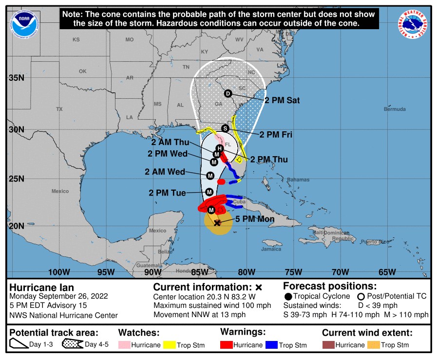
At 500 PM EDT (2100 UTC), the center of Hurricane Ian was located about 155 miles southeast of the western tip of Cuba. Ian is moving toward the north-northwest near 13 mph (20 km/h). A turn toward the north with a slightly slower forward speed is expected on Tuesday. A turn toward the north-northeast with a further reduction in forward speed is forecast on Wednesday. On the forecast track, the center of Ian is expected to move near or over western Cuba tonight and early Tuesday. Ian will then emerge over the southeastern Gulf of Mexico on Tuesday, pass west of the Florida Keys late Tuesday, and approach the west coast of Florida on Wednesday into Thursday.
Maximum sustained winds have increased to near 100 mph (155 km/h) with higher gusts. Rapid strengthening is expected during the next day or so, and Ian is forecast to become a major hurricane tonight or early Tuesday when it is near western Cuba and remain a major hurricane over the southeastern Gulf of Mexico on Wednesday.
Hurricane-force winds extend outward up to 35 miles (55 km) from the center and tropical-storm-force winds extend outward up to 115 miles (185 km).
The estimated minimum central pressure is 972 mb (28.71 inches).
Visit the National Hurricane Center website at hurricanes.gov for additional forecast information on Ian.
The next intermediate advisory will be at 8:00 PM EDT, followed by the next complete advisory at 11:00 PM EDT.

